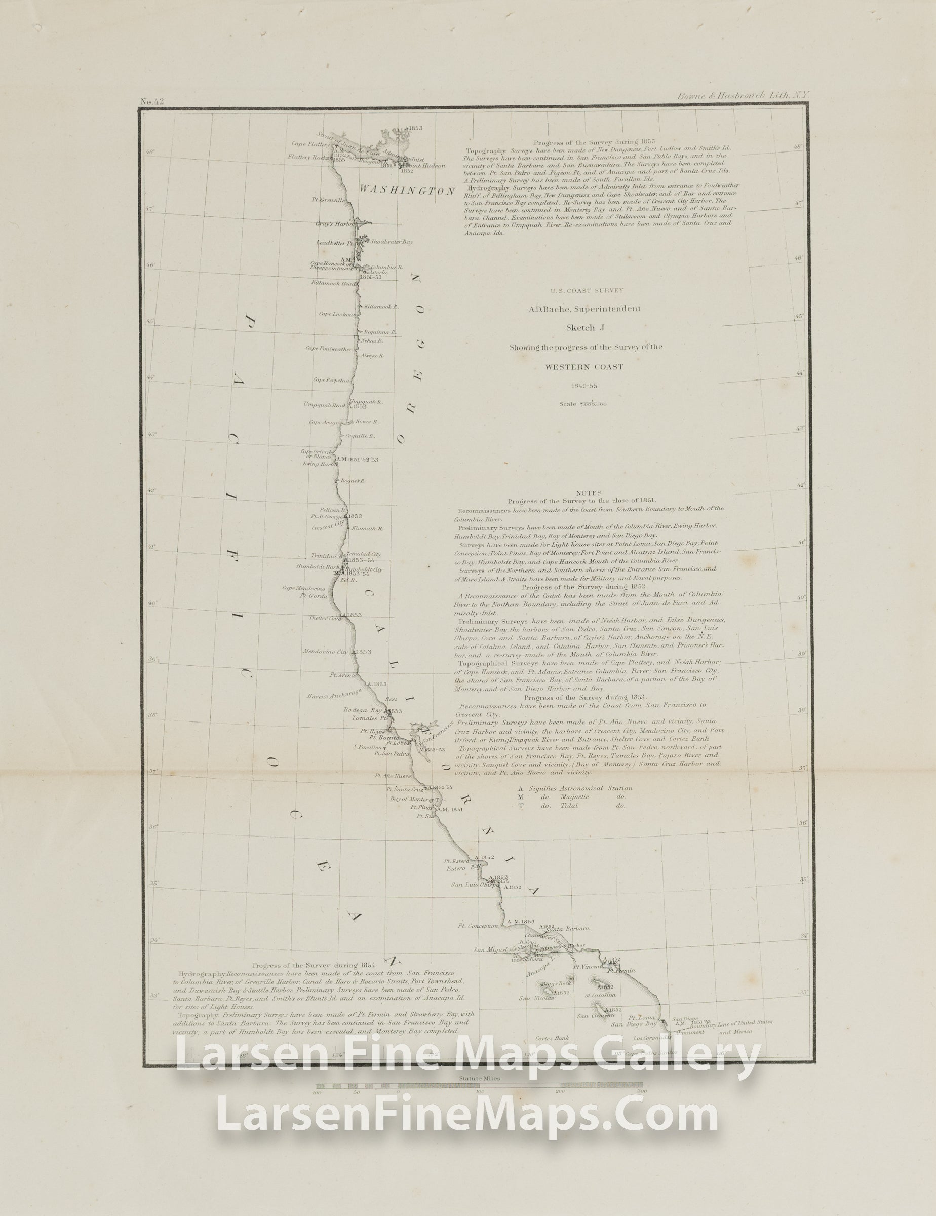
588 products
Sort by
Sort by
Sold out
Base Map of United States
Sold out
Huntington Bay
Sold out
Sketch I Showing the Progress of the Survey in Section No. IX From 1848 to 1866 U.S. Coast Survey
Sold out
Portland Harbor Maine U.S. Coast Survey
Sold out
Vues de quelques Parties de la Côte Sud Ouest de la Nouvelle Hollande et des Îles Oparo et Snares.
Sold out
Newport Harbor and Approaches Rhode Island U.S. Coast Survey
Sold out
Theodore Roosevelt President of The United States - Appointment Certificate for Postmaster Signed, Gold Foil Seal, Signature Theodore Roosevelt President of The United States - Appointment Certificate for Postmaster Signed, Gold Foil Seal, Signature, detail-1
Sold out
Carte De Suisse Suivant Sa Nouvelle Division En XVIII Cantons Formant al Republique Helvetique, Mallet, Henri Carte De Suisse Suivant Sa Nouvelle Division En XVIII Cantons Formant al Republique Helvetique, Mallet, Henri, details
Sold out
Penfield Township, Lorain County, OhioTitus, Simmons & Titus, PhiladelphiaD.J. Lake, C.E.
Sold out
Preliminary Chart of Florida Reefs from Key Biscayne to Carysfort Reef U.S. Coast Survey
Sold out
Showing the progressive changes in Sandy Hook From 1779 to 1855 U.S. Coast Survey
Sold out
Coast Chart No. 28, From Isle of Wight to Chincoteague Inlet U.S. Coast Survey
Sold out
Absecom Inlet New Jersey U.S. Coast Survey
Sold out
Port of Providence, Rhode Island U.S. Coast Survey
Sold out
Johnson's Asia A.J. Johnson Johnson's Asia A.J. Johnson Back
Sold out
Johnson's Europe A.J. Johnson Johnson's Europe A.J. Johnson Back
Sold out
Reconnaissance of the Western Coast of The United States From Monterey to the Columbia River in three sheets, Sheet No. 3
Sold out
U.S. Coast Survey A.D. Bache Superintendent, Sketch J, Showing the progress of the Survey of the Western Coast 1849-55 U.S. Coast Survey
Sold out
Sketch Showing the Progress of the Survey in Section VI. East Coast of Florida, Halifax River to Cape Canaveral U.S. Coast Survey
Sold out
Vues de Diverses Parties de la Côte Nord-Ouest d'Amérique
Sold out
Report of The Superintendent of the U.S. Coast and Geodetic Survey showing The Progress of The Work during the Fiscal Year Ending With June, 1883 Report of The Superintendent of the U.S. Coast and Geodetic Survey showing The Progress of The Work during the Fiscal Year Ending With June, 1883 Example-1
Sold out
LARGE Map of Connecticut Prepared by The U.S. Geological Survey in Co-Operation With The State of Connecticut
Sold out
Islands in The Indian Ocean, The Society for the Diffusion of Useful Knowledge (SDUK)
Sold out
North America--West Coast, Strait of Juan de Fuca and The Channels Between The Continent & Vancouver Island, Great Britain. Hydrographic Office.; Powell, Edward J.