YEAR PUBLISHED: 1794
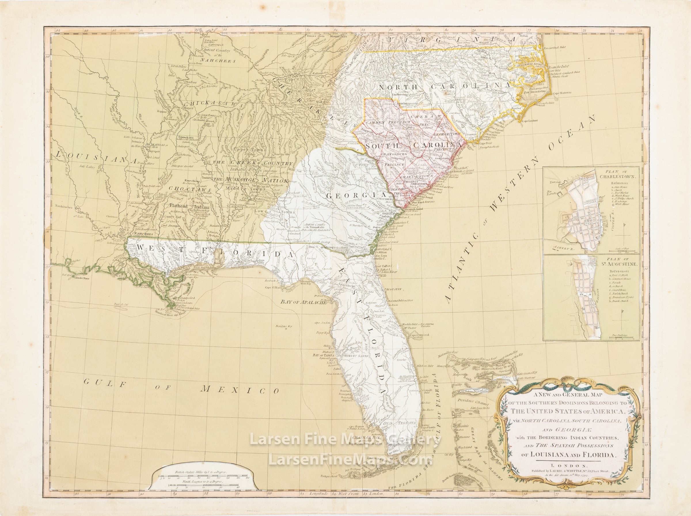
A New and General Map of The Southern Dominions Belonging to The United States of America
DESCRIPTION
A very striking and interesting map depicting the eastern seaboard from Florida to southern Virginia as far west as Louisiana, as well as the Bahamas. Shows natural features, cities, roads trading paths, and areas inhabited by Native American tribes. North Carolina tribes include the Cherakees (Cherokees), and the Catawba (shown as "possessing 144,000 Acres" south of Charlotte). Prime meridian: London. Includes 2 insets with reference lists: Plan of Charlestown--Plan of St. Augustine. Relief shown pictorially.
FULL TITLE
MAPMAKER/CARTOGRAPHER/AUTHOR
PUBLISHER
PUBLICATION
DIMENSIONS (Inches)
CONDITION
Choose options
DESCRIPTION
FULL TITLE
MAPMAKER/CARTOGRAPHER/AUTHOR
PUBLISHER
PUBLICATION
DIMENSIONS (Inches)
CONDITION
DESCRIPTION
FULL TITLE
MAPMAKER/CARTOGRAPHER/AUTHOR
PUBLISHER
PUBLICATION
DIMENSIONS (Inches)
CONDITION