A New and General Map of The Southern Dominions Belonging to The United States of America, Robert Laurie, James Whittle

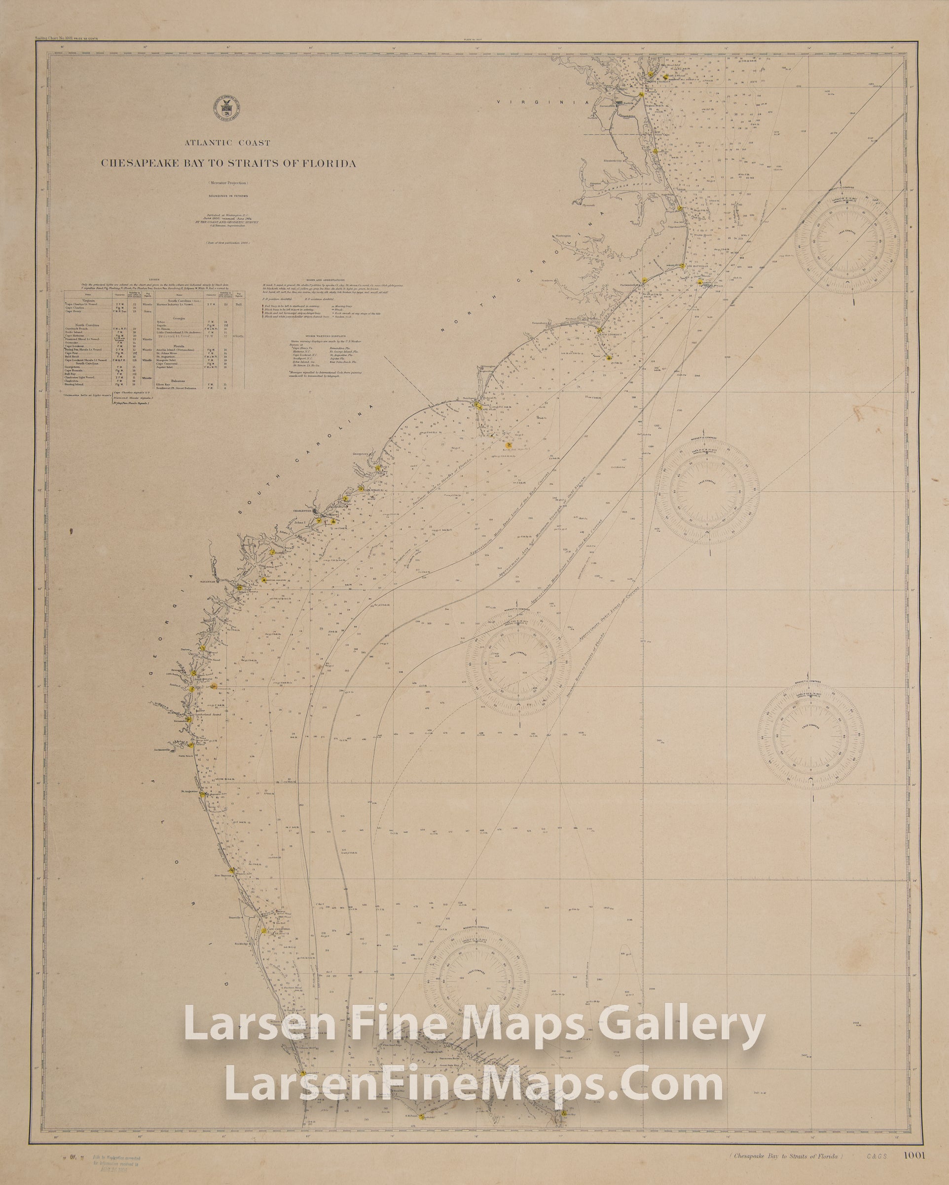
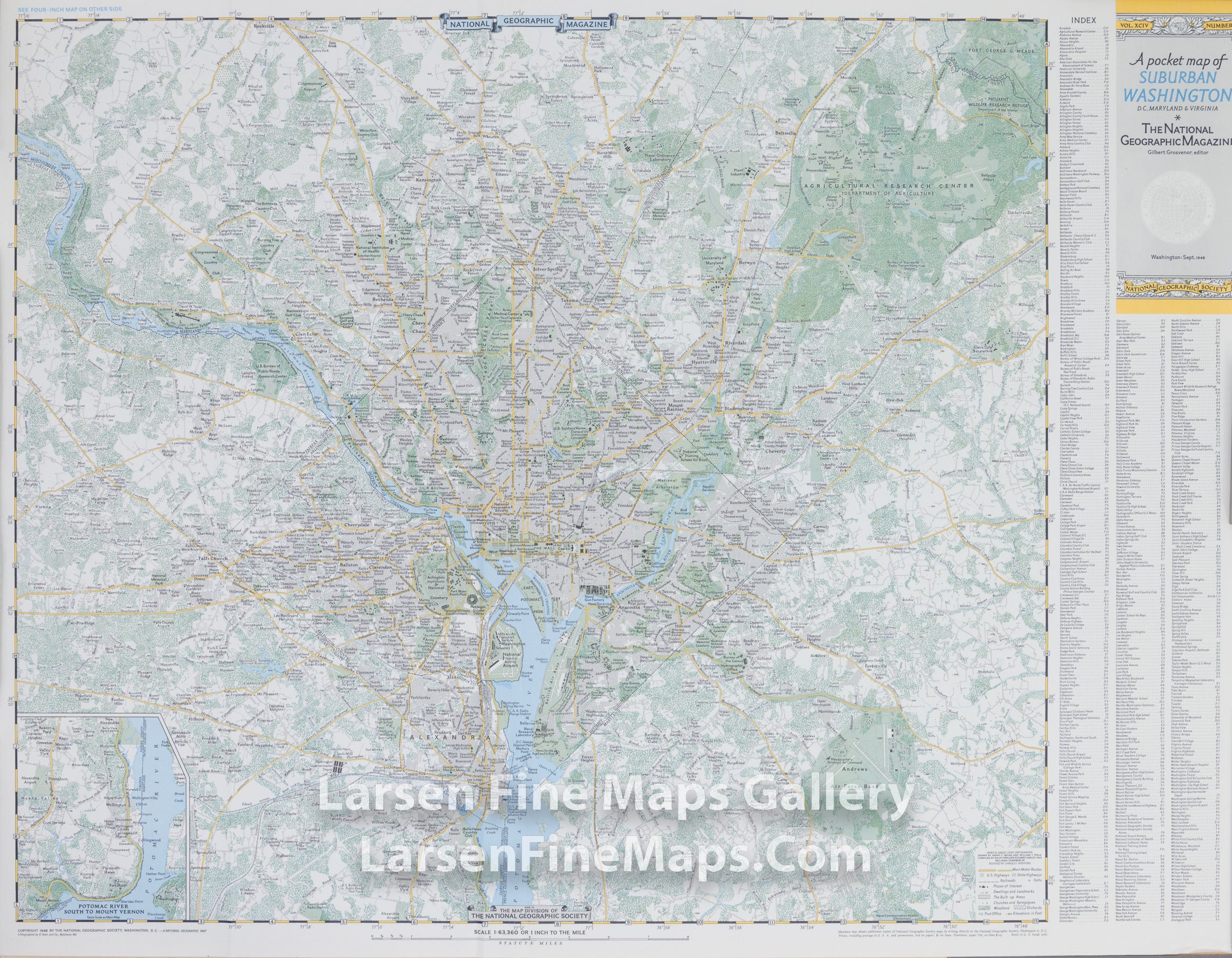
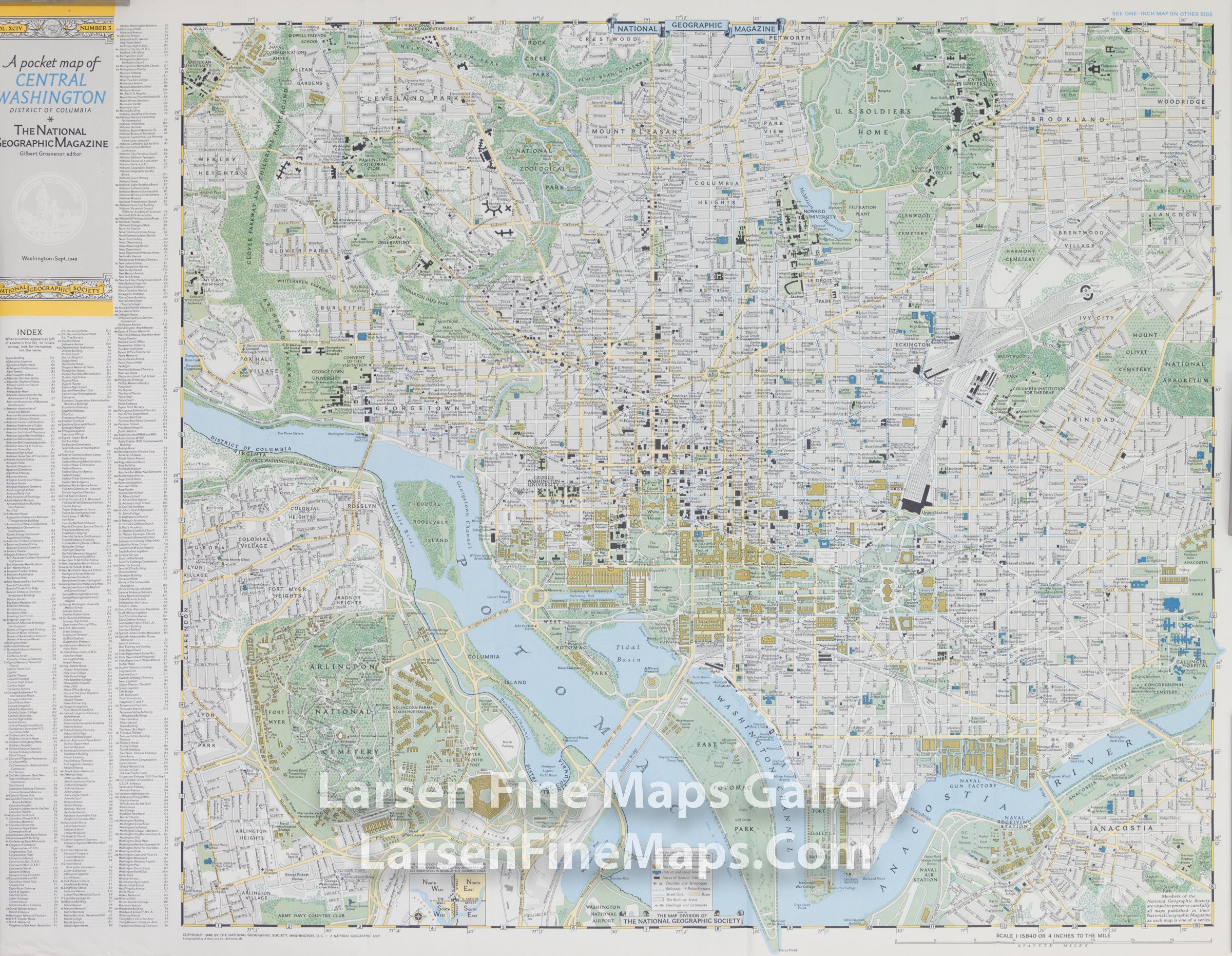
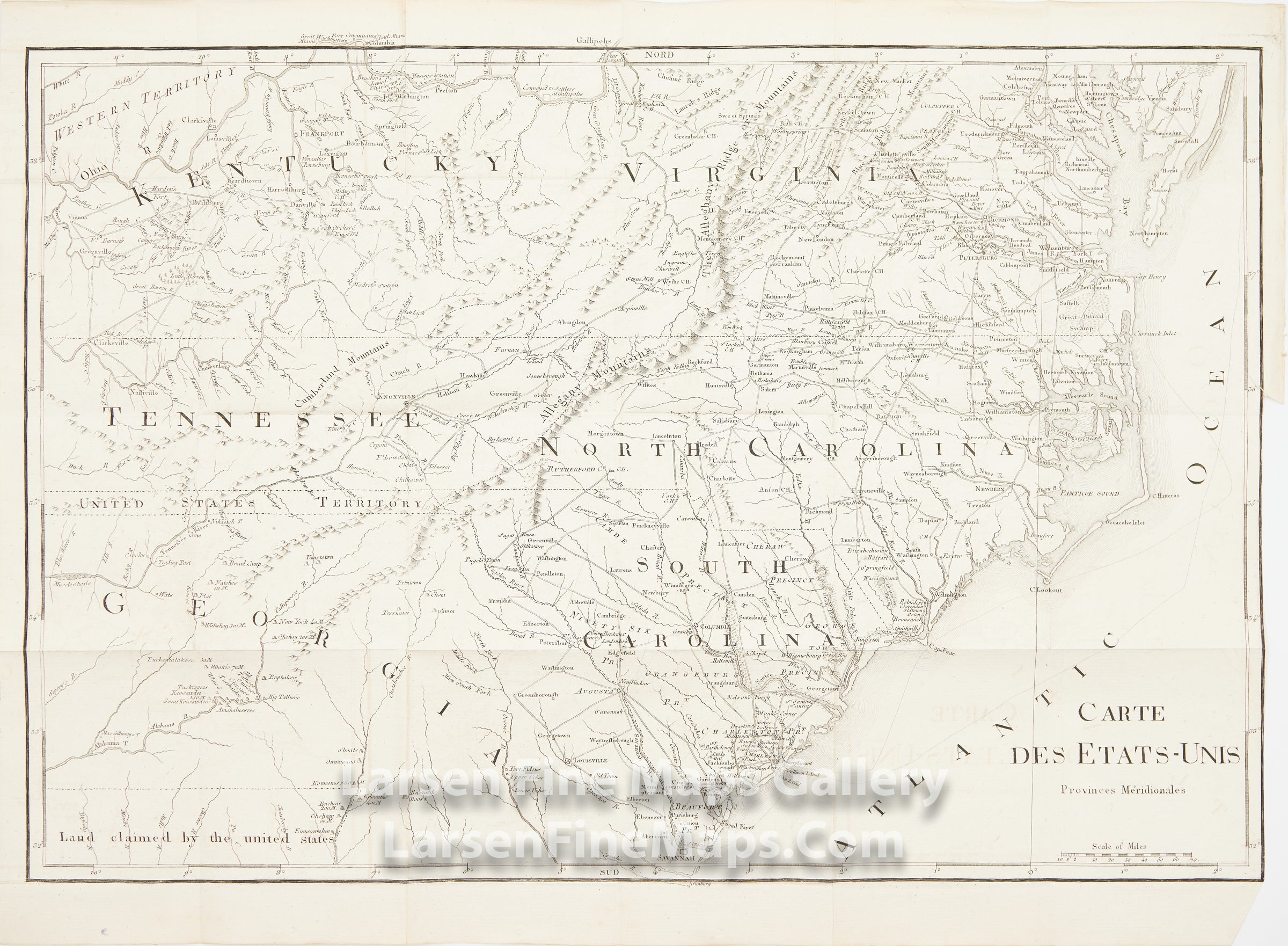
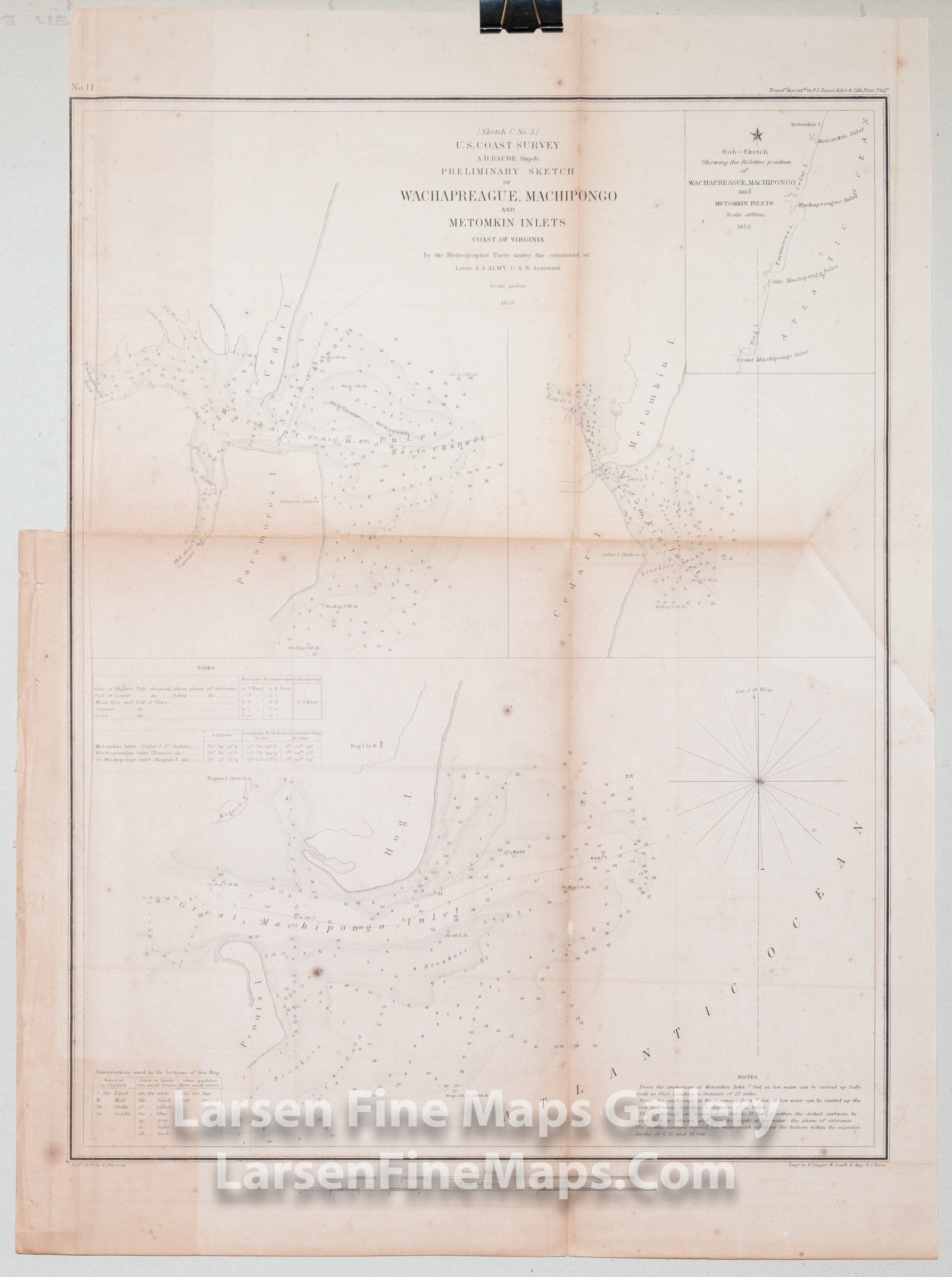
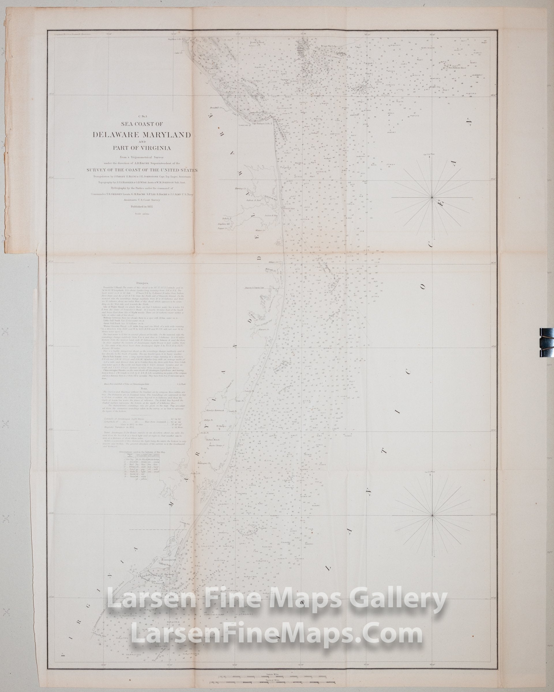
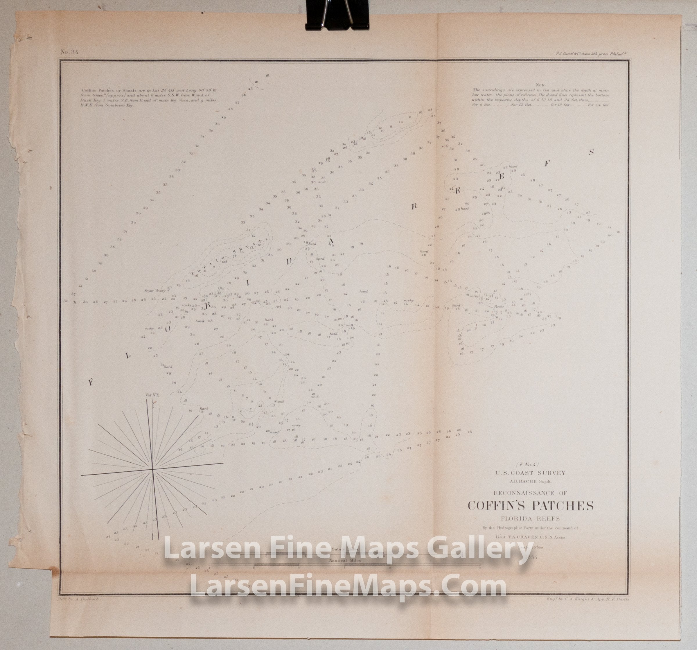
Southern United States Antique Maps, Rare Maps, Vintage Maps, and Old World Maps

Antique maps, rare maps, vintage maps, charts and atlases of the West Indies & The Caribbean.

Old world maps. Browse online to see photos and deals.

43 products
Sort by
Sort by
Mitchell's National Map of the American Republic or United States of North America Mitchell's National Map of the American Republic or United States of North America
Die Staaten von Arkansas, Mississippi, Louisiana & Alabama. 1850. United States of North America, Meyer, Joseph
Southeast Coast of United States Sea Chart, Charleston Harbour. Entrance to St. John's River, E. & G. W. Blunt. Edmund & George William Blunt Southeast Coast of United States Sea Chart, Charleston Harbour. Entrance to St. John's River, E. & G. W. Blunt. Edmund & George William Blunt, example-1
Savannah River and Wassaw Sound U.S. Coast Survey
Sketch E Showing the Progress of the Survey in Section No. V. From 1847 to 1866 U.S. Coast Survey
Sketch D Showing the Progress of The Survey in Section No. IV From 1850 to 1866 U.S. Coast Survey
Preliminary Chart of Wassaw Sound Wilimington and Tybee Rivers Georgia U.S. Coast Survey
Cape Lookout Shoals U.S. Coast Survey
United States, Tallis, John
Sketch H Showing the Progress of the Survey in Section No. 8 1846 - 1855 U.S. Coast Survey
Reconnaissance of Romerly Marshes, Georgia U.S. Coast Survey
Reconnaissance of Doboy Bar and Inlet, Georgia U.S. Coast Survey
Legare Anchorage, Florida Reefs U.S. Coast Survey
Reconnaissance of The Entrances to Vermilion Bay & Calcasieu River, Louisiana U.S. Coast Survey
Atlantic Coast Chesapeake Bay to Straits of Florida, The Coast and Geodetic Survey Atlantic Coast Chesapeake Bay to Straits of Florida, The Coast and Geodetic Survey, details
A Pocket Map of Central Washington District of Columbia, National Geographic A Pocket Map of Central Washington District of Columbia, National Geographic, details
A MAP of the COUNTRY from RARITON RIVER in EAST JERSEY to ELK HEAD in MARYLAND Showing the several Operations of the American and British Armies, in 1776 & 1777, C.P. Wayne, S. Lewis
Die Staaten von Missouri, Illinois, Indiana, Ohio, Kentucky & Tennessee 1850, United States of North America, Meyer, Joseph
H No. 2 Horn Island Pass Mississippi Sound U.S. Coast Survey
Sketch C Showing the Progress of the Survey in Section III From 1843 to 1851 U.S. Coast Survey
Sketch F No. 6 Showing the Proposed Site of a Beacon on Rebecca Shoal Florida Reef U.S. Coast Survey
Carte Des Etats-Unis Provinces Meridionales, La Rochefoucauld-Liancourt
Preliminary Sketch of Wachapreague, Machipongo, and Metomkin Inlets Coast of Virginia U.S. Coast Survey
C No. 3 Sea Coast of Delaware, Maryland, and part of Virginia U.S. Coast Survey