YEAR PUBLISHED: 1650
Virginiæ partis australis, et Floridæ partis orientalis
DESCRIPTION
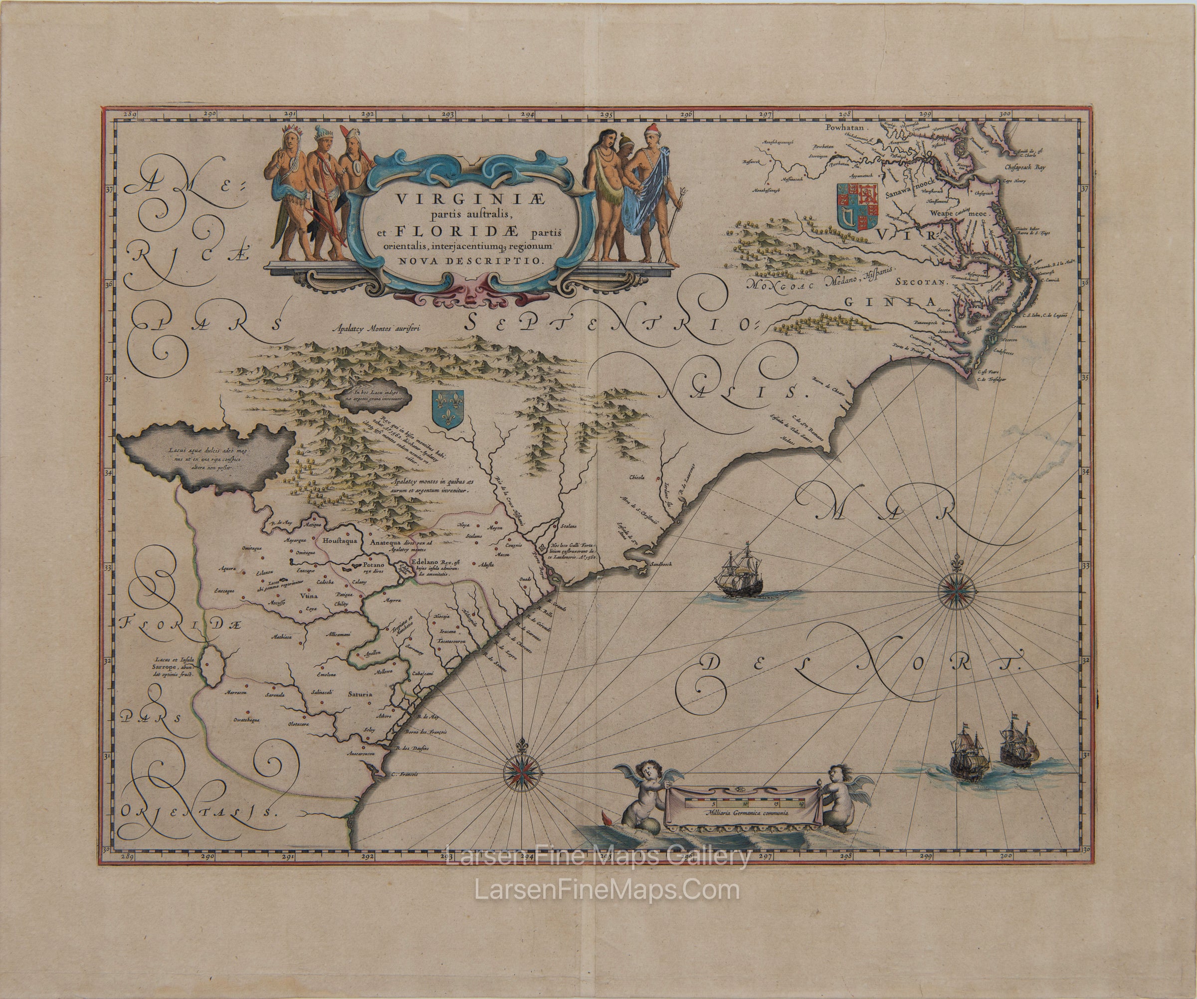
A beautiful map of the southeastern part of North America from Florida to the Chesapeake Bay. The map depicts the colonial claims of France in the south and England in the north, as indicated by the coats of arms. The Appalachian mountains are shown pictorially, along with two large lakes. Elaborate cartouches at the title block, as well as the scale bar, compass roses, and vignettes of ships in the ocean, along with the creative calligraphy, add to the beauty of this map.
This is the second state of the map by Baeu as described by Burden (253) and is of the Dutch edition of 1650. The map appeared in this Dutch edition in either the Nieuwe Atlas of 1650 or 1658 or in the Grooten Atlas of 1665
Virginiae partis australis, et Floridae partis orientalis, interjacentiumq regionum Nova Descriptio
FULL TITLE
MAPMAKER/CARTOGRAPHER/AUTHOR
PUBLISHER
PUBLICATION
DIMENSIONS (Inches)
CONDITION
Choose options
DESCRIPTION
FULL TITLE
MAPMAKER/CARTOGRAPHER/AUTHOR
PUBLISHER
PUBLICATION
DIMENSIONS (Inches)
CONDITION
DESCRIPTION
FULL TITLE
MAPMAKER/CARTOGRAPHER/AUTHOR
PUBLISHER
PUBLICATION
DIMENSIONS (Inches)
CONDITION