YEAR PUBLISHED: 1806
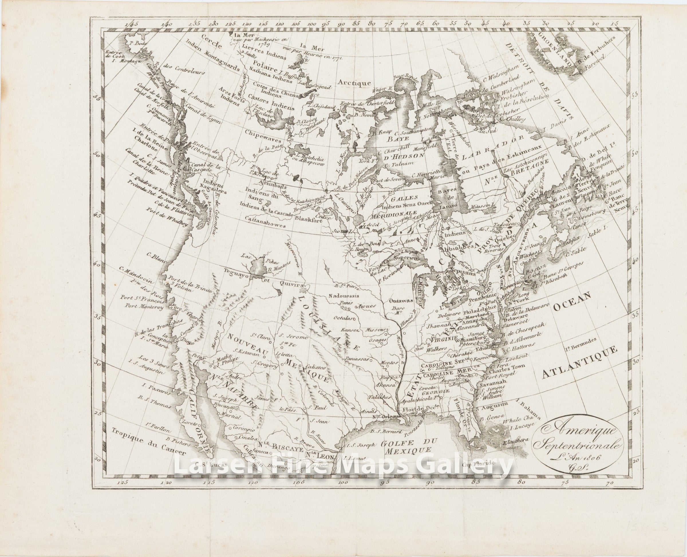
Amerique Septentrionale L'An 1806 G. S.
DESCRIPTION
An interesting map of North America and Canada showing the United States, French Louisiane, New Mexico.
Small engraved map of North America showing principal waterways and geographical features as well as the names of countries and provinces.
The map comes from the following publication:
Picturesque journeys in the four parts of the world, or the third edition of the Travel Encyclopedia. Paris, Hocquart, 1806.
Third edition, which "differs completely from the other two, the plates are re-engraved and more beautiful than in the previous ones" (Chadenat).
FULL TITLE
MAPMAKER/CARTOGRAPHER/AUTHOR
PUBLISHER
PUBLICATION
DIMENSIONS (Inches)
CONDITION
Choose options
DESCRIPTION
FULL TITLE
MAPMAKER/CARTOGRAPHER/AUTHOR
PUBLISHER
PUBLICATION
DIMENSIONS (Inches)
CONDITION
DESCRIPTION
FULL TITLE
MAPMAKER/CARTOGRAPHER/AUTHOR
PUBLISHER
PUBLICATION
DIMENSIONS (Inches)
CONDITION