YEAR PUBLISHED: 1843
The World, On Mercator's Projection
DESCRIPTION
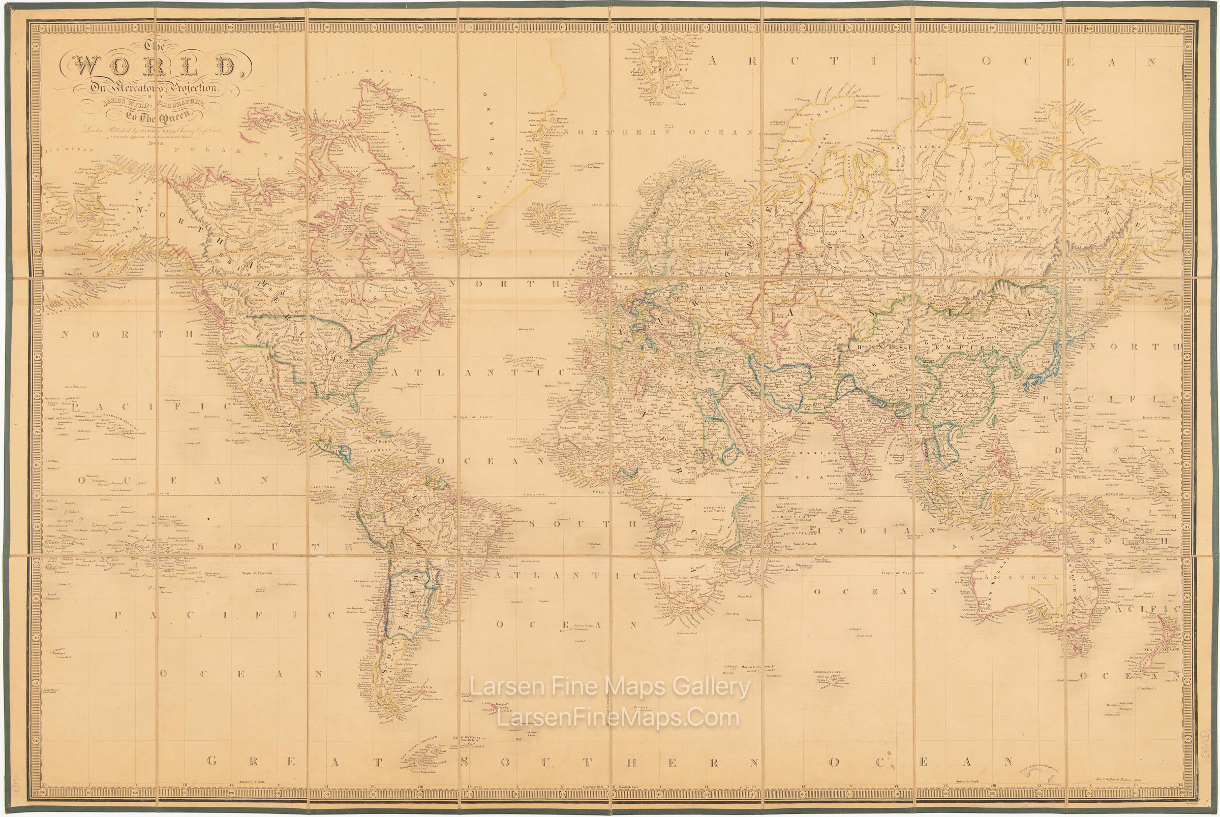
Large folding case-map of the world with original outline colour, dissected into 24 sections and mounted on linen, edges trimmed with green cloth, marbled paper to the folded end sections with a map advertisement to one side, folding into original pebbled brown cloth slipcase wanting all but a few scraps of the publisher's printed label to the upper board. The map paper evenly browned overall, slight wear to the linen at a few of the folds, marking to the slipcase but sound. Outline color at political boundaries. The map notably shows Texas as an independent republic. The republic existed for 10 years between 1836 and 1846 after which time the U.S. government invaded the territory as part of its ongoing campaign against Mexico.
FULL TITLE
MAPMAKER/CARTOGRAPHER/AUTHOR
PUBLISHER
PUBLICATION
DIMENSIONS (Inches)
CONDITION
Choose options
DESCRIPTION
FULL TITLE
MAPMAKER/CARTOGRAPHER/AUTHOR
PUBLISHER
PUBLICATION
DIMENSIONS (Inches)
CONDITION
DESCRIPTION
FULL TITLE
MAPMAKER/CARTOGRAPHER/AUTHOR
PUBLISHER
PUBLICATION
DIMENSIONS (Inches)
CONDITION