YEAR PUBLISHED: 1857
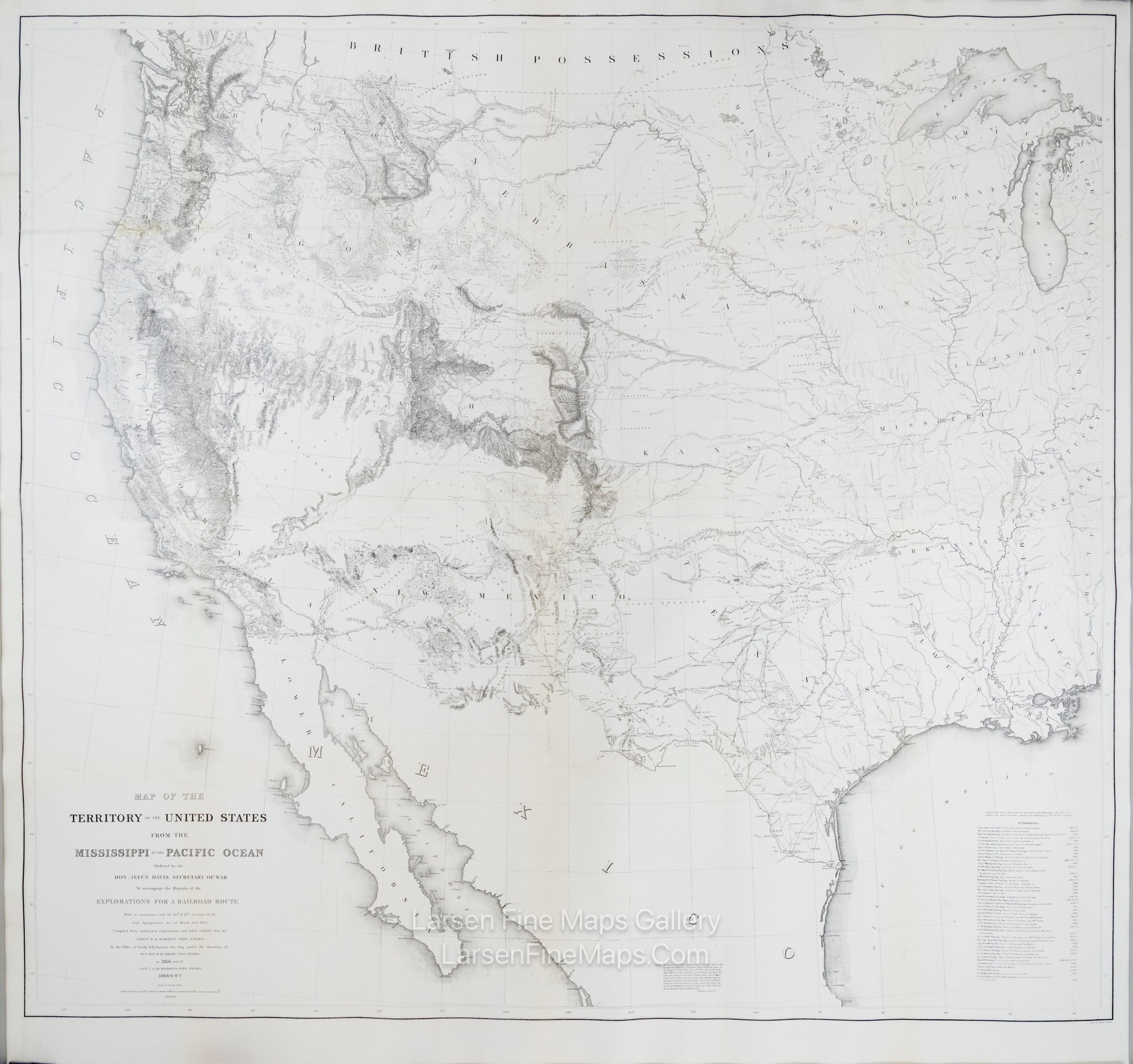
Map of the Territory of the United States from the Mississippi to the Pacific Ocean
DESCRIPTION
This is a monumentally important and scarce map that is considered to be the first accurate overall picture of the US West. It is known as Warren's General Map and he was just 24 years old when commissioned to conduct the survey. This very large map on two joined pages is drawn on the polyconic projection, incorporates the result of a half-century of government explorations beginning with Lewis & Clark to that of Warren's. Much detail is provided as to topography, rivers, lakes, settlements and the like. From Reports of Explorations and Surveys, to Ascertain the Most Practicable and Economical Route for Railroad from the Mississippi River to the Pacific Ocean… 1853-56 Volume XI
FULL TITLE
MAPMAKER/CARTOGRAPHER/AUTHOR
PUBLISHER
PUBLICATION
DIMENSIONS (Inches)
CONDITION
Choose options
DESCRIPTION
FULL TITLE
MAPMAKER/CARTOGRAPHER/AUTHOR
PUBLISHER
PUBLICATION
DIMENSIONS (Inches)
CONDITION
DESCRIPTION
FULL TITLE
MAPMAKER/CARTOGRAPHER/AUTHOR
PUBLISHER
PUBLICATION
DIMENSIONS (Inches)
CONDITION