
YEAR PUBLISHED: 1844
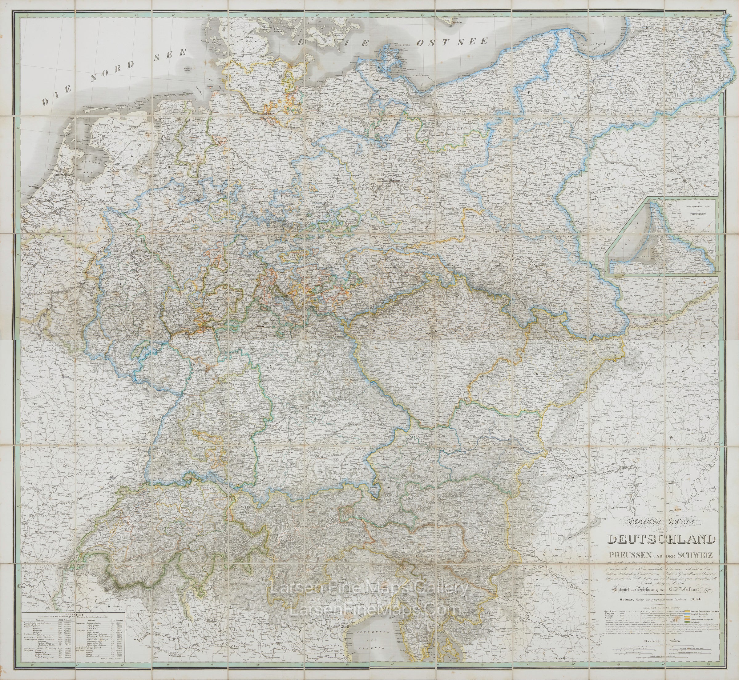
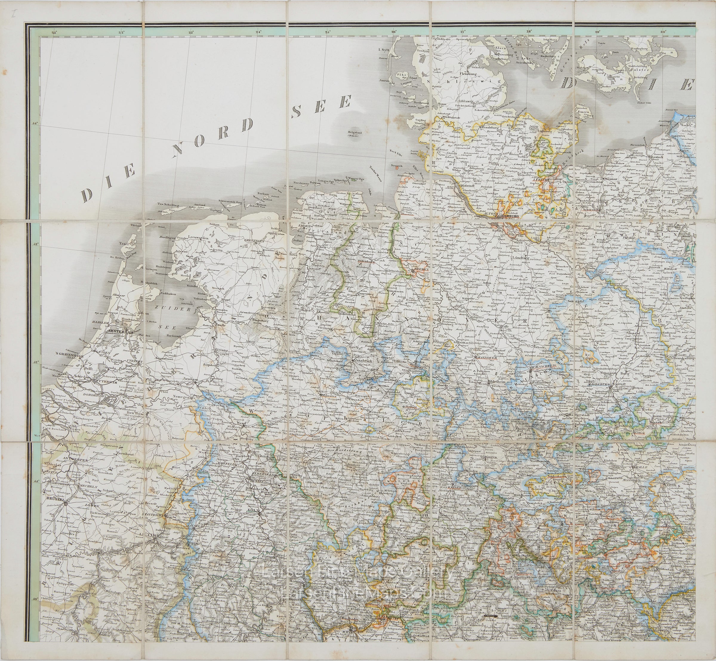
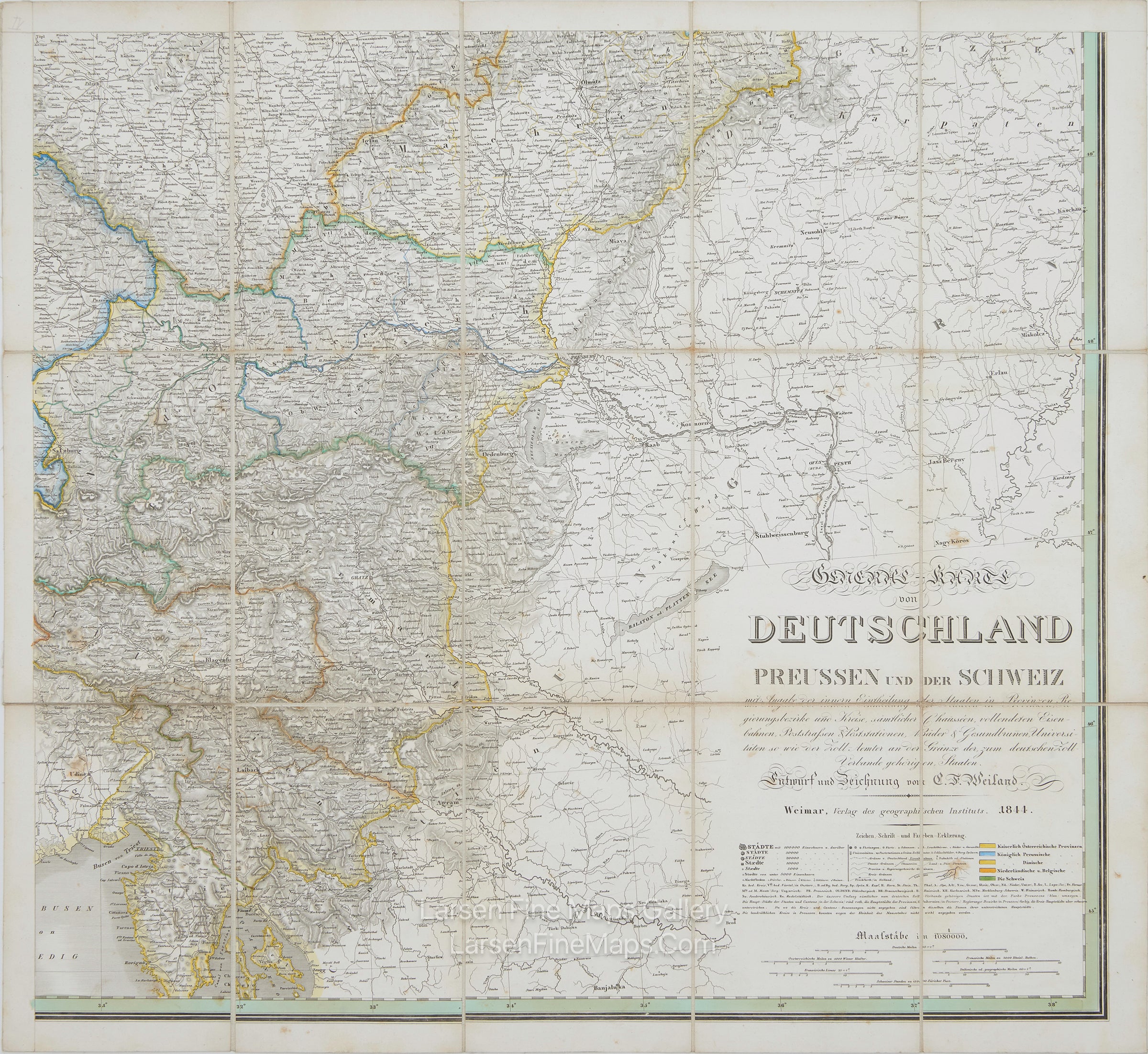
General Karte von Deutschland Preussen und der Schweiz
DESCRIPTION
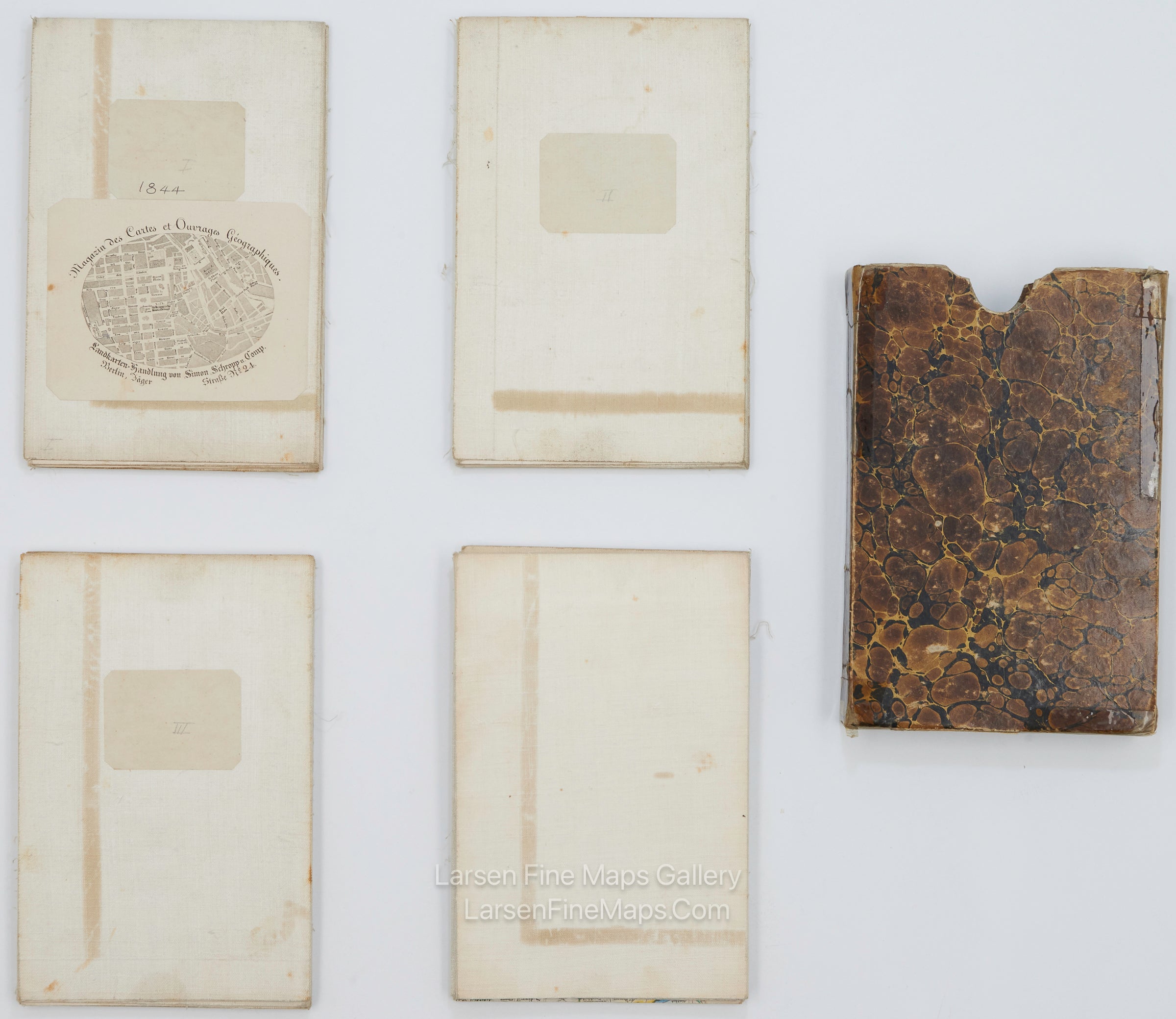
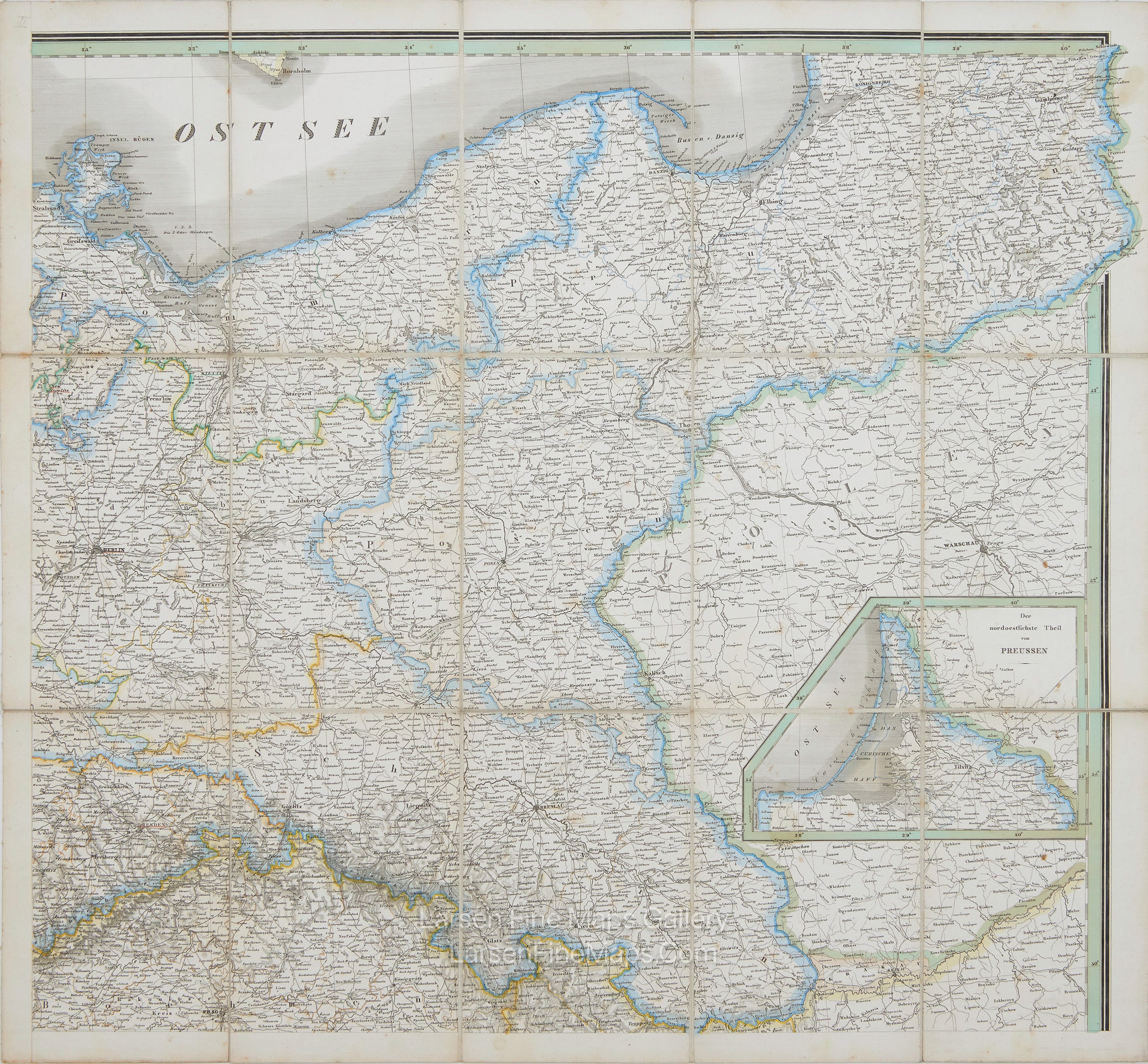
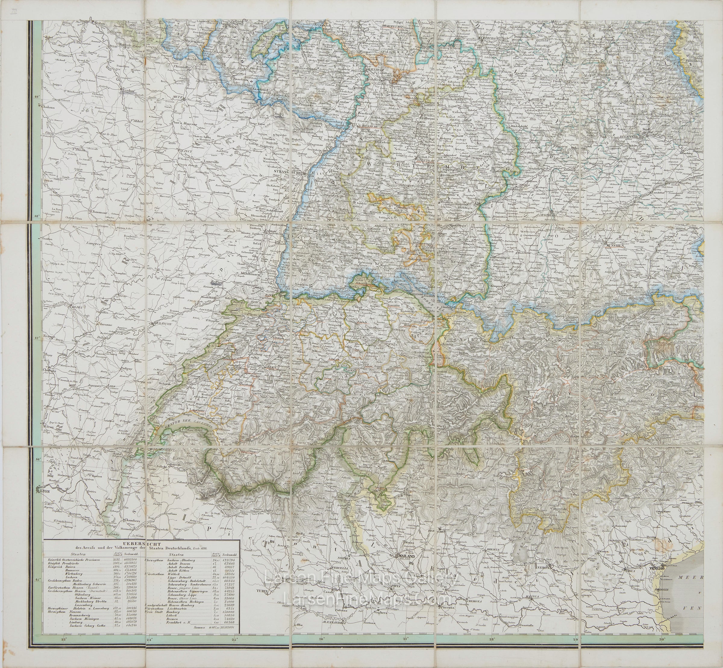
A gorgeous large case map of Germany, Prussia, and Switzerland in 4 sheets. General map of Germany, Prussia, and Switzerland: with details of the internal division of the states into provinces, administrative districts and counties, all highways, completed railways, postal roads & post stations, baths & health springs, universities, as well as the customs offices on the border of the states belonging to the German customs union, Weimar, 1844. Dissected and linen-backed. It is very detailed, and the outline colors are bright. A very clean copy. The map shows place names, roads, railroads, water courses, water bodies, states, and ports. Includes original case.
FULL TITLE
MAPMAKER/CARTOGRAPHER/AUTHOR
PUBLISHER
PUBLICATION
DIMENSIONS (Inches)
CONDITION
Choose options
DESCRIPTION
FULL TITLE
MAPMAKER/CARTOGRAPHER/AUTHOR
PUBLISHER
PUBLICATION
DIMENSIONS (Inches)
CONDITION
DESCRIPTION
FULL TITLE
MAPMAKER/CARTOGRAPHER/AUTHOR
PUBLISHER
PUBLICATION
DIMENSIONS (Inches)
CONDITION