YEAR PUBLISHED: 1799
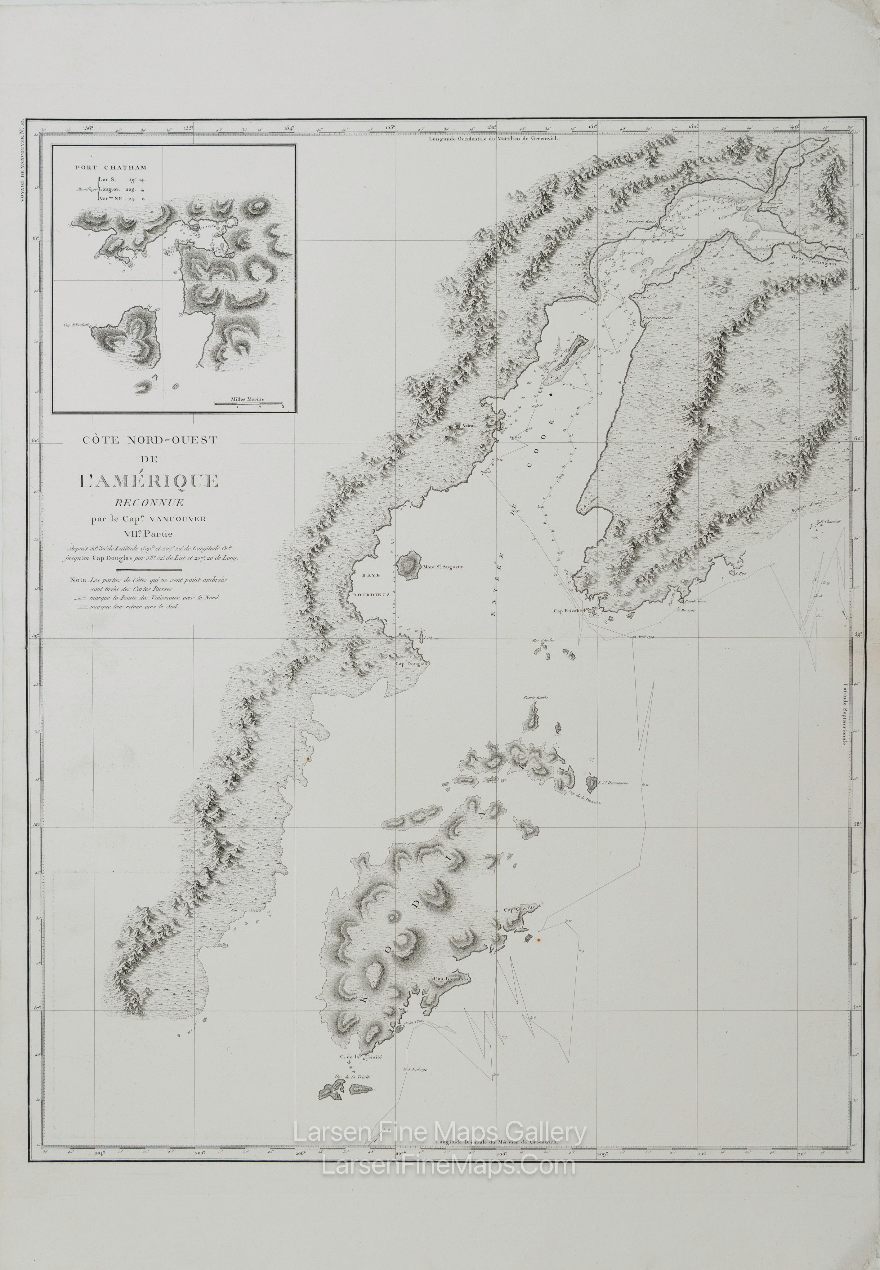
Côte Nord-Ouest de l'Amérique Reconnue par le Cape. Vancouver. VII.e Partie
DESCRIPTION
Striking and highly detailed refined unusual copper engraved large-format George Vancouver's 1799 sea chart depicting Kodiak Island and Cook Inlet, Alaska. Centered on the entrance to Cook Inlet, this map covers from Knik Arm and Turnagain Arm southwards as far as the southernmost tip of Kodiak Island. Offers detailed topography through numerous depth sounds and elevations rendered by profile. Mount St. Augustin and several volcanoes are noted. An inset of Port Chatham, at the southern tip of the Kenai Peninsula, appears in the upper left quadrant.
This particular example of Vancouver's map was issued as plate no. 10 in the highly desirable 1799 French edition of Vancouver's Atlas. It was drawn by Lieutenant Edward Roberts and engraved by Blondeau. The rare and coveted French edition of Vancouver's Atlas is more beautifully produced, with better engraving, higher-quality paper, and more detail than the 1798 English edition. This scarce map is a core piece for any serious collection focusing on California, Vancouver, British Columbia, or the Pacific Northwest.
FULL TITLE
MAPMAKER/CARTOGRAPHER/AUTHOR
PUBLISHER
PUBLICATION
DIMENSIONS (Inches)
CONDITION
Choose options
DESCRIPTION
FULL TITLE
MAPMAKER/CARTOGRAPHER/AUTHOR
PUBLISHER
PUBLICATION
DIMENSIONS (Inches)
CONDITION
DESCRIPTION
FULL TITLE
MAPMAKER/CARTOGRAPHER/AUTHOR
PUBLISHER
PUBLICATION
DIMENSIONS (Inches)
CONDITION