YEAR PUBLISHED: 1799
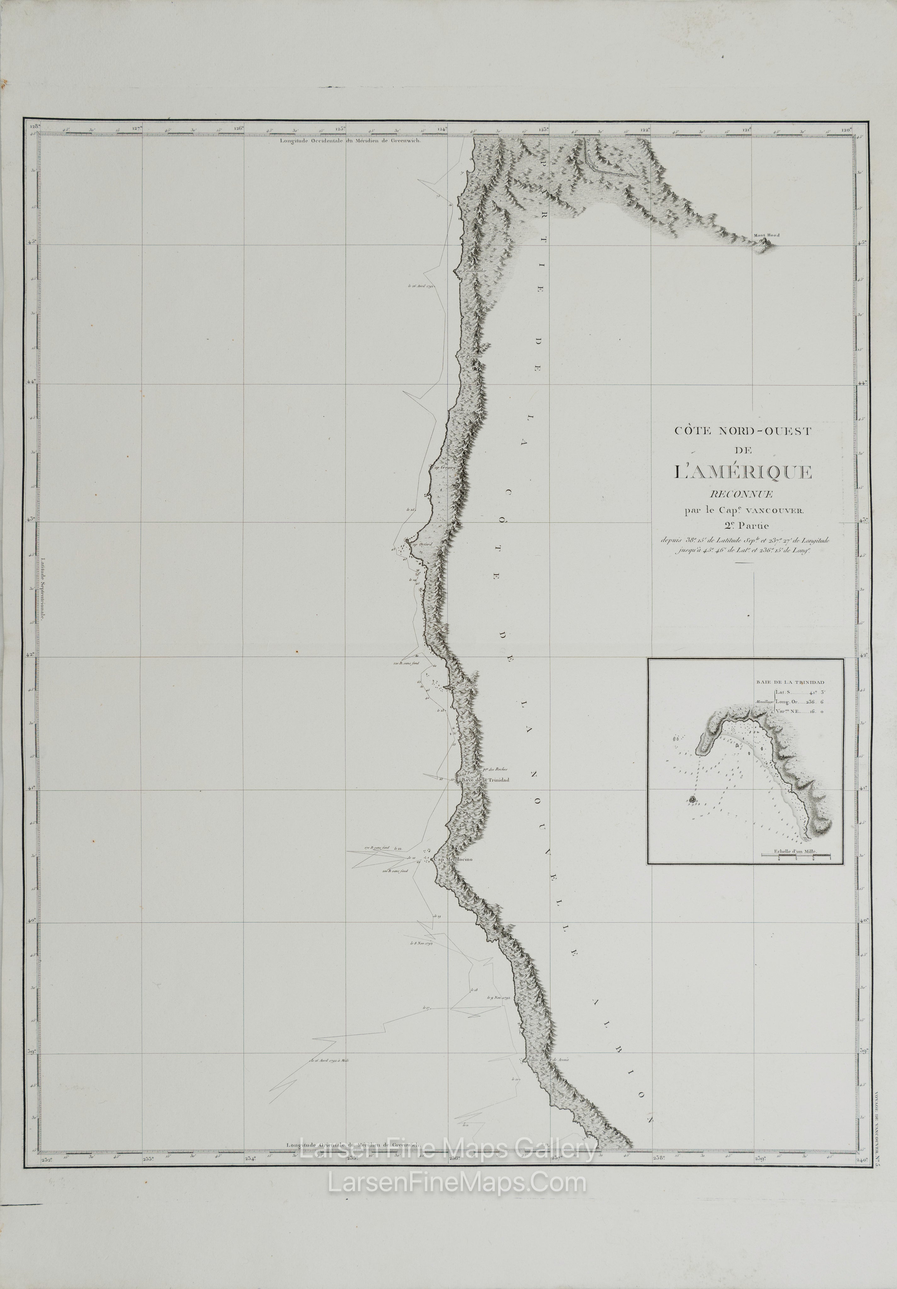
Côte Nord-Ouest de l'Amérique Reconnue par le Cape. Vancouver. 2e Partie
DESCRIPTION
Striking and highly detailed refined unusual copper engraved large-format George Vancouver's 1799 sea chart of northern California and Oregon. This map covers from Cape Lookout and the Columbia River southward past Cape Gregory, Cape Orford, Port St. George, the Bay of Trinidad, and Cape Mendocino to roughly 38 degrees 15 minutes north latitude. Vancouver mapped this coastline, which he identified as New Albion, recognizing the English claim to this territory established by Sir Frances Drake in 1792. An inset map of the Bay of Trinidad (Baie de la Trinidad) appears in the lower right quadrant. Vancouver visited the Bay of Trinidad in 1793 and noted the 'friendly and courteous' natives. The route of the Vancouver expedition is shown zigzagging back and forth along the coast. Elevation is shown by profile. While inland detail is minimal, there is a more sophisticated interior mapping in the upper right quadrant, including a map of the course of the Columbia River to Point Vancouver – the extent of Vancouver's exploration in the region. Mount Hood appears in the distance – as Vancouver's crew must have seen it from the Columbia River. Though not the goal of his expedition, which lay further north, Vancouver's mapping of the California and Oregon coastlines generated the finest coastal charts of this region to date and is an important stepping stone in the cartographic history of the American west coast.
This particular example of Vancouver's map was issued as plate no. 5 in the highly desirable 1799 French edition of Vancouver's Atlas. It was drawn by Lieutenant Edward Roberts and engraved by Blondeau. The rare and coveted French edition of Vancouver's Atlas is more beautifully produced, with better engraving, higher-quality paper, and more detail than the 1798 English edition. This scarce map is a core piece for any serious collection focusing on California, Vancouver, British Columbia, or the Pacific Northwest.
FULL TITLE
MAPMAKER/CARTOGRAPHER/AUTHOR
PUBLISHER
PUBLICATION
DIMENSIONS (Inches)
CONDITION
Choose options
DESCRIPTION
FULL TITLE
MAPMAKER/CARTOGRAPHER/AUTHOR
PUBLISHER
PUBLICATION
DIMENSIONS (Inches)
CONDITION
DESCRIPTION
FULL TITLE
MAPMAKER/CARTOGRAPHER/AUTHOR
PUBLISHER
PUBLICATION
DIMENSIONS (Inches)
CONDITION