YEAR PUBLISHED: 1824
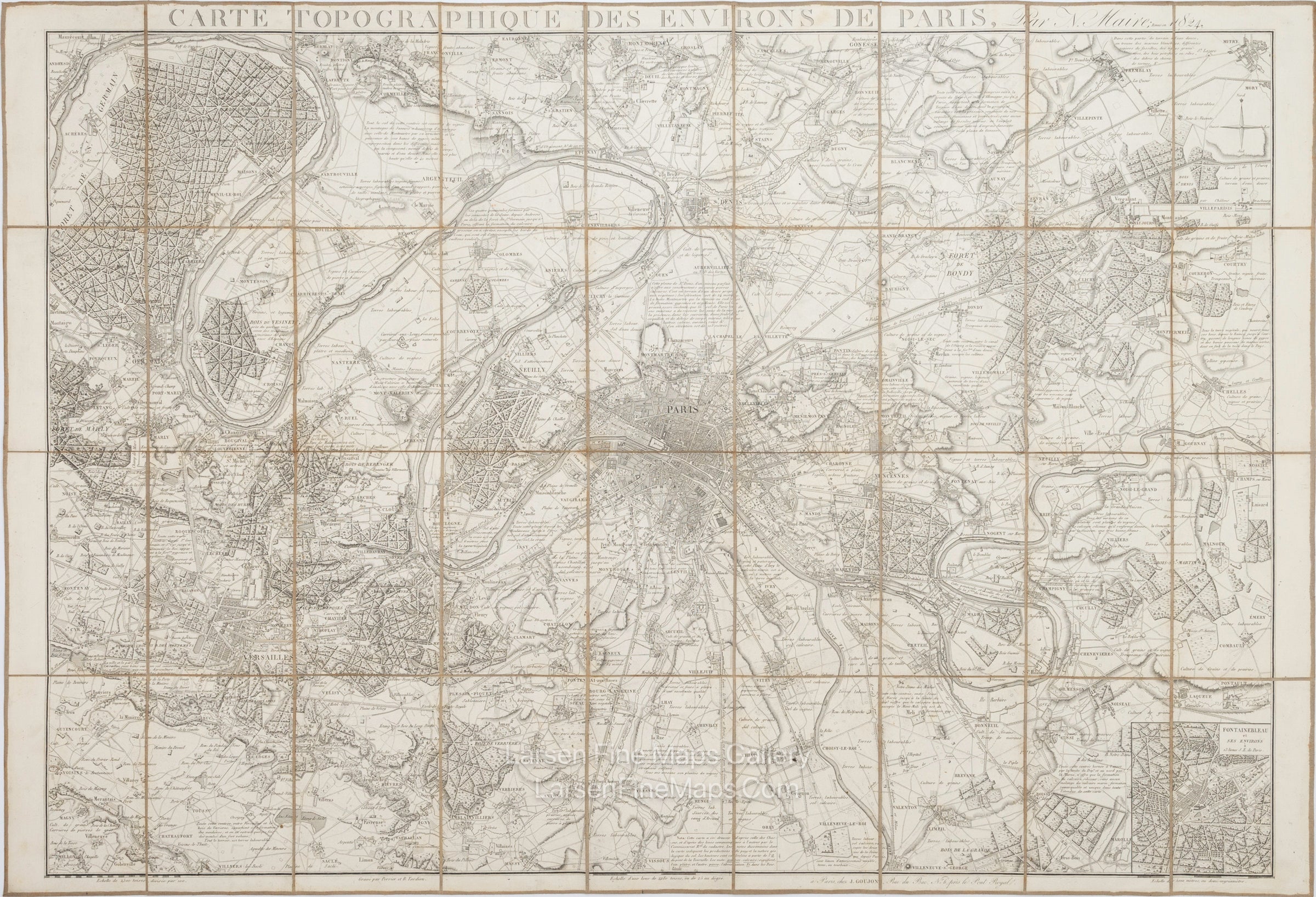
Carte Topographique Des Environs De Paris
DESCRIPTION
This gorgeous map of Paris and its environs shows fine detail of the countryside. It shows the area from Chateaufort in the SW east to Laqueue and Pontault, then north to Mitry, and finally west to Foret de Sr. Germain. It includes Versailles and an inset of the Fontainebleau and Environs.
FULL TITLE
MAPMAKER/CARTOGRAPHER/AUTHOR
PUBLISHER
PUBLICATION
DIMENSIONS (Inches)
CONDITION
Choose options
DESCRIPTION
FULL TITLE
MAPMAKER/CARTOGRAPHER/AUTHOR
PUBLISHER
PUBLICATION
DIMENSIONS (Inches)
CONDITION
DESCRIPTION
FULL TITLE
MAPMAKER/CARTOGRAPHER/AUTHOR
PUBLISHER
PUBLICATION
DIMENSIONS (Inches)
CONDITION