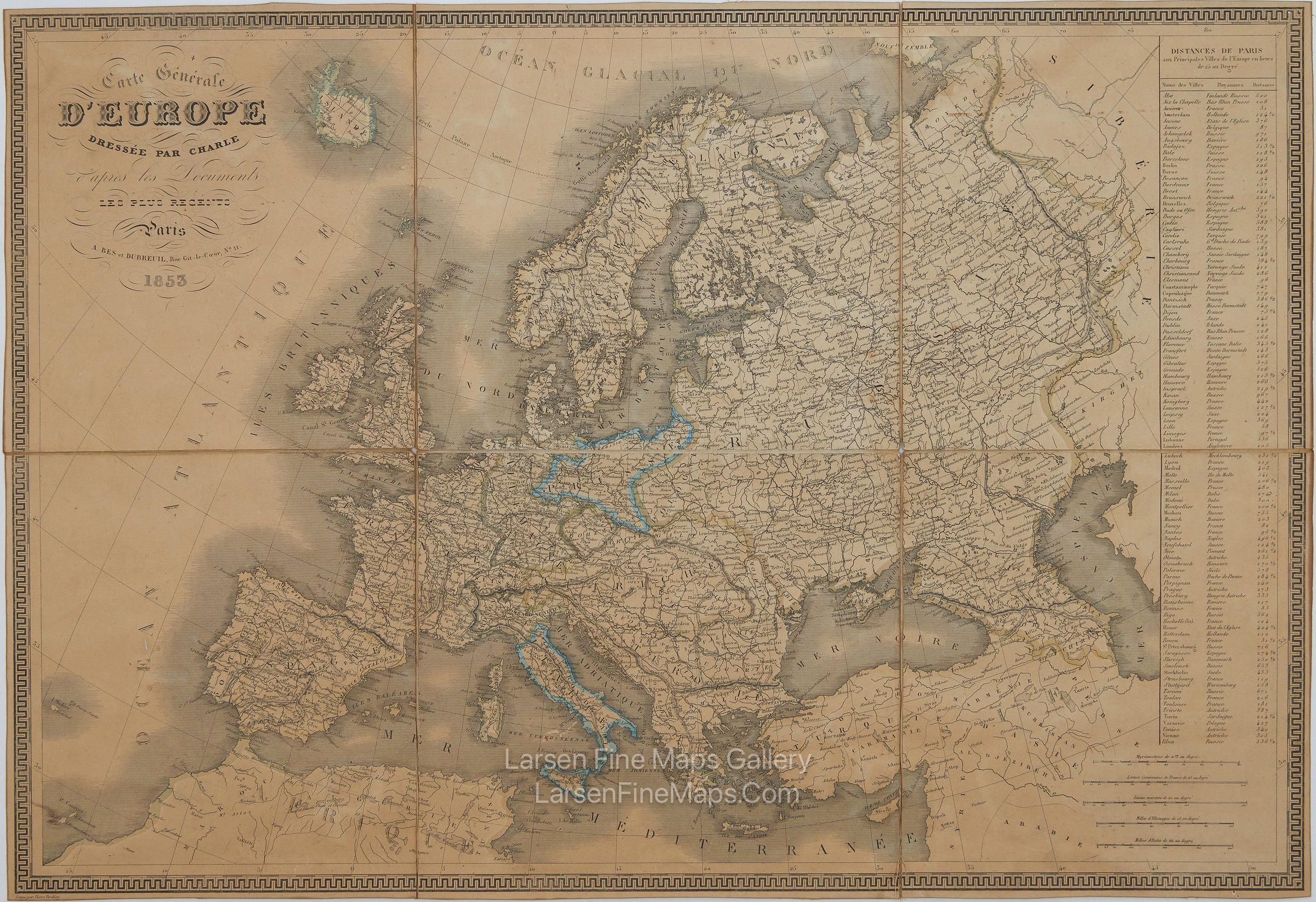
YEAR PUBLISHED: 1853
Carte Générale D'Europe
DESCRIPTION
This is a very nicely detailed map of the European continent, including Turkey and Iceland. A large table of distances adorns the right side, along with several scale bars. It is an elegant-looking map with a geometric border and relief shown by hachures. This is Europe as it was in the mid-19th Century. This is a difficult-to-find 1853 edition of the 1828 map associated with Langlois.
FULL TITLE
MAPMAKER/CARTOGRAPHER/AUTHOR
PUBLISHER
PUBLICATION
DIMENSIONS (Inches)
CONDITION
Choose options
DESCRIPTION
FULL TITLE
MAPMAKER/CARTOGRAPHER/AUTHOR
PUBLISHER
PUBLICATION
DIMENSIONS (Inches)
CONDITION
DESCRIPTION
FULL TITLE
MAPMAKER/CARTOGRAPHER/AUTHOR
PUBLISHER
PUBLICATION
DIMENSIONS (Inches)
CONDITION