YEAR PUBLISHED: 1760
Americae Septentrionalis (Pars I, II, III, IV)
DESCRIPTION
This is the FULL SET of all four sheets of Euler's map.
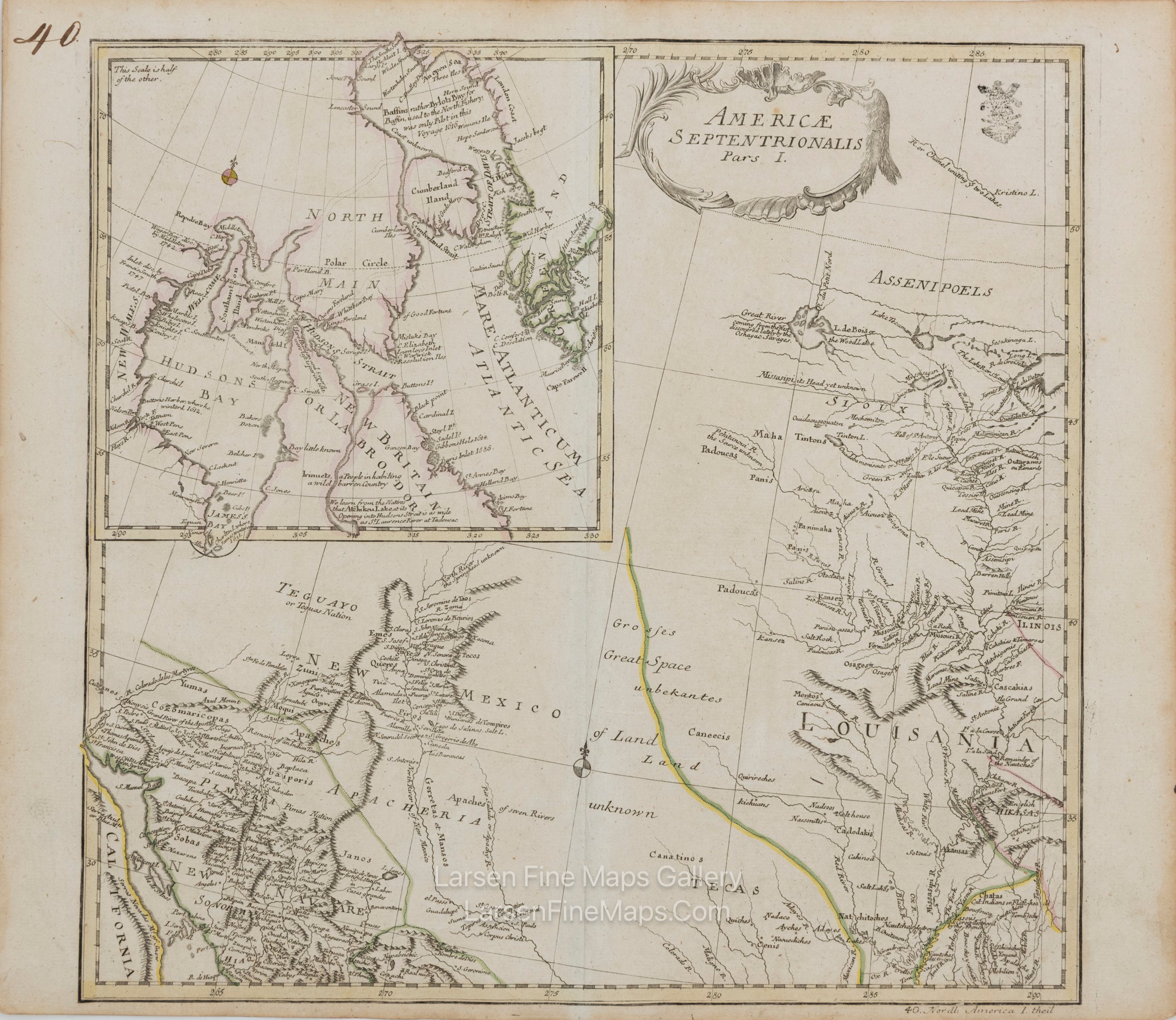
The northwest sheet (Pars I) from von Euler's scarce four-sheet map set of North America (Americae Septentrionalis). Pars I covers the region from a portion of peninsular California in the southwest through Tecas (Texas) to Louisania (Louisiana) in the southeast and north (via a large inset map) to Hudson’s and Baffin’s Bay, with parts of New Mexico in the interior. This sheet contains decorative but simple title cartouche in the upper right. Relief shown pictorially. This sheet originates from Euler’s second atlas of 1760 as can be ascertained by the page number “40” in the upper right. The sheet also contains “40. Nordl. America 1. theil” in the lower right margin.
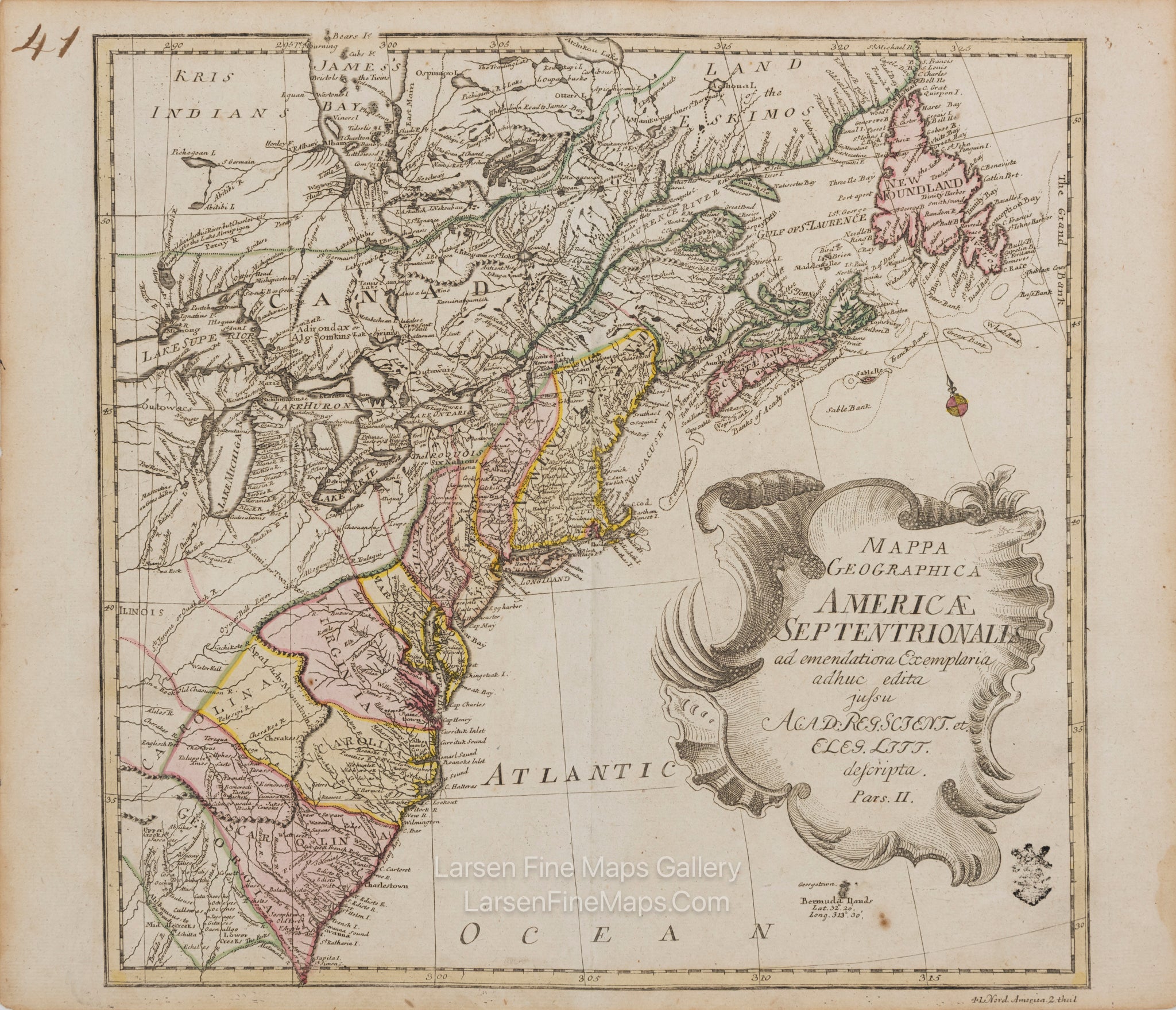
The northeast sheet (Pars II) from von Euler's scarce four-sheet map set of North America (Americae Septentrionalis). Pars II covers the region from Georgia to New Foundland, Gulf of St. Laurence and “Land of the Eskimos” in the northeast, and westward to the reaches of Lake Superior. This sheet contains the main larger title cartouche in the lower right. Relief shown pictorially. This sheet originates from Euler’s second atlas of 1760 as can be ascertained by the page number “41” in the upper right. The sheet also contains “41. Nord. America 2. theil” in the lower right margin.
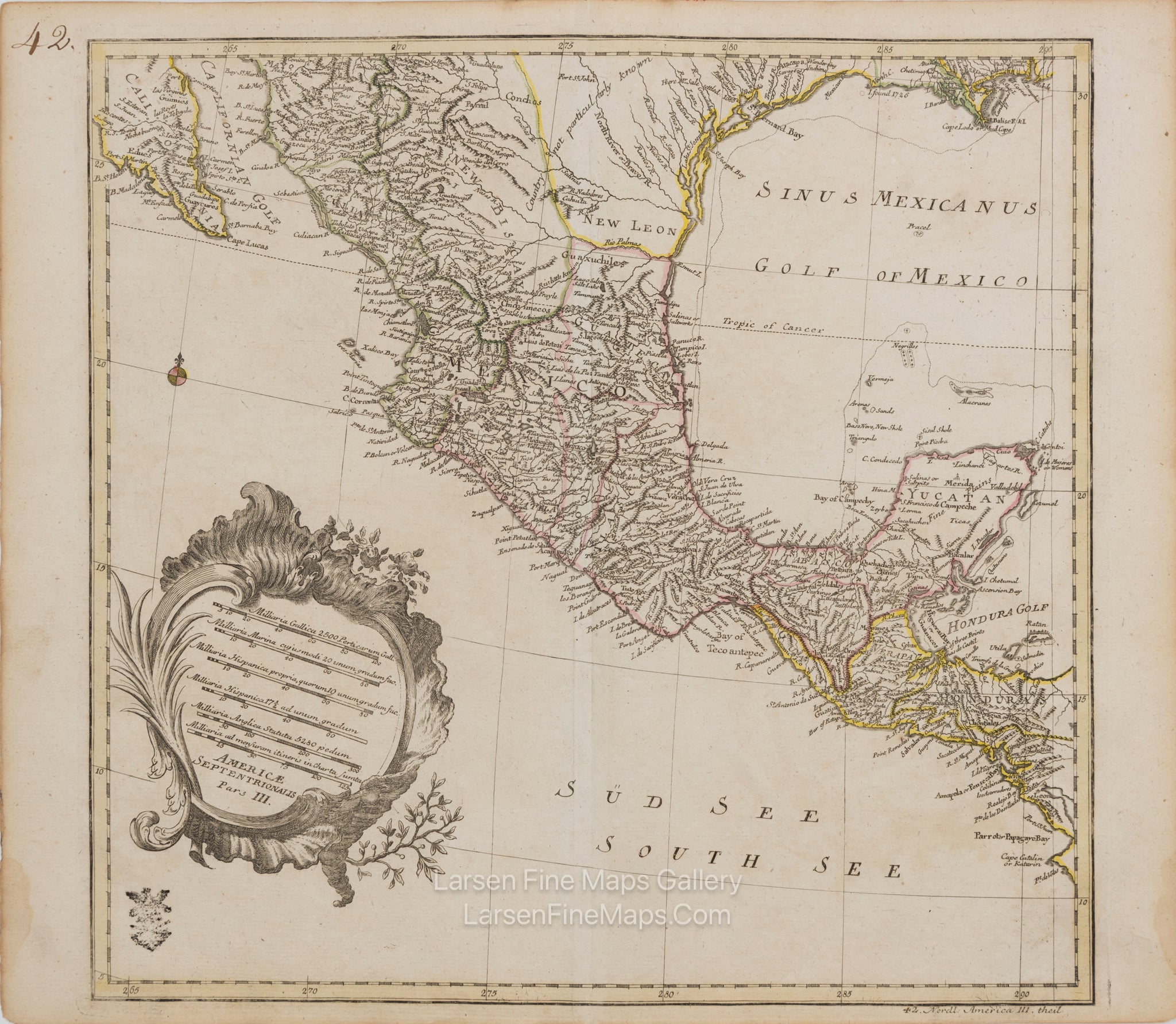
The southwest sheet (Pars III) from von Euler's scarce four-sheet map set of North America (Americae Septentrionalis). Pars III covers the region from the south portion of peninsular California to Mobile Bay and south through Mexico and Central America as far as the Yucatan and Honduras. This sheet has a table of distant scales, the title and sheet designation in a decorative cartouche in the lower left. Relief shown pictorially. This state is from the second atlas issue (sheet 42 of sheets 40, 41, 42, 43 of the set). Notations in the lower right margin is "42. Nordl. America III. Theil"
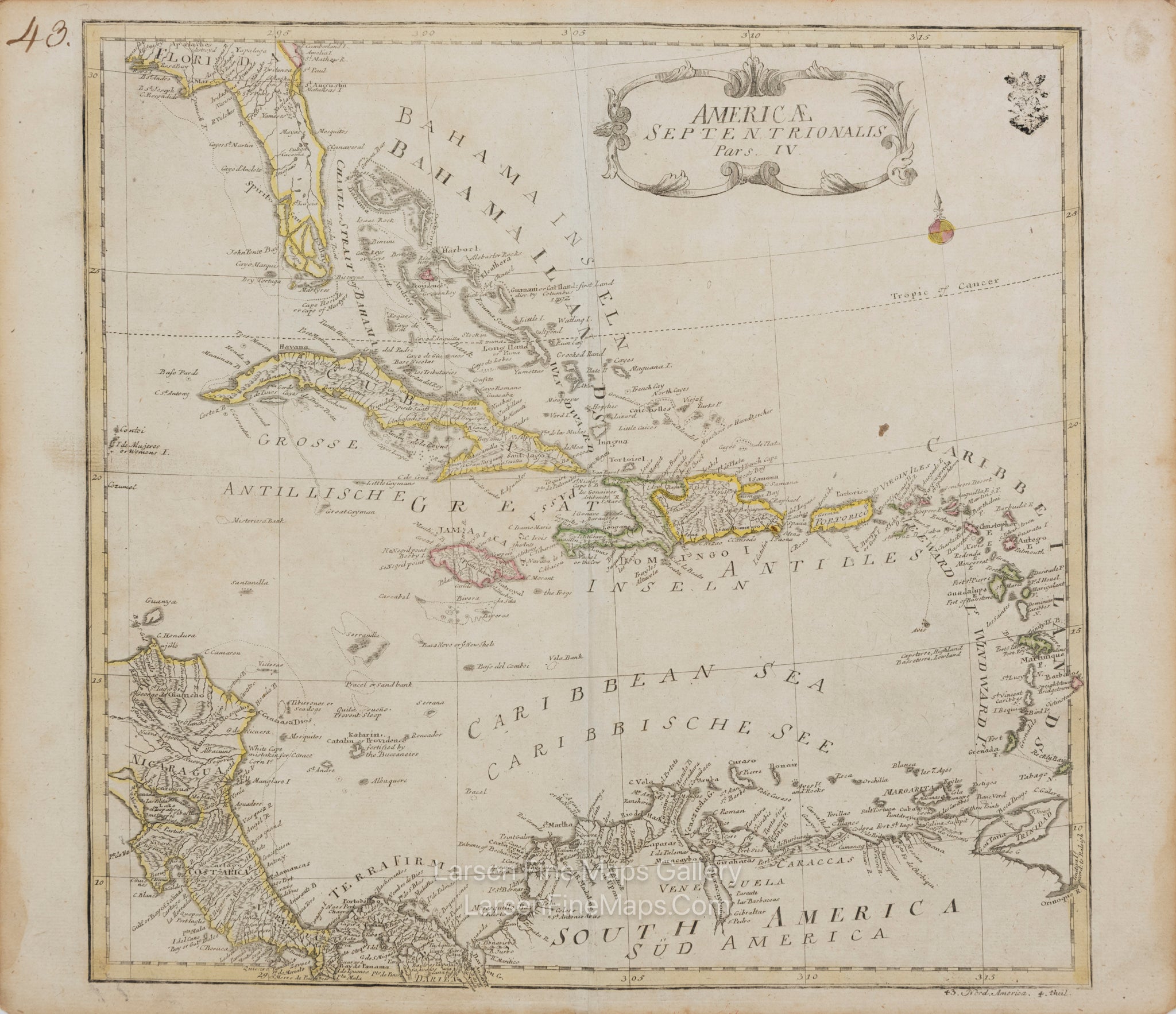
The Southeast sheet (pars IV) from von Euler's scarce four-sheet map set of North America (Americae Septentrionalis). Pars IV covers the region from the peninsula of Florida through the West Indies and most of the Carribean islands and sea, parts of Central America and the top portion of South America. This sheet contains decorative but simple title cartouche in the upper right. Relief shown pictorially. This sheet originates from Euler’s second atlas of 1760 as can be ascertained by the page number “43” in the upper right. The sheet also contains “43. Nord. America 4. theil” in the lower right margin.
Dimension of each sheet is 16.5" x 14"
NOTE: the four sheets are numbered 37, 38, 39, 40 in the first issue of Euler’s atlas in 1753.
Additional Notes:
Sheet 40: Northwest part, extends west to show part of Baja California, inset of Hudson's Bay region;
Sheet 41: Northeast part, shows the Colonies, and Canada;
Sheet 42: Southwest part, Mexico and Central America, table of distance scales;
Sheet 43: Southeast part shows Caribbean. Each sheet approx. 34x35 cm. (13¼x13¾").
Uncommon German map of North America. The legends are all in English, only in a few places does German appear.
FULL TITLE
MAPMAKER/CARTOGRAPHER/AUTHOR
PUBLISHER
PUBLICATION
DIMENSIONS (Inches)
CONDITION
Choose options
DESCRIPTION
FULL TITLE
MAPMAKER/CARTOGRAPHER/AUTHOR
PUBLISHER
PUBLICATION
DIMENSIONS (Inches)
CONDITION
DESCRIPTION
FULL TITLE
MAPMAKER/CARTOGRAPHER/AUTHOR
PUBLISHER
PUBLICATION
DIMENSIONS (Inches)
CONDITION