YEAR PUBLISHED: 1855
Sketch of South Farallon Island Pacific Ocean
DESCRIPTION
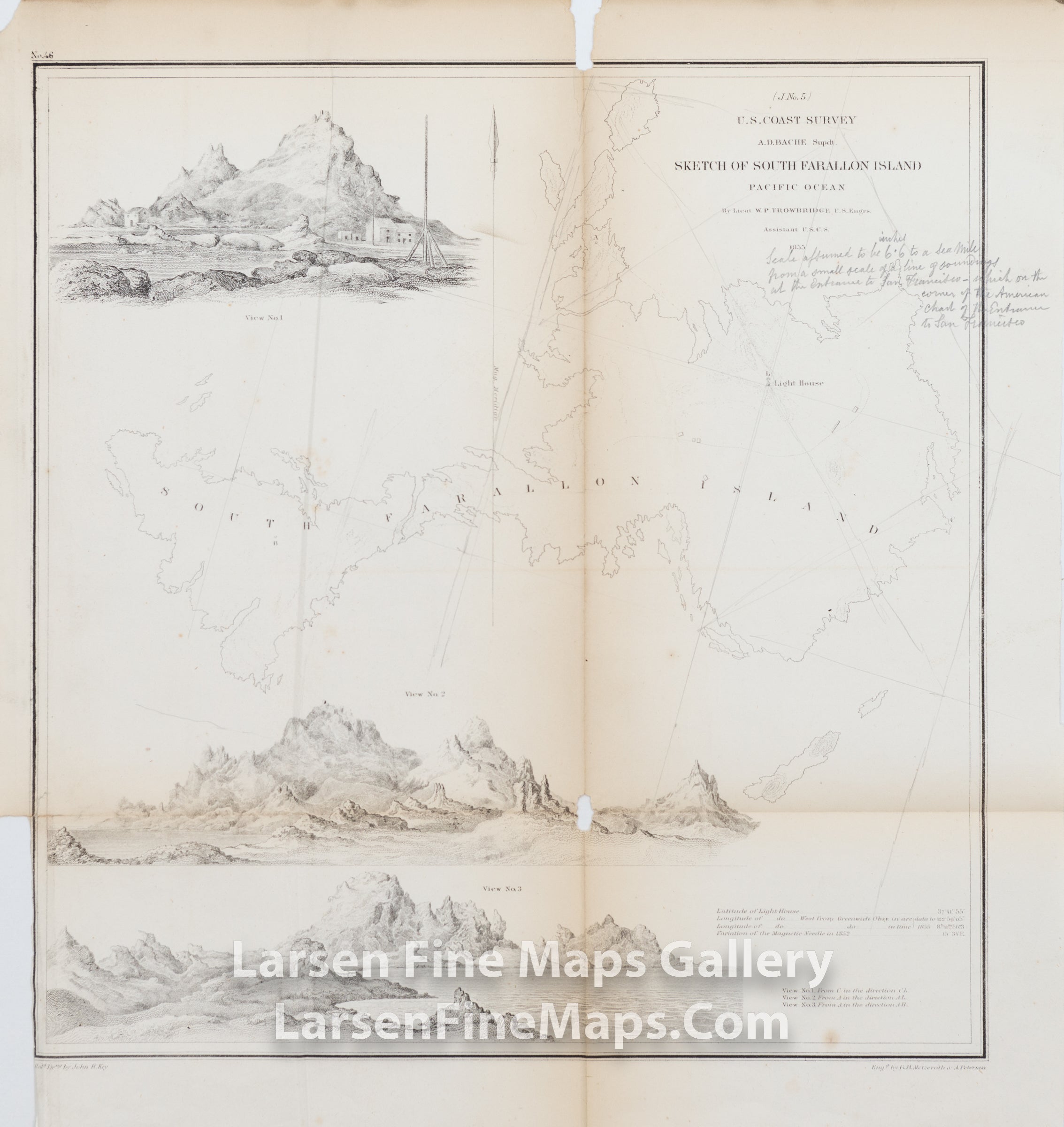
A striking chart of South Farallon Island with 3 beautiful etchings showing the profile of the island from different vantage points, including an etching showing some buildings on the island. The chart itself only has the coastline of the island and the lighthouse and associated structures.
IMPORTANT NOTE:
All of our United States Coast Survey (USCS), United States Coast & Geodetic Survey (USC&GS), and similar maps and charts have been professionally unfolded and flattened using humidity baths, semi-permeable membrane, and drying blotter techniques. Most others you typically see on eBay have not been, and worse, are quickly and crudely unfolded for the low-quality photos you see. Unfolding these maps in that way is damaging and weakens them. Please be aware.
FULL TITLE
MAPMAKER/CARTOGRAPHER/AUTHOR
PUBLISHER
PUBLICATION
DIMENSIONS (Inches)
CONDITION
Choose options
DESCRIPTION
FULL TITLE
MAPMAKER/CARTOGRAPHER/AUTHOR
PUBLISHER
PUBLICATION
DIMENSIONS (Inches)
CONDITION
DESCRIPTION
FULL TITLE
MAPMAKER/CARTOGRAPHER/AUTHOR
PUBLISHER
PUBLICATION
DIMENSIONS (Inches)
CONDITION