YEAR PUBLISHED: 1844
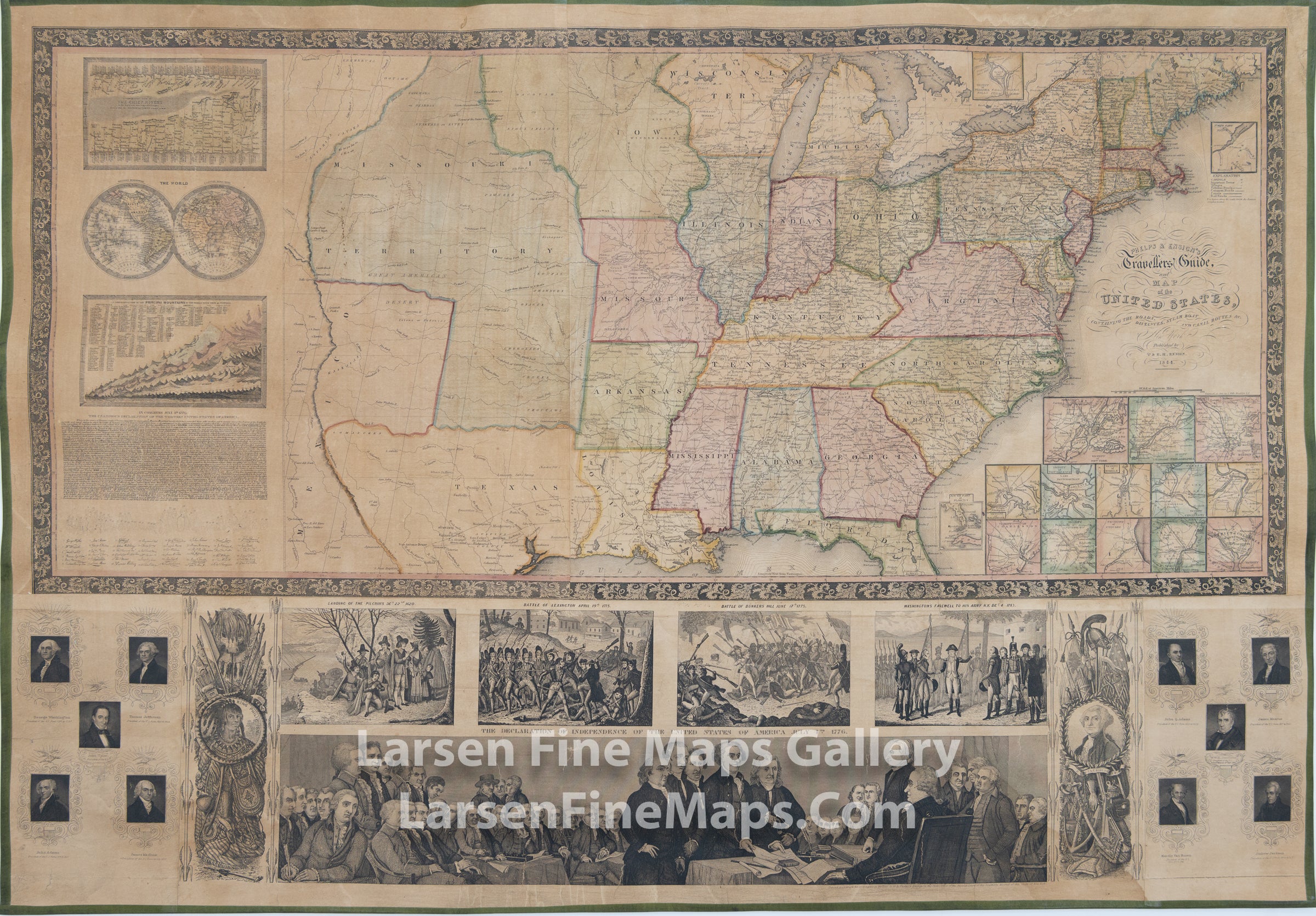
Phelps & Ensign's Travellers' Guide and Map of the United States
DESCRIPTION
A fascinating map of the United States in 1844 before Texas joined the Union. It shows the progression of states and settlements westward not long before the gold rush of California. You can see the Missouri and Wisconsin Territories with the sizeable early shape of Iowa in-between. Texas has an early configuration sometimes referred to as the "strawberry shaped Texas." Included are maps of many important cities and towns in the lower right of the main map frame. Vicinity of Washington, Vicinity of Detroit, Vicinity of Chicago, Vicinity of Pittsburg, Vicinity of Charleston, Vicinity of St. Louis, Vicinity of Cincinnati, Vicinity of Mobile, Vicinity of New Orleans, Vicinity of Baltimore, Vicinity of Boston, Vicinity of Philadelphia, and Vicinity of New York. On the left are a chart of the Comparative View of The Chief Rivers of the World, two hemispherical maps of the World, a Comparative View of the Principal Mountains fo the World, and a facsimile of The Declaration of Independence. Along the bottom are many vignettes of key events in history, including; Landing of the Pilgrims December 22nd 1620, Battle of Lexington April 19th 1775, Battle of Bunker's Hill June 17th 1775, Washington's Farewell to his Army N.Y. December 4th 1783, and a large pictorial of the signing of the Declaration of Independence, July 4th, 1776. In addition are portraits of 10 of the former Presidents of the young United States.
FULL TITLE
MAPMAKER/CARTOGRAPHER/AUTHOR
PUBLISHER
PUBLICATION
DIMENSIONS (Inches)
CONDITION
Choose options
DESCRIPTION
FULL TITLE
MAPMAKER/CARTOGRAPHER/AUTHOR
PUBLISHER
PUBLICATION
DIMENSIONS (Inches)
CONDITION
DESCRIPTION
FULL TITLE
MAPMAKER/CARTOGRAPHER/AUTHOR
PUBLISHER
PUBLICATION
DIMENSIONS (Inches)
CONDITION