
YEAR PUBLISHED:1783
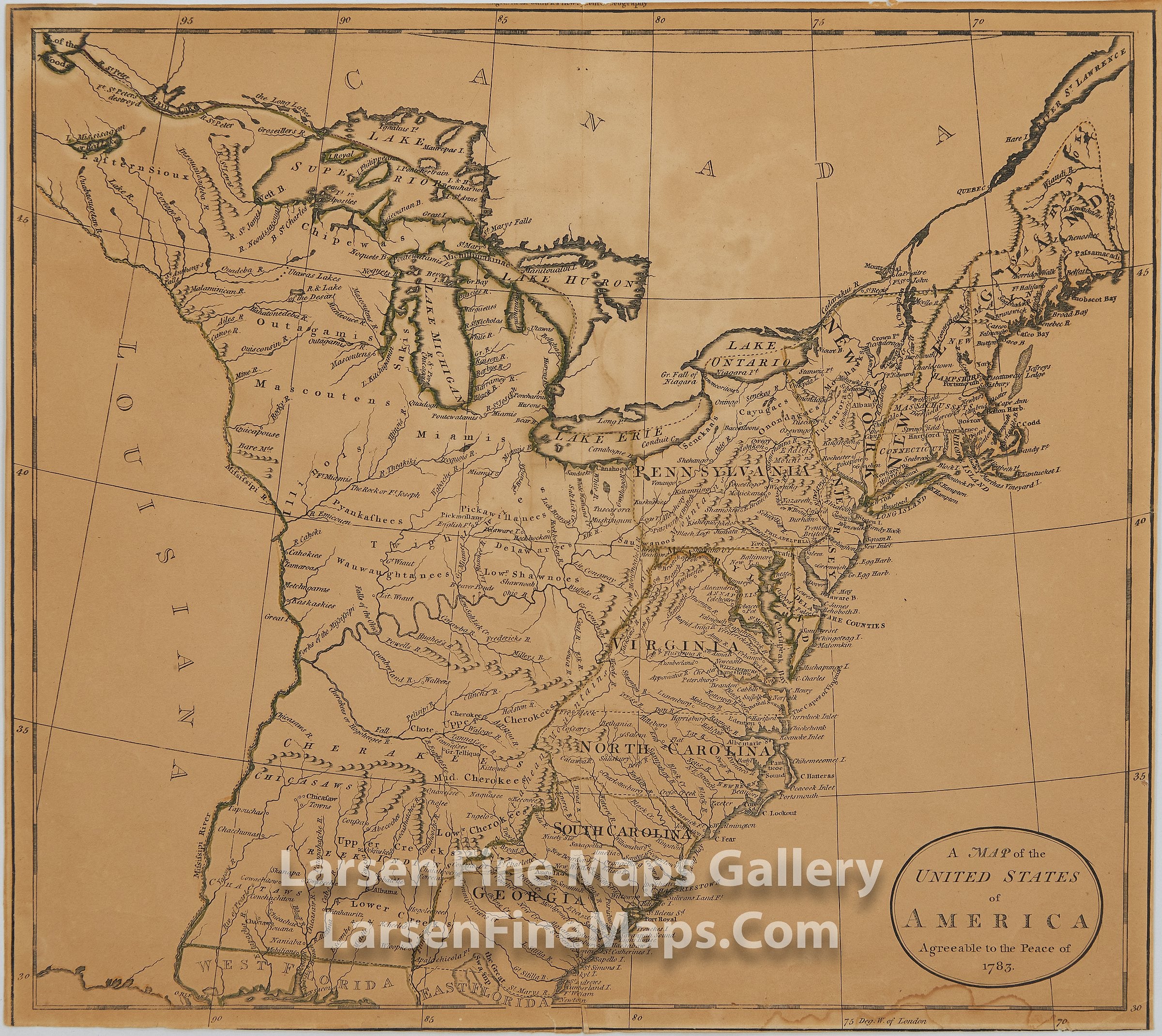
A Map of The United States of America Agreeable to the Peace of 1783
DESCRIPTION
A nicely detailed map that shows provincial boundaries, Indian villages and tribal territory, rivers, and lakes, a few forts and place-names of Northeastern United States just after the Revolutionary War. Relief is shown pictorially. Shows the states along the Atlantic seaboard. Florida is divided into West and East indicating a territorial dispute with Spain from the ambiguities of the Louisiana Purchase. The Great Lakes, the territory east of the Appalachian and Allegheny Mountains to then French Louisiana.
FULL TITLE
MAPMAKER/CARTOGRAPHER/AUTHOR
PUBLISHER
PUBLICATION
DIMENSIONS (Inches)
CONDITION
Choose options
DESCRIPTION
FULL TITLE
MAPMAKER/CARTOGRAPHER/AUTHOR
PUBLISHER
PUBLICATION
DIMENSIONS (Inches)
CONDITION
DESCRIPTION
FULL TITLE
MAPMAKER/CARTOGRAPHER/AUTHOR
PUBLISHER
PUBLICATION
DIMENSIONS (Inches)
CONDITION