YEAR PUBLISHED: 1852
Preliminary Sketch of Mobile Bay
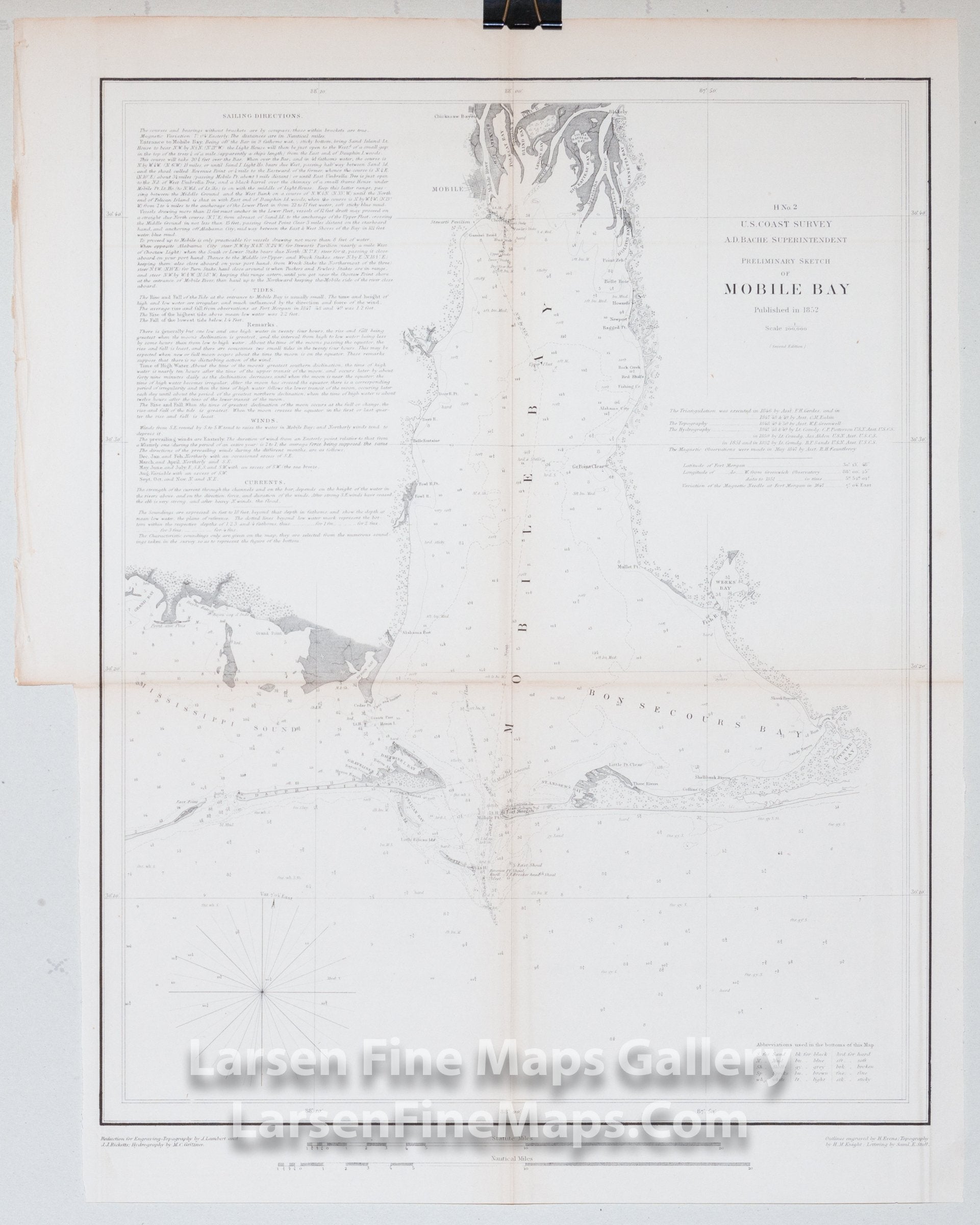
DESCRIPTION
Chart of Mobile Bay, Alabama detailing the region from Grand Bay and Mississippi Sound on the west to Bon Secour Bay on the east. Great detail all along Mobile Bay including the Alabama and Apalachee Rivers, Mobile Point, Dauphine Island, Weeks Bay, Oyster Bay, Sand Island Bank and the city of Moblie, Alabama are given. Depth soundings, bearings and channels are included throughout. Very thorough sailing directions, tidal, current, and wind notes are included.
IMPORTANT NOTE:
All of our United States Coast Survey (USCS), United States Coast & Geodetic Survey (USC&GS), and similar maps and charts have been professionally unfolded and flattened using humidity baths, semi-permeable membrane, and drying blotter techniques. Most others you typically see on eBay have not been, and worse, are quickly and crudely unfolded for the low-quality photos you see. Unfolding these maps in that way is damaging and weakens them. Please be aware.
FULL TITLE
MAPMAKER/CARTOGRAPHER/AUTHOR
PUBLISHER
PUBLICATION
DIMENSIONS (Inches)
CONDITION
Choose options
DESCRIPTION
FULL TITLE
MAPMAKER/CARTOGRAPHER/AUTHOR
PUBLISHER
PUBLICATION
DIMENSIONS (Inches)
CONDITION
DESCRIPTION
FULL TITLE
MAPMAKER/CARTOGRAPHER/AUTHOR
PUBLISHER
PUBLICATION
DIMENSIONS (Inches)
CONDITION