YEAR PUBLISHED: 1853
Cedar Keys, Bahia Honda, Key Biscayne, Key West, & Dry Tortuga 1849-1852
DESCRIPTION
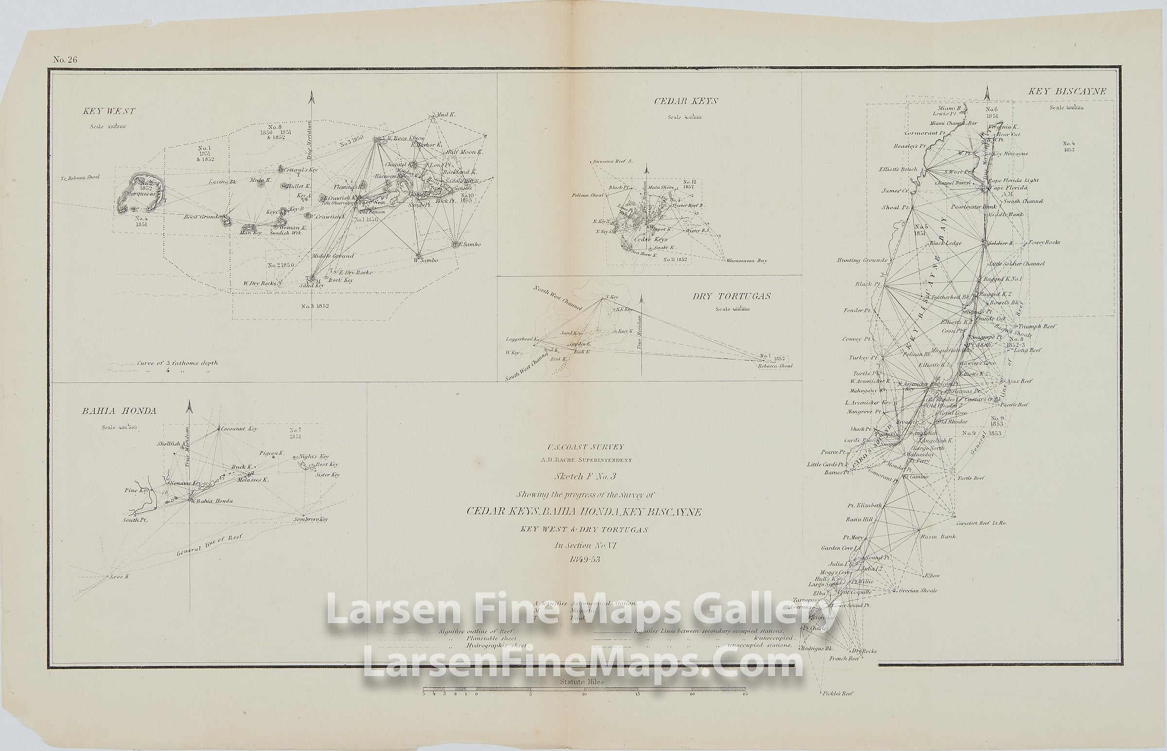
1849-53 Chart ofCedar Keys, Bahia Honda, Key Biscayne, Key West, and Dry Tortugas. This chart consists of four charts/insets on a single map sheet. The upper left chart gives detail on Key West, Florida, and some nearby islands. The upper center chart details Cedar Keys and then Key Biscayne Bay is shown on the right. Bahia Honda is shown on the lower left. Many triangulations are shown as well.
IMPORTANT NOTE:
All of our United States Coast Survey (USCS), United States Coast & Geodetic Survey (USC&GS), and similar maps and charts have been professionally unfolded and flattened using humidity baths, semi-permeable membrane, and drying blotter techniques. Most others you typically see on eBay have not been, and worse, are quickly and crudely unfolded for the low-quality photos you see. Unfolding these maps in that way is damaging and weakens them. Please be aware.
FULL TITLE
MAPMAKER/CARTOGRAPHER/AUTHOR
PUBLISHER
PUBLICATION
DIMENSIONS (Inches)
CONDITION
Choose options
DESCRIPTION
FULL TITLE
MAPMAKER/CARTOGRAPHER/AUTHOR
PUBLISHER
PUBLICATION
DIMENSIONS (Inches)
CONDITION
DESCRIPTION
FULL TITLE
MAPMAKER/CARTOGRAPHER/AUTHOR
PUBLISHER
PUBLICATION
DIMENSIONS (Inches)
CONDITION