YEAR PUBLISHED: 1874
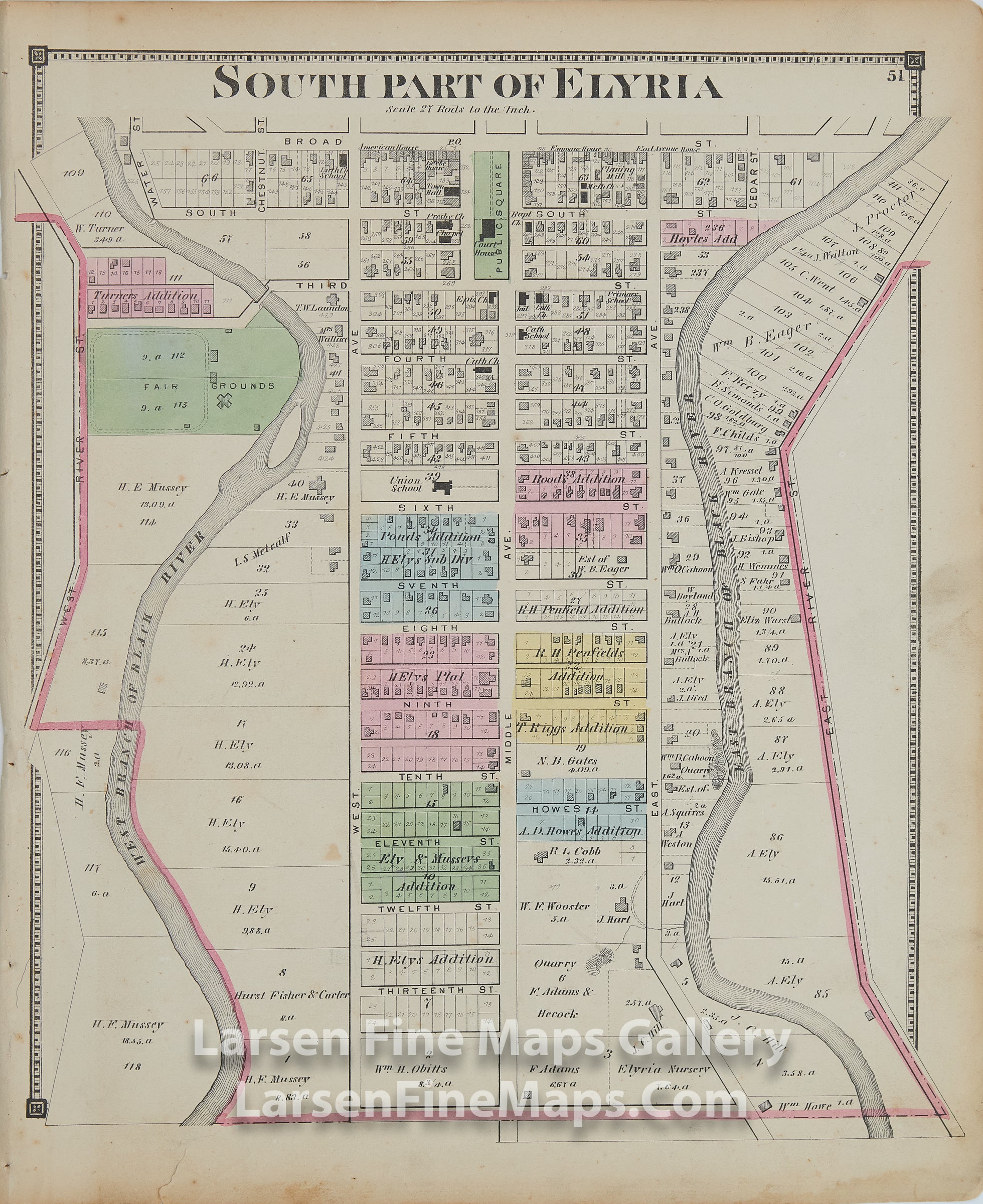
South Part of Elyria, Lorain County, Ohio
DESCRIPTION
A very informative antique vintage map of the South Part of Elyria, Lorain County, Ohio. This is a very nice hand-colored map showing the town of 1874 including ownership, primary thoroughfares, waterways, parcels, buildings, and miscellaneous other points of interest. Original hand coloring, blank verso, and decorative neatline. Includes the West and East branches of the Black River.
FULL TITLE
MAPMAKER/CARTOGRAPHER/AUTHOR
PUBLISHER
PUBLICATION
DIMENSIONS (Inches)
CONDITION
Choose options
DESCRIPTION
FULL TITLE
MAPMAKER/CARTOGRAPHER/AUTHOR
PUBLISHER
PUBLICATION
DIMENSIONS (Inches)
CONDITION
DESCRIPTION
FULL TITLE
MAPMAKER/CARTOGRAPHER/AUTHOR
PUBLISHER
PUBLICATION
DIMENSIONS (Inches)
CONDITION