
YEAR PUBLISHED:1787
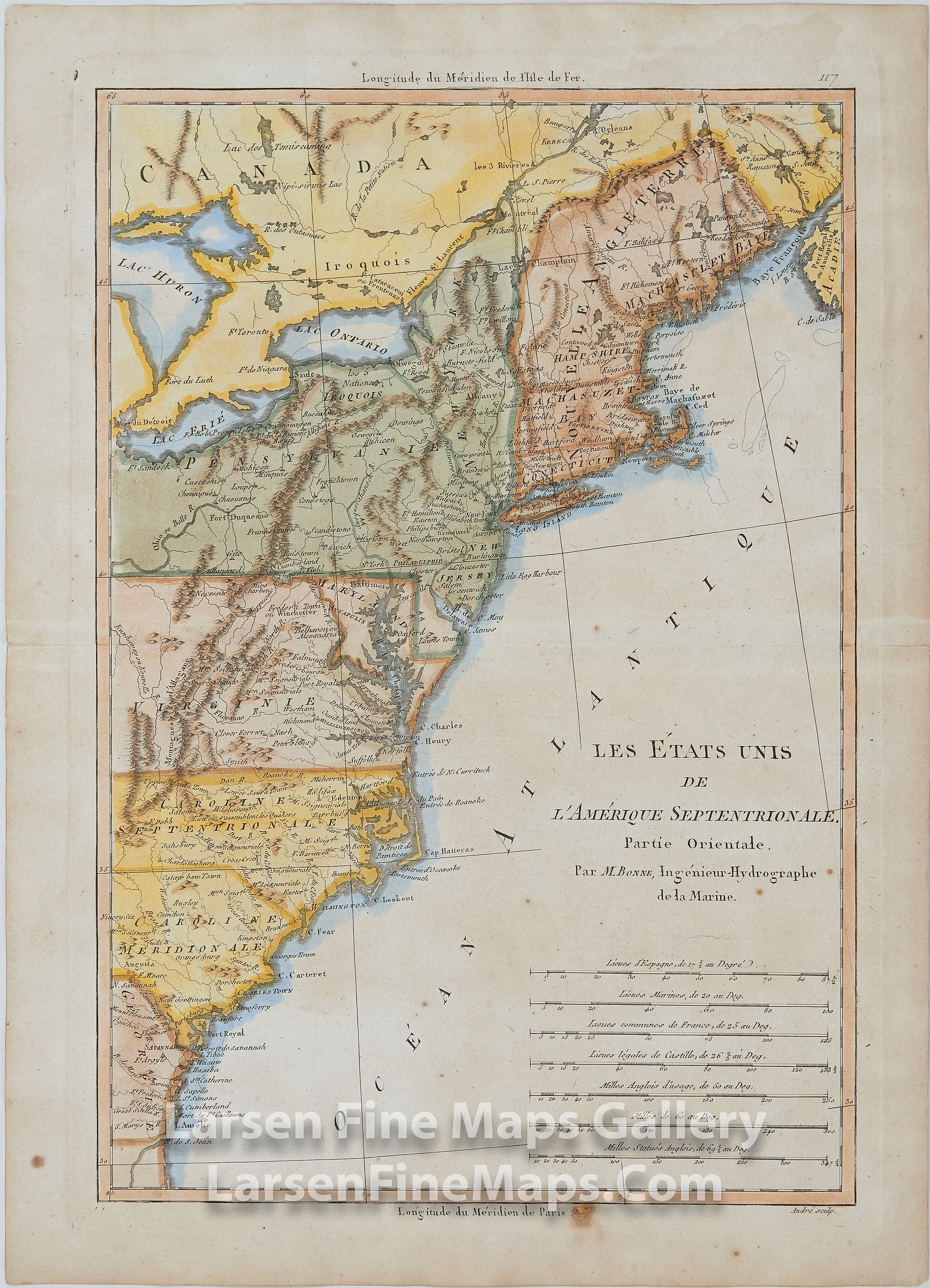
Les Etats Unis de l'Amerique Septentrionale. Partie Orientale
DESCRIPTION
This is a very nice and vivid map depicting New England and the Colonies during the Revolutionary War. The map extends from Georgia to present-day Maine. Richly colored, relief shown pictorially, mountain ranges, rivers, places shown in nice detail.
Publication in question, possibly:
Atlas Encyclopedique, sheet 117
Atlas Supplement, Paris 1787
FULL TITLE
MAPMAKER/CARTOGRAPHER/AUTHOR
PUBLISHER
PUBLICATION
DIMENSIONS (Inches)
CONDITION
Choose options
DESCRIPTION
FULL TITLE
MAPMAKER/CARTOGRAPHER/AUTHOR
PUBLISHER
PUBLICATION
DIMENSIONS (Inches)
CONDITION
DESCRIPTION
FULL TITLE
MAPMAKER/CARTOGRAPHER/AUTHOR
PUBLISHER
PUBLICATION
DIMENSIONS (Inches)
CONDITION