YEAR PUBLISHED: 1856
Map of the Village of Rochester, in 1820
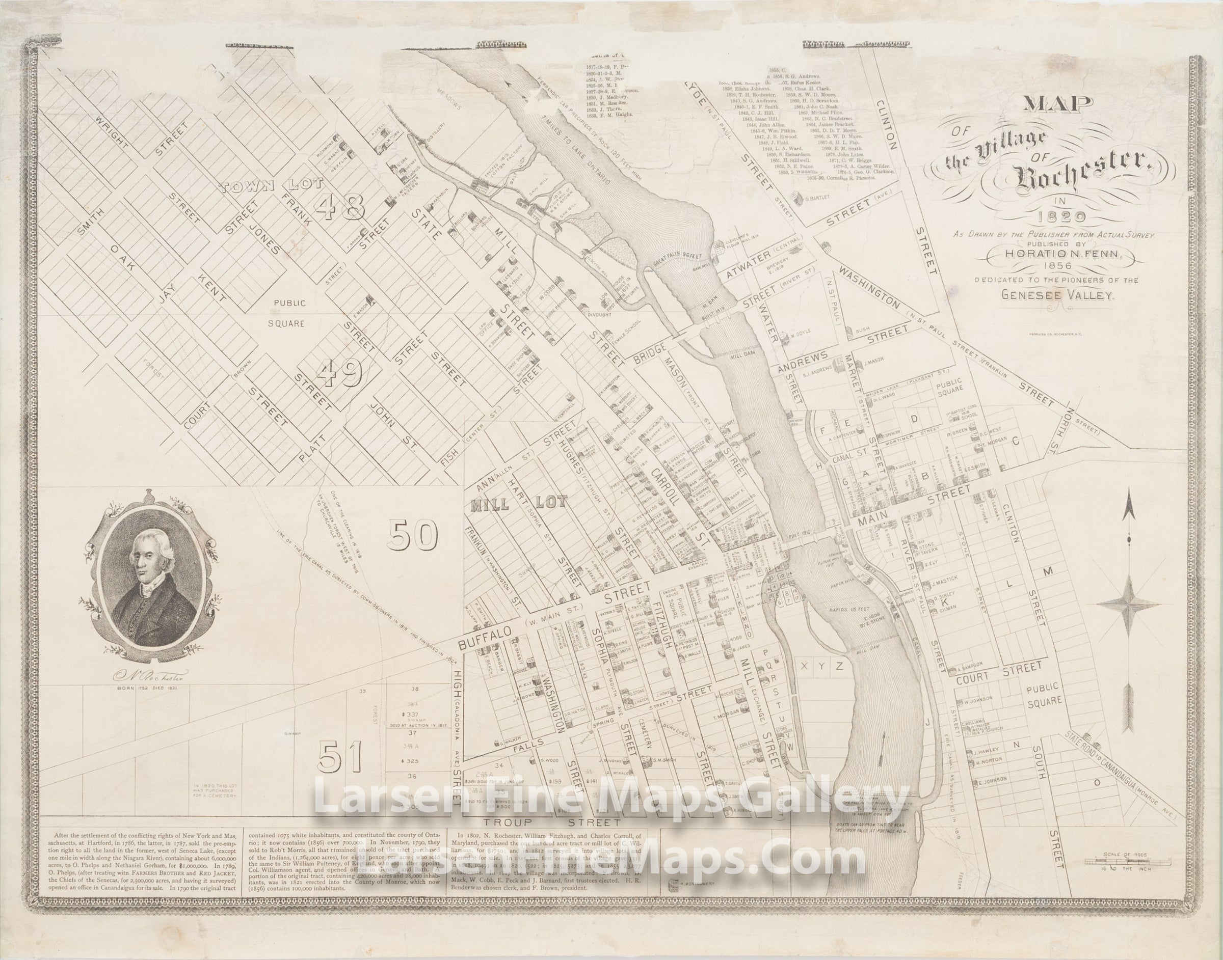
DESCRIPTION
This a map published in 1856 showing the Village of Rochester as it was in 1820. The map shows streets, lots and parcels, ownership. There is a historical account of the land tract history that ultimatley led to the founding of Rochester. A very interesting map from a genealogical point of view.
FULL TITLE
MAPMAKER/CARTOGRAPHER/AUTHOR
PUBLISHER
PUBLICATION
DIMENSIONS (Inches)
CONDITION
Choose options
DESCRIPTION
FULL TITLE
MAPMAKER/CARTOGRAPHER/AUTHOR
PUBLISHER
PUBLICATION
DIMENSIONS (Inches)
CONDITION
DESCRIPTION
FULL TITLE
MAPMAKER/CARTOGRAPHER/AUTHOR
PUBLISHER
PUBLICATION
DIMENSIONS (Inches)
CONDITION