YEAR PUBLISHED:1863
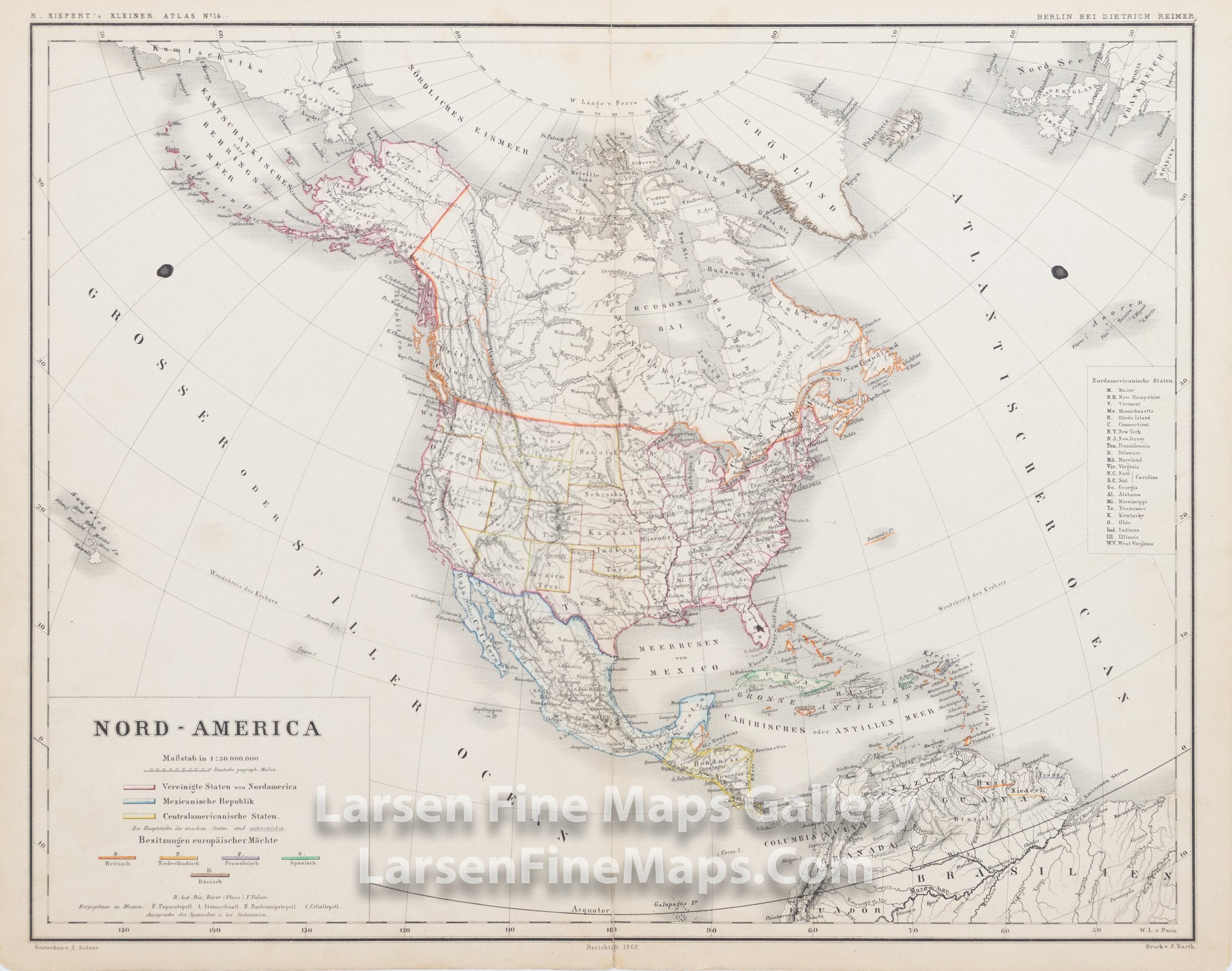
Nord - America
DESCRIPTION
This is a very nice map showing the various possessions of the British, Dutch, French, Spanish, and Danish in the North American, Central American continent (United States and Territories, Republic of Mexico, and Central American States). Nicely colored. Shows the approximate Territory configuration of 1863 1866 (not entirely accurate to one particular point in time). Lists West Virginia (1863) as a State but not Nevada (1864).
FULL TITLE
MAPMAKER/CARTOGRAPHER/AUTHOR
PUBLISHER
PUBLICATION
DIMENSIONS (Inches)
CONDITION
Choose options
DESCRIPTION
FULL TITLE
MAPMAKER/CARTOGRAPHER/AUTHOR
PUBLISHER
PUBLICATION
DIMENSIONS (Inches)
CONDITION
DESCRIPTION
FULL TITLE
MAPMAKER/CARTOGRAPHER/AUTHOR
PUBLISHER
PUBLICATION
DIMENSIONS (Inches)
CONDITION