YEAR PUBLISHED: 1852
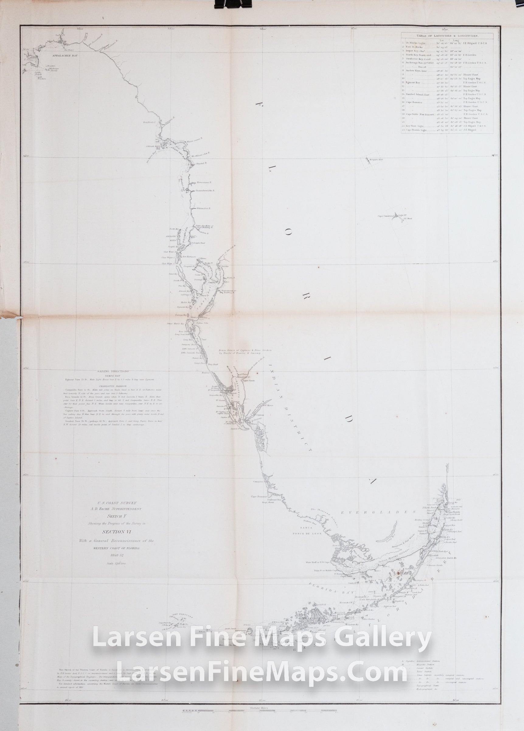
Sketch F Showing the Progress of the Survey in Section VI With a General Reconnoissance of the Western Coast of Florida 1848-1852
DESCRIPTION
1848-1852 Chart of Florida showing the entire Florida peninsula, but only detailing the western coastline, mapping all bays and harbors, including the Florida Keys. Shows few internal features, however, does note the Mangrove Swamps and Indian Hunting Grounds near the Everglades. On the eastern coastline, little is shown other than the Key Biscayne Bay region and Cape Canaveral being noted with little detail. Latitudes and longitudes for various locations and some sailing instructions are shown as well.
IMPORTANT NOTE:
All of our United States Coast Survey (USCS), United States Coast & Geodetic Survey (USC&GS), and similar maps and charts have been professionally unfolded and flattened using humidity baths, semi-permeable membrane, and drying blotter techniques. Most others you typically see on eBay have not been, and worse, are quickly and crudely unfolded for the low-quality photos you see. Unfolding these maps in that way is damaging and weakens them. Please be aware.
FULL TITLE
MAPMAKER/CARTOGRAPHER/AUTHOR
PUBLISHER
PUBLICATION
DIMENSIONS (Inches)
CONDITION
Choose options
DESCRIPTION
FULL TITLE
MAPMAKER/CARTOGRAPHER/AUTHOR
PUBLISHER
PUBLICATION
DIMENSIONS (Inches)
CONDITION
DESCRIPTION
FULL TITLE
MAPMAKER/CARTOGRAPHER/AUTHOR
PUBLISHER
PUBLICATION
DIMENSIONS (Inches)
CONDITION