YEAR PUBLISHED:1860
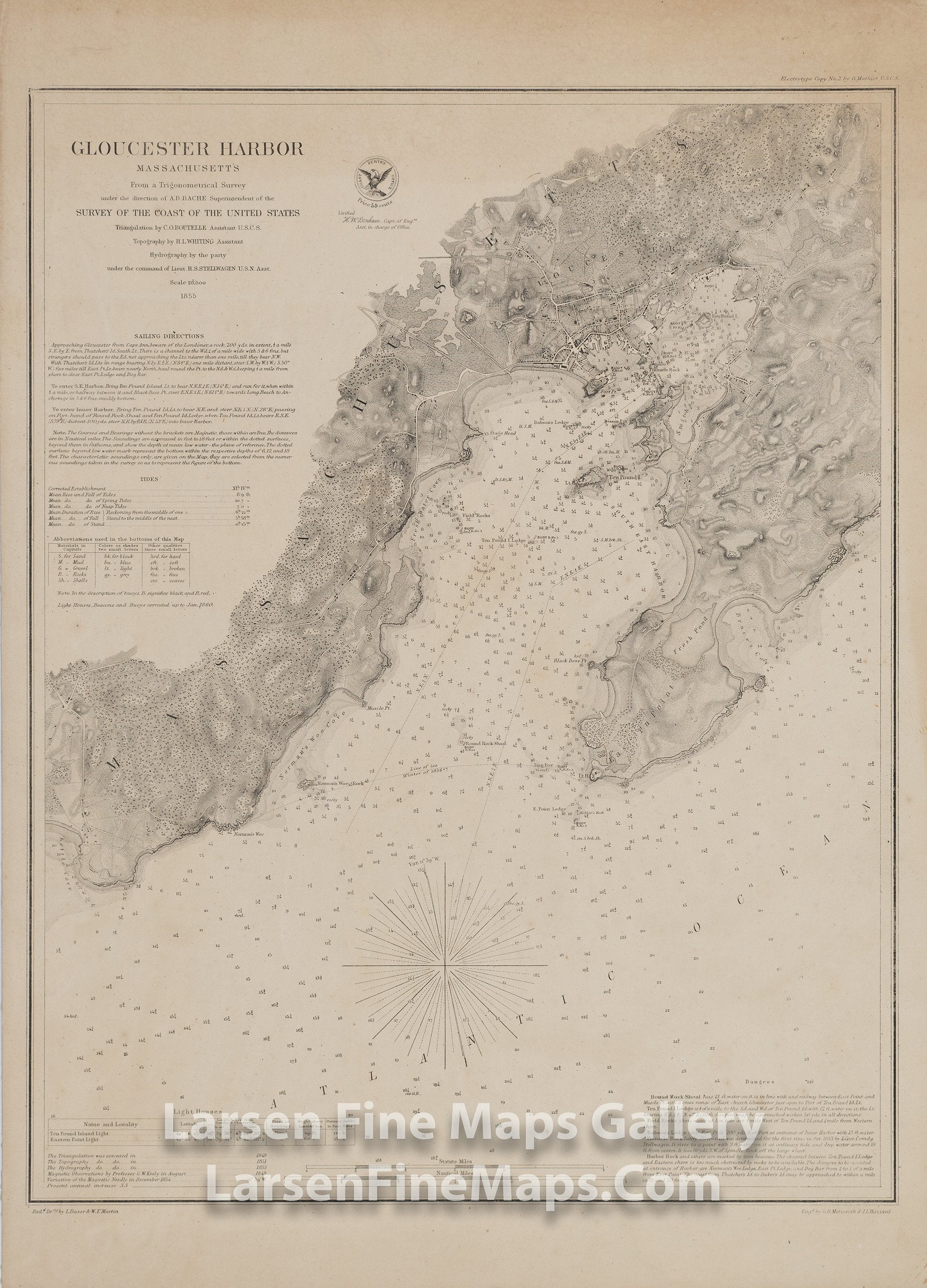
Gloucester Harbor Massachusetts
DESCRIPTION
A very nice detailed chart of Gloucester Harbor, Massachusetts. This is a separately issued thick paper edition with linen backing. This chart shows great inland details of topography by hachures, vegetation, farmlands, roads, buildings, facilities, and place names. Many aids to navigation are also shown such as buoys, courses, depth soundings, anchorages, rocks, ledges, and other dangers, bearings, lighthouses. Originally published in 1855 with this edition was published and corrected to 1860. Notes, Sailing Directions, and Tidal information along with currents are also given.
FULL TITLE
MAPMAKER/CARTOGRAPHER/AUTHOR
PUBLISHER
PUBLICATION
DIMENSIONS (Inches)
CONDITION
Choose options
DESCRIPTION
FULL TITLE
MAPMAKER/CARTOGRAPHER/AUTHOR
PUBLISHER
PUBLICATION
DIMENSIONS (Inches)
CONDITION
DESCRIPTION
FULL TITLE
MAPMAKER/CARTOGRAPHER/AUTHOR
PUBLISHER
PUBLICATION
DIMENSIONS (Inches)
CONDITION