YEAR PUBLISHED:1848
Harbors of Black Rock and Bridgeport
DESCRIPTION
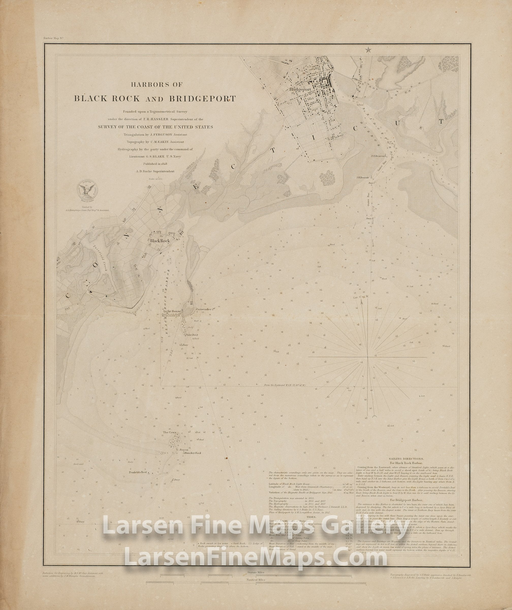
A very nice detailed chart of the Harbors of Black Rock and Bridgeport, Connecticut. This is a separately issued thick paper edition with linen backing. This chart shows great inland details of topography by hachures, vegetation, farmlands, roads, buildings, facilities, and place names. Many aids to navigation are also shown such as buoys, courses, depth soundings, anchorages, rocks, ledges, and other dangers, bearings, lighthouses. Notes and Sailing Directions for Black Rock Harbor and Bridgeport Harbor. Tidal information along with currents are also given.
FULL TITLE
MAPMAKER/CARTOGRAPHER/AUTHOR
PUBLISHER
PUBLICATION
DIMENSIONS (Inches)
CONDITION
Choose options
DESCRIPTION
FULL TITLE
MAPMAKER/CARTOGRAPHER/AUTHOR
PUBLISHER
PUBLICATION
DIMENSIONS (Inches)
CONDITION
DESCRIPTION
FULL TITLE
MAPMAKER/CARTOGRAPHER/AUTHOR
PUBLISHER
PUBLICATION
DIMENSIONS (Inches)
CONDITION