YEAR PUBLISHED:1851
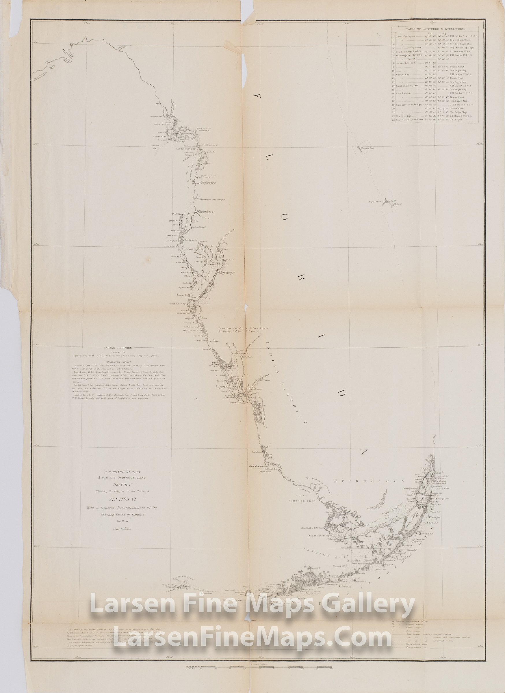
Sketch F General Reconnoissance of Western Coast of Florida 1848-1851
DESCRIPTION
Chart of Florida showing the entire Florida peninsula, but only detailing the western coastline, mapping all bays and harbors, including the Florida Keys. Shows few internal features, however, does note the Mangrove Swamps and Indian Hunting Grounds near the Everglades. On the eastern coastline, little is shown other than the Key Biscayne Bay region and Cape Canaveral being noted with little detail. Latitudes and longitudes for various locations and some sailing instructions are shown as well.
FULL TITLE
MAPMAKER/CARTOGRAPHER/AUTHOR
PUBLISHER
PUBLICATION
DIMENSIONS (Inches)
CONDITION
Choose options
DESCRIPTION
FULL TITLE
MAPMAKER/CARTOGRAPHER/AUTHOR
PUBLISHER
PUBLICATION
DIMENSIONS (Inches)
CONDITION
DESCRIPTION
FULL TITLE
MAPMAKER/CARTOGRAPHER/AUTHOR
PUBLISHER
PUBLICATION
DIMENSIONS (Inches)
CONDITION