YEAR PUBLISHED: 1851
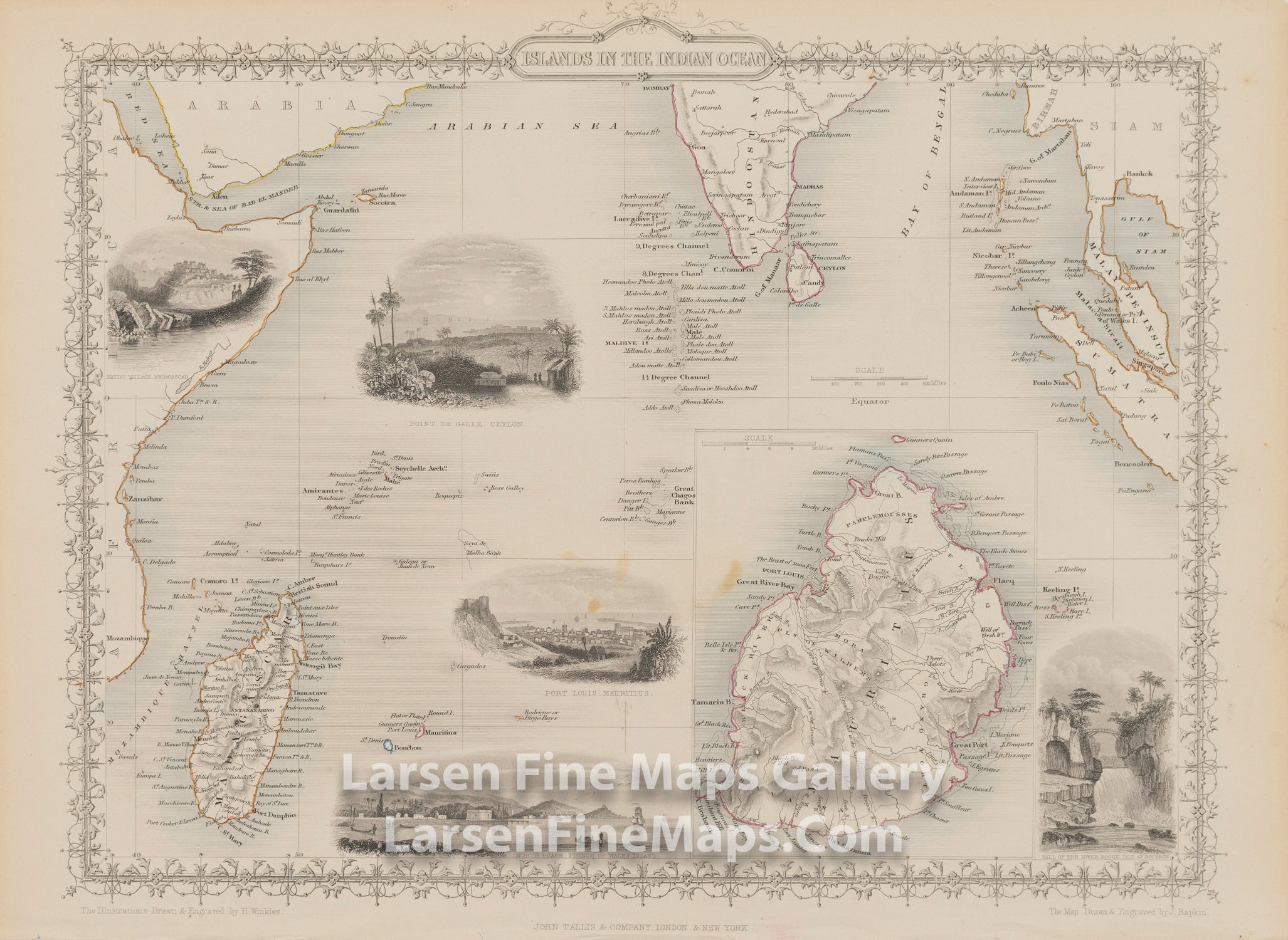
Islands in The Indian Ocean
DESCRIPTION
A striking and decorative and detailed map of the Islands of the Indian Ocean -- including an inset of Mauritius.
This map is from The Illustrated Atlas and Modern History of the World, published from 1849 to 1853. This map has a decorative border and attractive vignettes by H. Winkles. Beautiful inset perspective views of Port Louis, Mautitius; Point De Galle, Ceylon (now Sri Lanka); North Beach, Prince of Wales Island (now Penang Island, Malaysia); the Fall of the River Roche, Isle of Bourbon (now Reunion Island) and a native village in Madagascar are shown.
FULL TITLE
MAPMAKER/CARTOGRAPHER/AUTHOR
PUBLISHER
PUBLICATION
DIMENSIONS (Inches)
CONDITION
Choose options
DESCRIPTION
FULL TITLE
MAPMAKER/CARTOGRAPHER/AUTHOR
PUBLISHER
PUBLICATION
DIMENSIONS (Inches)
CONDITION
DESCRIPTION
FULL TITLE
MAPMAKER/CARTOGRAPHER/AUTHOR
PUBLISHER
PUBLICATION
DIMENSIONS (Inches)
CONDITION