

YEAR PUBLISHED: 1857
A New Map of The United States
DESCRIPTION
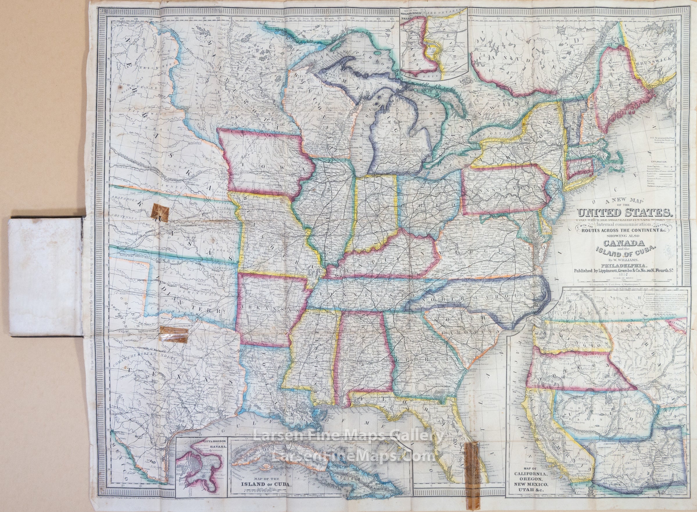
This travellers map shows state and territorial boundaries, railroads, common roads, canals, swamps, military posts, areas of Native American habitation, cities and towns. Insets: "Map of the Niagara River and Falls," "Map of California, Oregon, New Mexico, Utah &c.," "Map of the island of Cuba," and "City & Harbor of Havana." Includes "explanation" and notes. Relief shown by hachures and spot heights on insets.
Lithographed map, hand-colored in outline.
Spectacular map of the United States, the main map covering the eastern states to beyond the Mississippi, with large portions of Texas, Nebraska, "part of the North-West Territory," etc. There is a large inset at lower right, "Map of California, Oregon, New Mexico, Utah, &c.," covering those portions not on the main map, and smaller insets of Havana, of Cuba, and of Niagara Falls. The map in its present form was first issued in 1852. Wheat, in describing the map, concentrates on the inset of the West, "which is largely based on Fremont but which carries much up-to-date information..." In California, the Gold Region is named; Utah covers Nevada and part of Colorado, the remainder of which is consumed by Nebraska; Washington and Oregon both extend eastward to the Rockies, beyond which is the aforementioned North-West Territory; New Mexico includes present Arizona, with pre-Gadsden southern border. Wheat Transmississippi 769 & 818.
FULL TITLE
MAPMAKER/CARTOGRAPHER/AUTHOR
PUBLISHER
PUBLICATION
DIMENSIONS (Inches)
CONDITION
Choose options
DESCRIPTION
FULL TITLE
MAPMAKER/CARTOGRAPHER/AUTHOR
PUBLISHER
PUBLICATION
DIMENSIONS (Inches)
CONDITION
DESCRIPTION
FULL TITLE
MAPMAKER/CARTOGRAPHER/AUTHOR
PUBLISHER
PUBLICATION
DIMENSIONS (Inches)
CONDITION