YEAR PUBLISHED: 1866
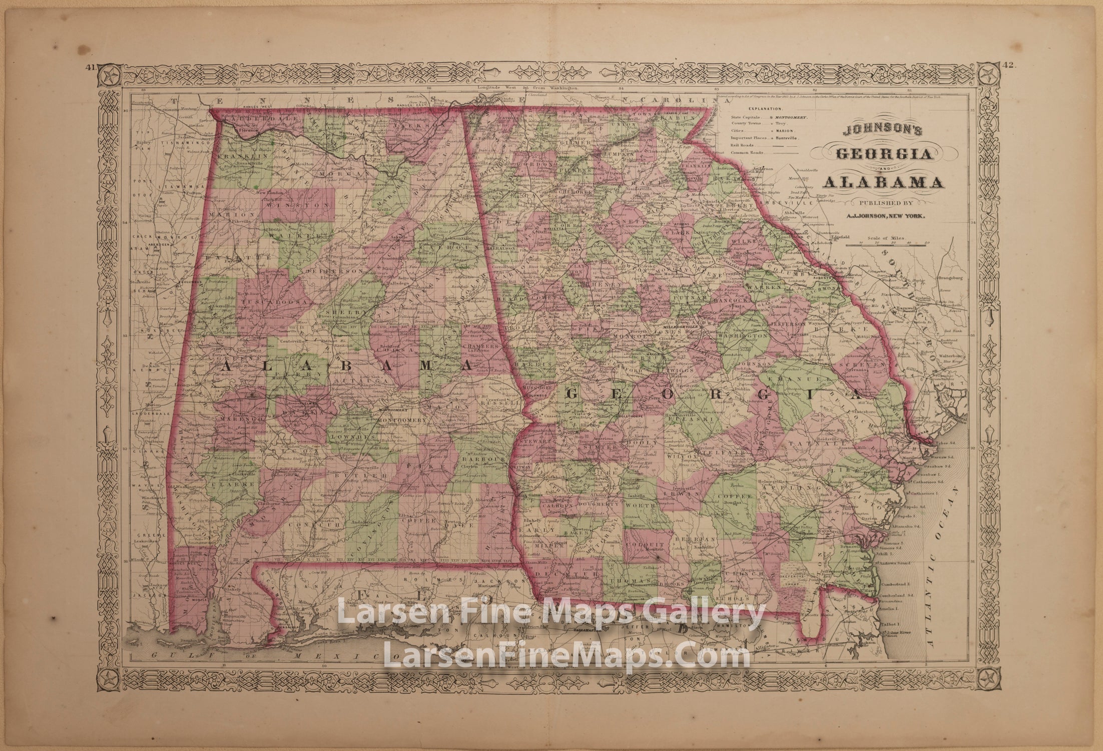
Johnson's Georgia and Alabama
DESCRIPTION
This is a colorful map from Johnson's Atlas showing great detail of Georgia and Alabama. Colored by divisions, this map shows railroads, roads, places, towns, canals, rivers, and some detail on neighboring regions.
FULL TITLE
MAPMAKER/CARTOGRAPHER/AUTHOR
PUBLISHER
PUBLICATION
DIMENSIONS (Inches)
CONDITION
Choose options
DESCRIPTION
FULL TITLE
MAPMAKER/CARTOGRAPHER/AUTHOR
PUBLISHER
PUBLICATION
DIMENSIONS (Inches)
CONDITION
DESCRIPTION
FULL TITLE
MAPMAKER/CARTOGRAPHER/AUTHOR
PUBLISHER
PUBLICATION
DIMENSIONS (Inches)
CONDITION