YEAR PUBLISHED: 1852
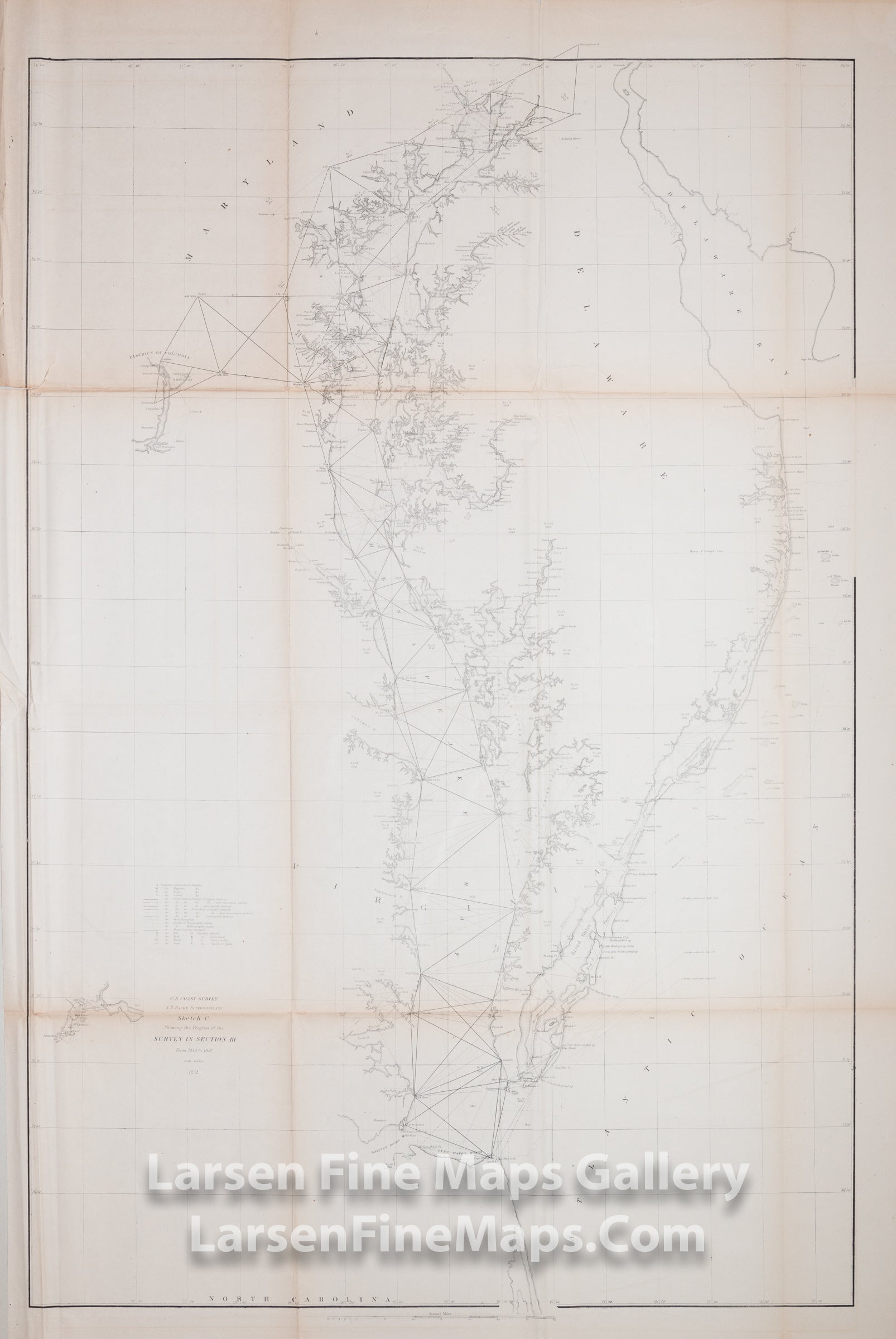
Sketch C Showing the Progress of the Survey in Section III From 1843 to 1852
DESCRIPTION
Chart for the Chesapeake Bay and Delaware Bay Region. Covers from the entrance of the Bay at Cape Henry northward to the entrance to the Susquehanna River. Extends eastward to cover the Delaware Atlantic Coast and Delaware Bay. Extends westward as far as Richmond, Virginia, and the District of Columbia. Locates all major Islands, Rivers, and inlets. Lighthouses, ports, cities, beaches, and industrial sites are also depicted.
The Rappahannock, parts of the Potomac (including an inset chart showing Washington D.C.), and York Rivers are noted, as are Hampton Roads. A small inset showing the James River and Appomattox River to Petersburg is included. Cape Henlopen, Cape May, and Delaware Bay are depicted without detail.
IMPORTANT NOTE:
All of our United States Coast Survey (USCS), United States Coast & Geodetic Survey (USC&GS), and similar maps and charts have been professionally unfolded and flattened using humidity baths, semi-permeable membrane, and drying blotter techniques. Most others you typically see on eBay have not been, and worse, are quickly and crudely unfolded for the low-quality photos you see. Unfolding these maps in that way is damaging and weakens them. Please be aware.
FULL TITLE
MAPMAKER/CARTOGRAPHER/AUTHOR
PUBLISHER
PUBLICATION
DIMENSIONS (Inches)
CONDITION
Choose options
DESCRIPTION
FULL TITLE
MAPMAKER/CARTOGRAPHER/AUTHOR
PUBLISHER
PUBLICATION
DIMENSIONS (Inches)
CONDITION
DESCRIPTION
FULL TITLE
MAPMAKER/CARTOGRAPHER/AUTHOR
PUBLISHER
PUBLICATION
DIMENSIONS (Inches)
CONDITION