YEAR PUBLISHED: 1947
Canada Alaska & Greenland
DESCRIPTION
Chamberlin Trimetric Projection.
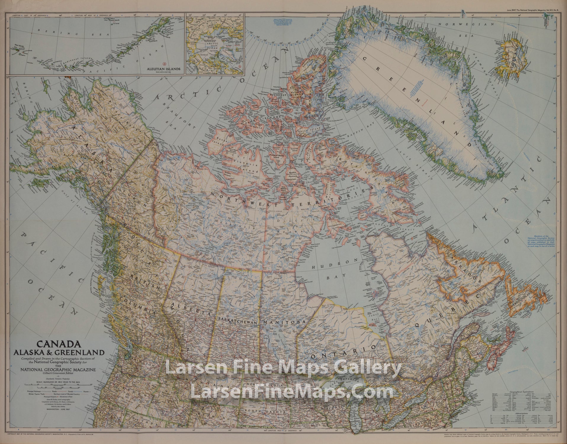
This unique map of Canada, Alaska, and Greenland shows North America's northernmost reaches. Published in June 1947, this map provides a snapshot of Canada two years before the Dominion of Newfoundland became its tenth province.
FULL TITLE
MAPMAKER/CARTOGRAPHER/AUTHOR
PUBLISHER
PUBLICATION
DIMENSIONS (Inches)
CONDITION
Choose options
DESCRIPTION
FULL TITLE
MAPMAKER/CARTOGRAPHER/AUTHOR
PUBLISHER
PUBLICATION
DIMENSIONS (Inches)
CONDITION
DESCRIPTION
FULL TITLE
MAPMAKER/CARTOGRAPHER/AUTHOR
PUBLISHER
PUBLICATION
DIMENSIONS (Inches)
CONDITION