YEAR PUBLISHED: 1851
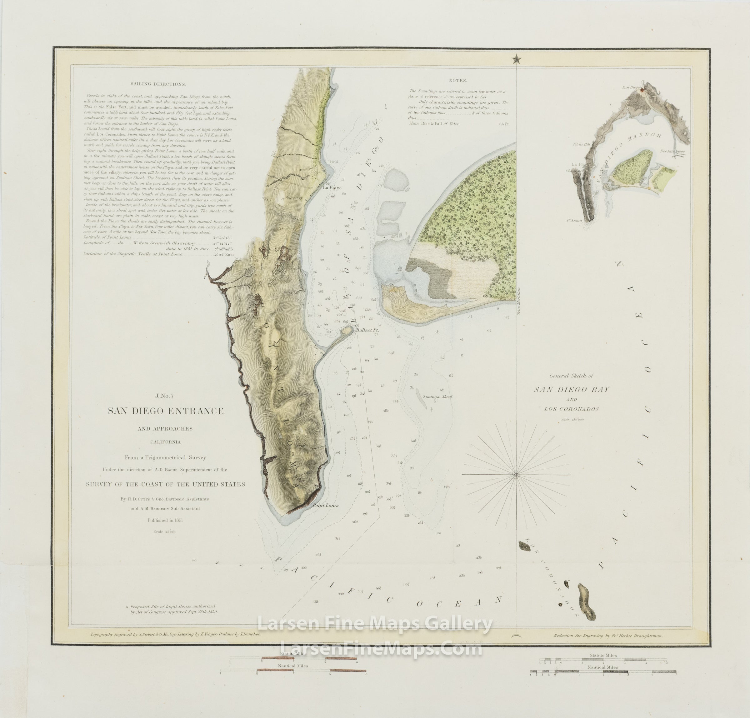
J No. 7 San Diego Entrance and Approaches California
DESCRIPTION
First edition chart of San Diego Entrance and Approaches. Two charts of the bay in different scales, both with fabulous detail, are shown. The larger scale map shows Point Loma, Ballast Point and the Bay of San Diego along with some sailing directions and notes to the mariner. The small-scale map shows a wider area extending as far south as Los Coronados. Depth soundings and some bathymetry are shown.
FULL TITLE
MAPMAKER/CARTOGRAPHER/AUTHOR
PUBLISHER
PUBLICATION
DIMENSIONS (Inches)
CONDITION
Choose options
DESCRIPTION
FULL TITLE
MAPMAKER/CARTOGRAPHER/AUTHOR
PUBLISHER
PUBLICATION
DIMENSIONS (Inches)
CONDITION
DESCRIPTION
FULL TITLE
MAPMAKER/CARTOGRAPHER/AUTHOR
PUBLISHER
PUBLICATION
DIMENSIONS (Inches)
CONDITION