YEAR PUBLISHED: 1952
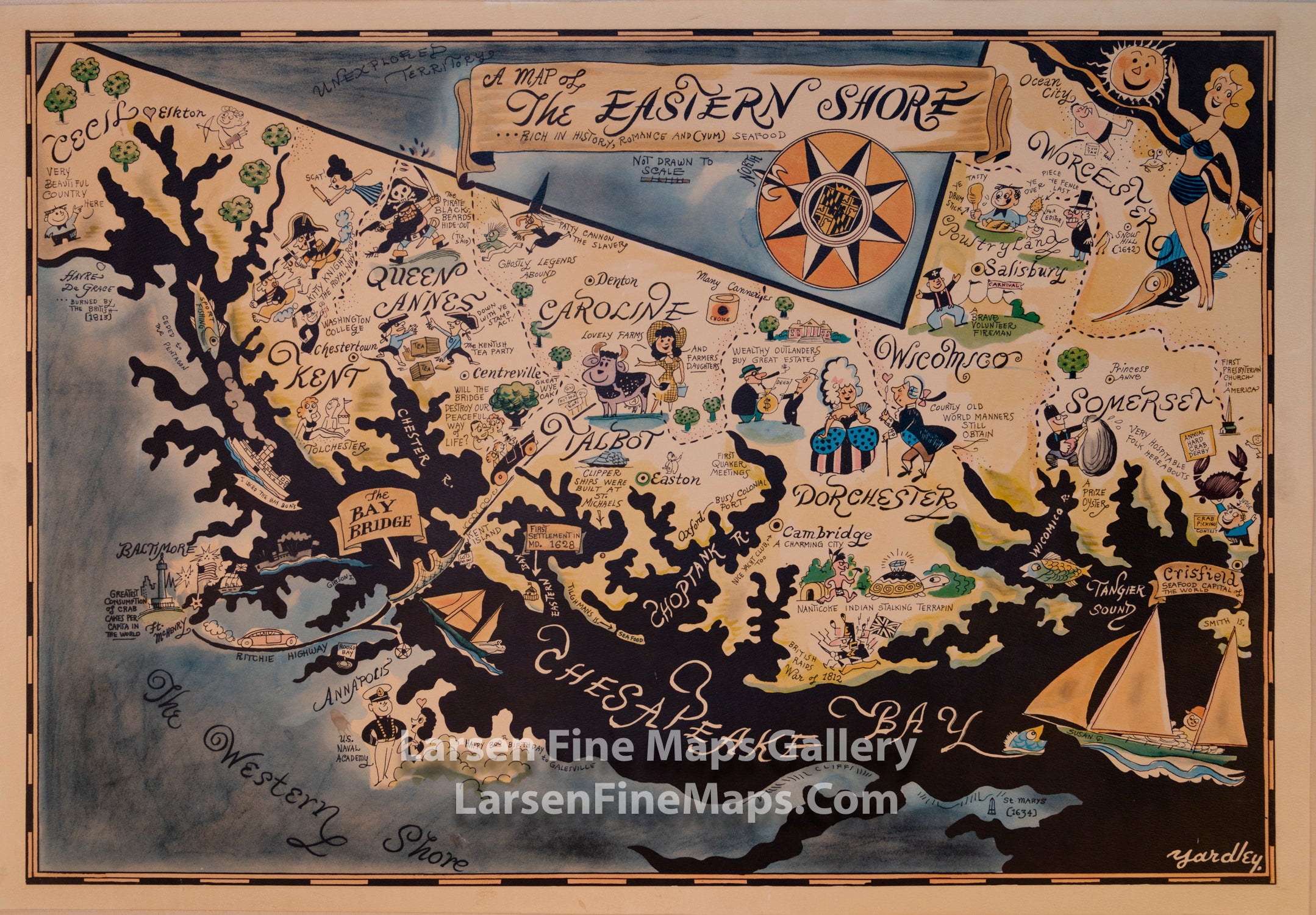
A Map of The Eastern Shore, Rich in History, Romance and (Yum) Seafood
DESCRIPTION
Pictorial map of Eastern Shore, Maryland in full color, by Richard Q. "Moco" Yardley (1903-1979) who was the Baltimore Morning Sun's cartoonist for many years. Sun papers gave away the maps to each new customer during complementary subscription period. Cover text "Enclosed is an attractive color map of the Eastern Shore ... " with illustration of Yardley with a cat that always included in his cartoons. Map is in Yardley's unique style, depiction of a colonial gentleman and a hoop-skirted woman with caption reading, "Courtly old world manners still obtain." Shows places names, and historical places and events. Includes decorative compass rose below title.
Map date is estimated from the existence of the Bay Bridge along with the comment about it: "Will the bridge destroy our peaceful way of life?" Suggesting it was new. The bridge was built in 1952. The second clue is the birthday salutations east of Annapolis stating: "Happy 300th Birthday Galesville". Galesville was founded in 1652 (under a different name).
This map is extremely rare on the market.
FULL TITLE
MAPMAKER/CARTOGRAPHER/AUTHOR
PUBLISHER
PUBLICATION
DIMENSIONS (Inches)
CONDITION
Choose options
DESCRIPTION
FULL TITLE
MAPMAKER/CARTOGRAPHER/AUTHOR
PUBLISHER
PUBLICATION
DIMENSIONS (Inches)
CONDITION
DESCRIPTION
FULL TITLE
MAPMAKER/CARTOGRAPHER/AUTHOR
PUBLISHER
PUBLICATION
DIMENSIONS (Inches)
CONDITION