YEAR PUBLISHED: 1851
Sketch J No. 3 Point Conception Coast of California
DESCRIPTION
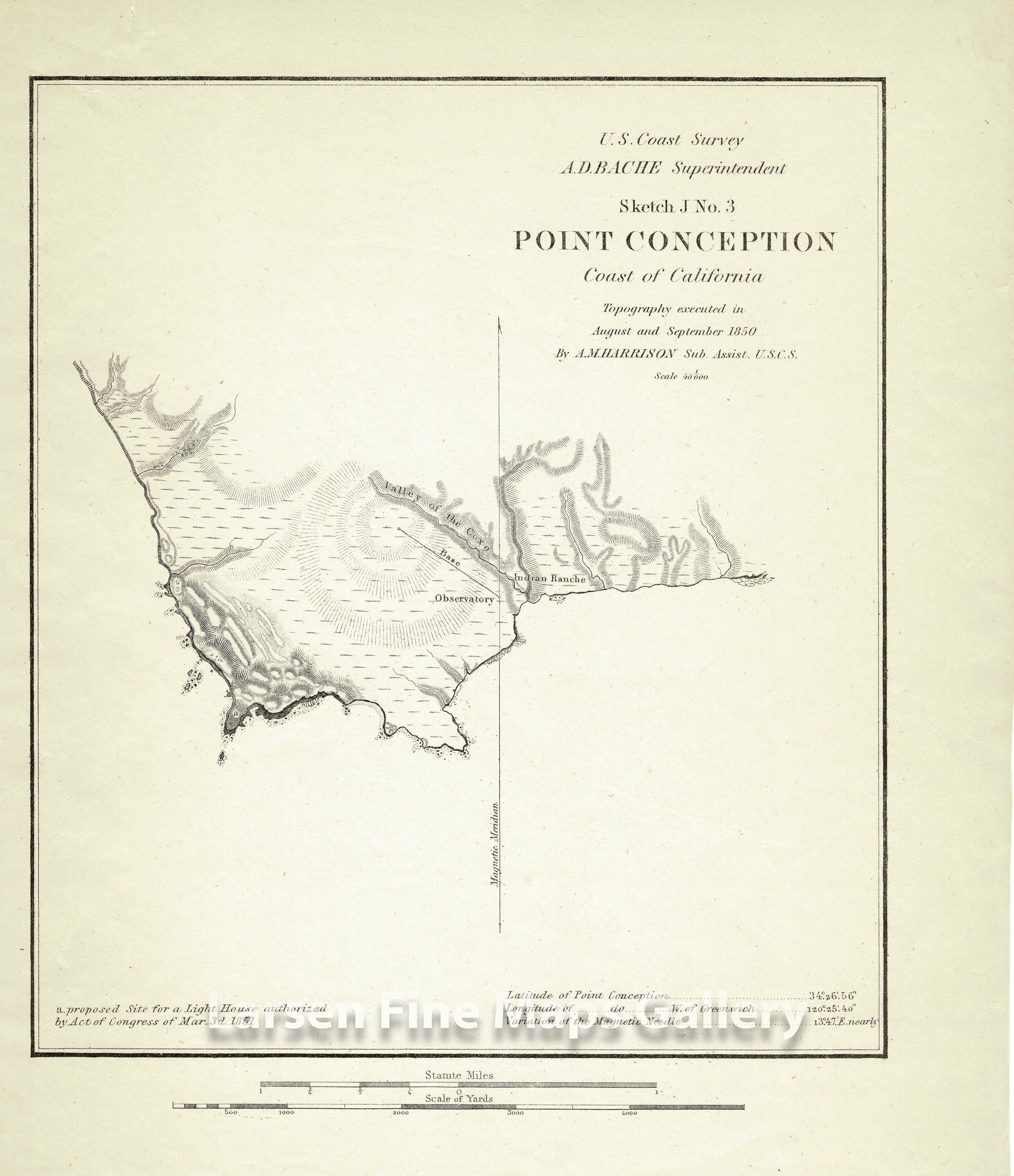
Chart of Point Conception on the California Coast, where the Santa Barbara Channel meets the Pacific Ocean.Locations and features noted are Valley of the Coxo, Indian Ranche and the proposed site for the lighthouse authorized in 1851. This would go on to become the Point Conception Light built in 1855-6 and first became activated on February 1, 1856, when Point Conception Lighthouse became the seventh operating lighthouse on the west coast. Government Point and Cojo Bay are shown but not called out.
IMPORTANT NOTE:
All of our United States Coast Survey (USCS), United States Coast & Geodetic Survey (USC&GS), and similar maps and charts have been professionally unfolded and flattened using humidity baths, semi-permeable membrane, and drying blotter techniques. Most others you typically see on eBay have not been, and worse, are quickly and crudely unfolded for the low-quality photos you see. Unfolding these maps in that way is damaging and weakens them. Please be aware.
FULL TITLE
MAPMAKER/CARTOGRAPHER/AUTHOR
PUBLISHER
PUBLICATION
DIMENSIONS (Inches)
CONDITION
Choose options
DESCRIPTION
FULL TITLE
MAPMAKER/CARTOGRAPHER/AUTHOR
PUBLISHER
PUBLICATION
DIMENSIONS (Inches)
CONDITION
DESCRIPTION
FULL TITLE
MAPMAKER/CARTOGRAPHER/AUTHOR
PUBLISHER
PUBLICATION
DIMENSIONS (Inches)
CONDITION