YEAR PUBLISHED:1874
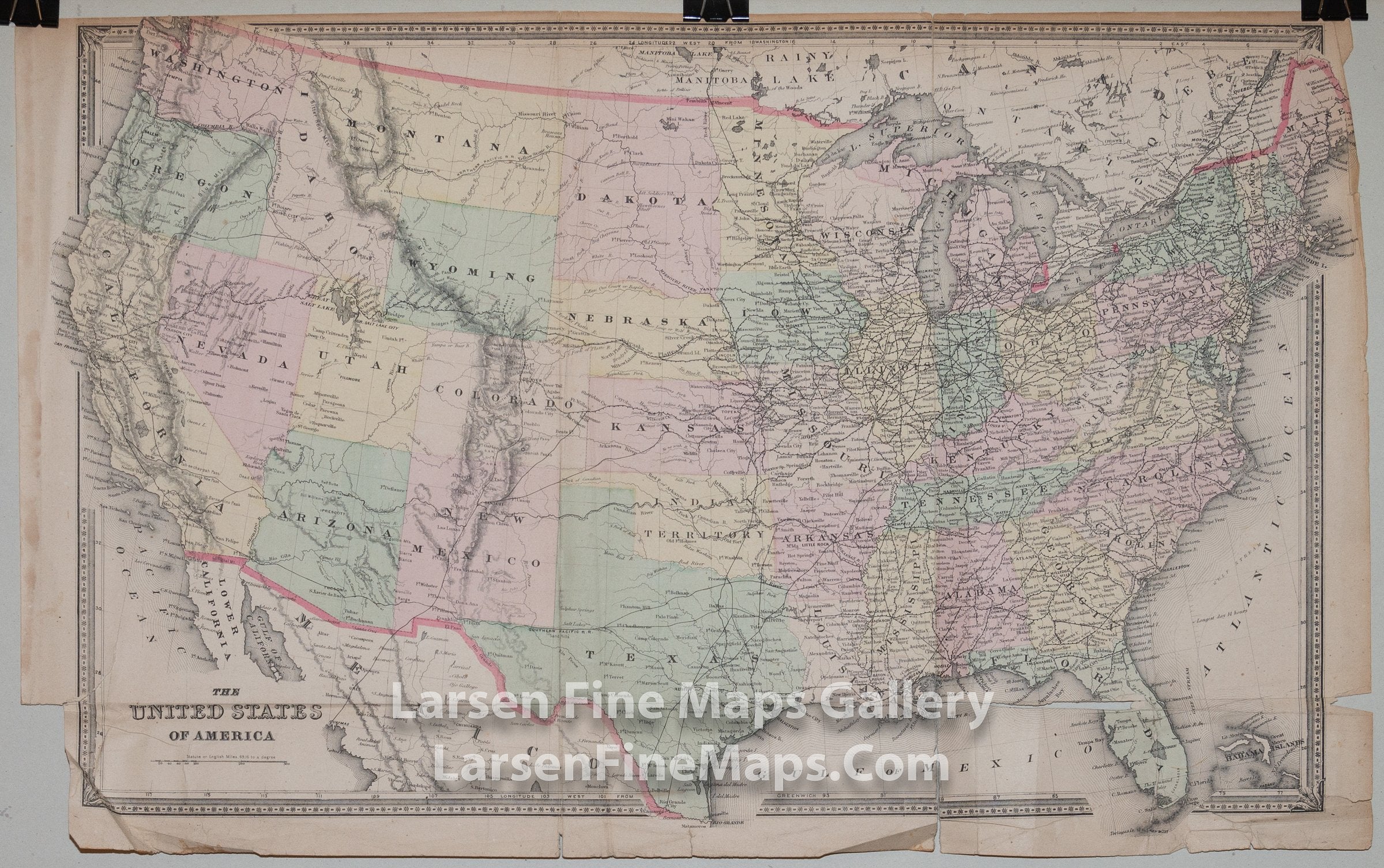
The United States of America
DESCRIPTION
Large map of the United States. Shows "Indian Territory" before it became the State of Indiana. Also shows the Dakota's as a single extent. Relief is shown pictorially. Nice railroad details for the entire country.
The map is part of the Atlas of Lorain County Ohio.
FULL TITLE
MAPMAKER/CARTOGRAPHER/AUTHOR
PUBLISHER
PUBLICATION
DIMENSIONS (Inches)
CONDITION
Choose options
DESCRIPTION
FULL TITLE
MAPMAKER/CARTOGRAPHER/AUTHOR
PUBLISHER
PUBLICATION
DIMENSIONS (Inches)
CONDITION
DESCRIPTION
FULL TITLE
MAPMAKER/CARTOGRAPHER/AUTHOR
PUBLISHER
PUBLICATION
DIMENSIONS (Inches)
CONDITION