YEAR PUBLISHED: 1788
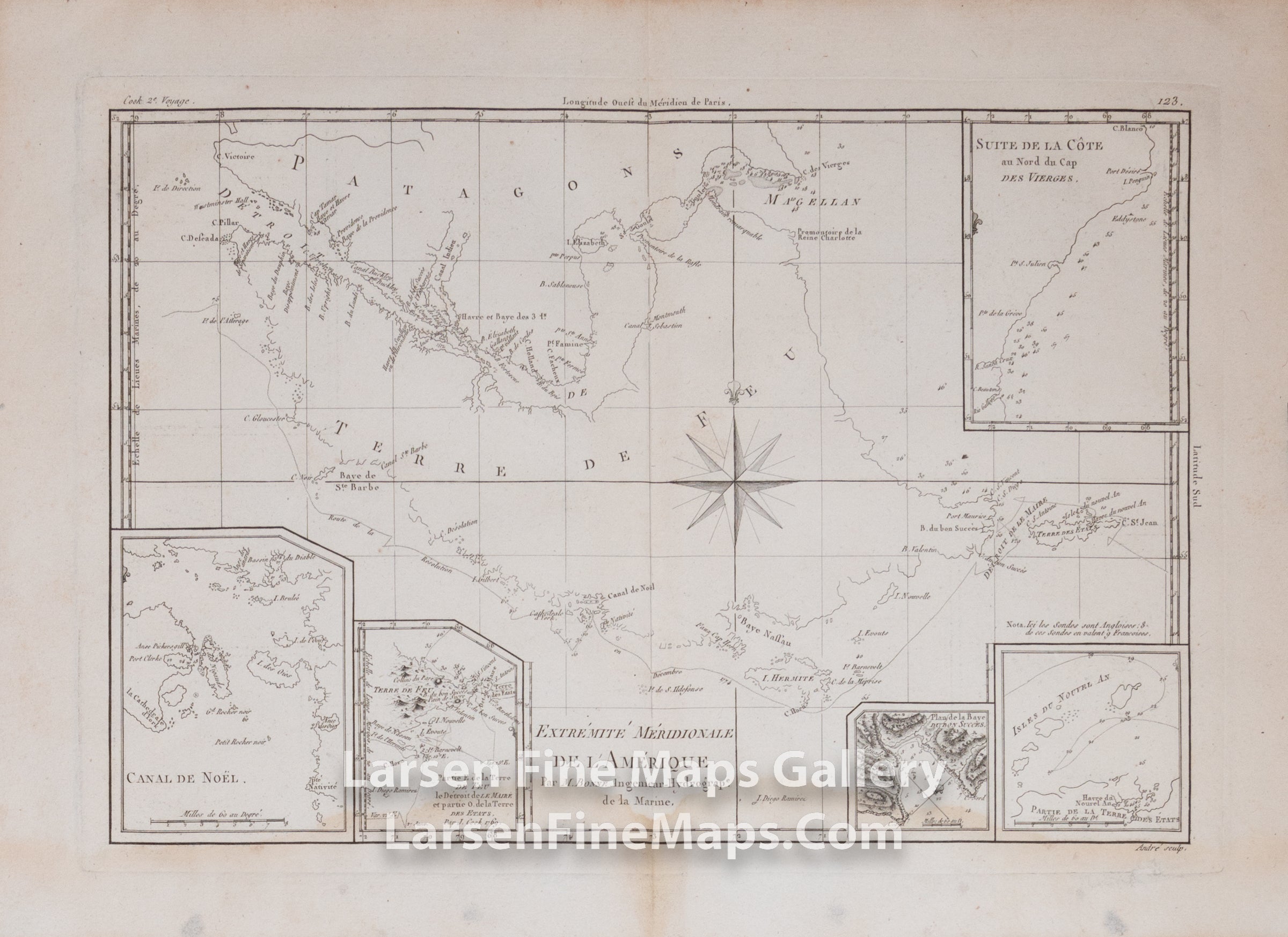
Extrémité Méridionale De L' Amérique, Par M. Bonne, Ingenieur-Hydrographie de la Marine
DESCRIPTION
A very interesting overview map of Tierra Del Fuego and Straits of Magellan showing details of the passage and coastal areas, also shows track of ship's route. The sheet includes 5 inset maps and charts.
FULL TITLE
MAPMAKER/CARTOGRAPHER/AUTHOR
PUBLISHER
PUBLICATION
DIMENSIONS (Inches)
CONDITION
Choose options
DESCRIPTION
FULL TITLE
MAPMAKER/CARTOGRAPHER/AUTHOR
PUBLISHER
PUBLICATION
DIMENSIONS (Inches)
CONDITION
DESCRIPTION
FULL TITLE
MAPMAKER/CARTOGRAPHER/AUTHOR
PUBLISHER
PUBLICATION
DIMENSIONS (Inches)
CONDITION