YEAR PUBLISHED: 1759
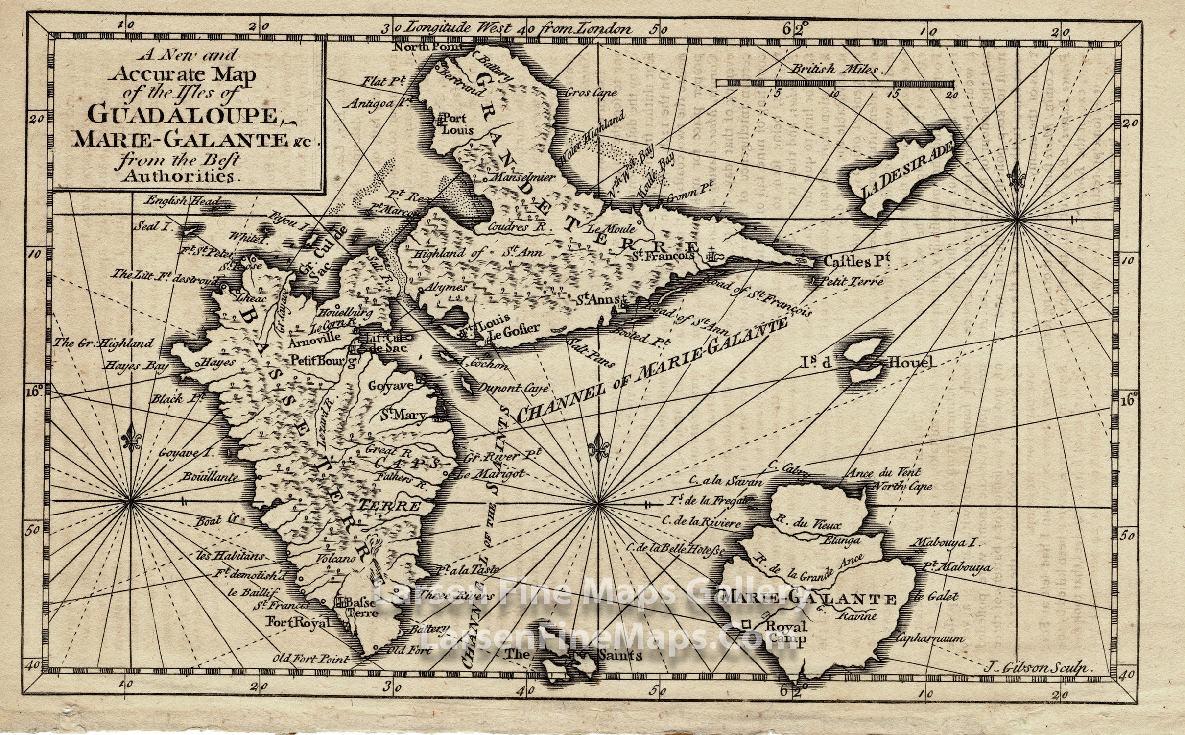
A New and Accurate Map of the Isles of Guadaloupe, Marie-Galante
DESCRIPTION
A chart of the Isles of Guadeloupe, Marie-Galante, The Saints and Ladesirade. Shows Grande Terre and Basse Terre of Guadeloupe. Relief shown pictorially. From Gentleman's magazine and historical chronicle. June 1759, v. 29. Well detailed for a small map that is decorated with rhumb lines and two fluer-de-lys.
FULL TITLE
MAPMAKER/CARTOGRAPHER/AUTHOR
PUBLISHER
PUBLICATION
DIMENSIONS (Inches)
CONDITION
Choose options
DESCRIPTION
FULL TITLE
MAPMAKER/CARTOGRAPHER/AUTHOR
PUBLISHER
PUBLICATION
DIMENSIONS (Inches)
CONDITION
DESCRIPTION
FULL TITLE
MAPMAKER/CARTOGRAPHER/AUTHOR
PUBLISHER
PUBLICATION
DIMENSIONS (Inches)
CONDITION