YEAR PUBLISHED: 1874
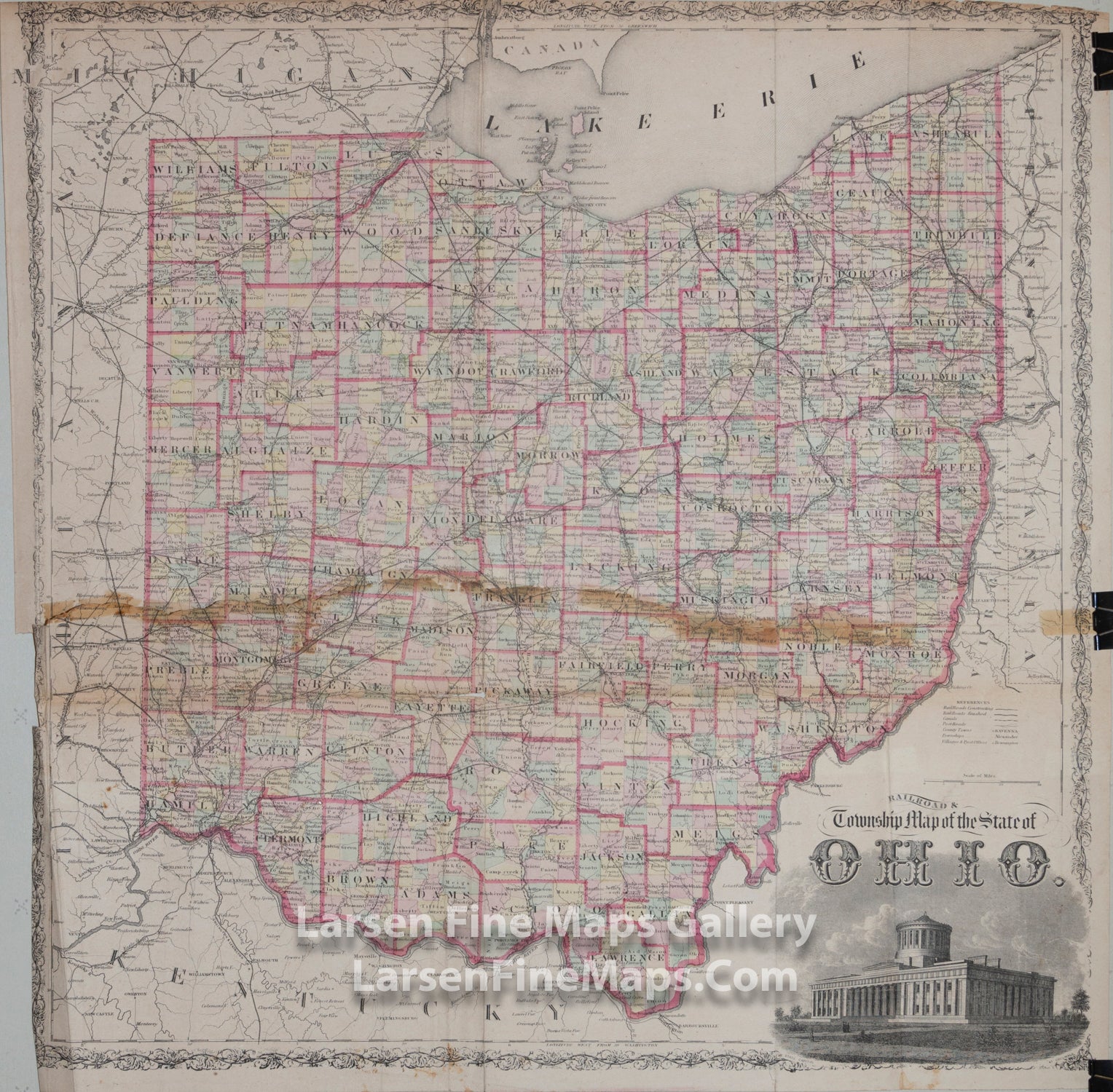
Railroad & Township Map of the State of Ohio
DESCRIPTION
Large map of Ohio showing the townships, counties and railroads, etc. The townships are colored with counties in outline color. A nice engraving of the State Capitol is shown in the lower right.
FULL TITLE
MAPMAKER/CARTOGRAPHER/AUTHOR
PUBLISHER
PUBLICATION
DIMENSIONS (Inches)
CONDITION
Choose options
DESCRIPTION
FULL TITLE
MAPMAKER/CARTOGRAPHER/AUTHOR
PUBLISHER
PUBLICATION
DIMENSIONS (Inches)
CONDITION
DESCRIPTION
FULL TITLE
MAPMAKER/CARTOGRAPHER/AUTHOR
PUBLISHER
PUBLICATION
DIMENSIONS (Inches)
CONDITION