YEAR PUBLISHED: 1797
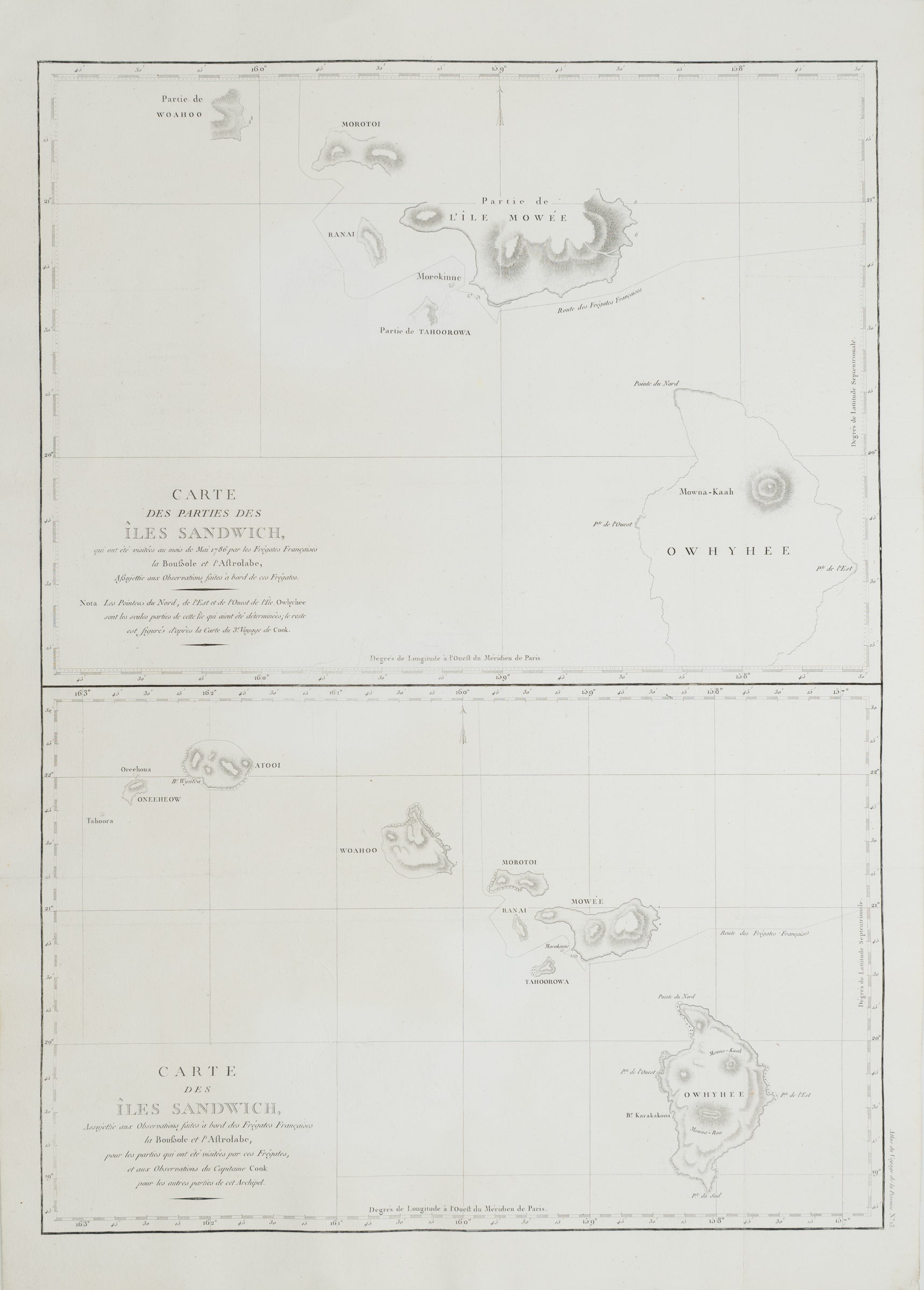
Carte des parties des Iles Sandwich
DESCRIPTION
Striking and highly decorative unusual copper engraved fine example of Jean François de Galaup, comte de La Pérouse and Gérard Sébastien Bernizet's map of Hawaii or the Sandwich Islands. Essentially two maps on a single sheet. The uppermost map details La Pérouse and Bernizet's shipboard surveys of the islands of Hawaii (Owhyhee), Maui (Mowée), Molokai (Morotoi), Oahu (Woahoo) and Niihau (Oneeheow). The mapping shows partial shorelines on all islands, suggesting incomplete survey work. Nonetheless, Pérouse praises Bernizet and his astronomer, Joseph Lepaute Dagelet (1751-1788), for their fine work:
Messrs. Dagelet and Bernizet have taken with the greatest care all bearings of the part of Mowee along which we coasted, as well as those of Morokinne. It was impossible for the English, who never came nearer than ten leagues, to have given any exact information respecting these coasts. Br. Bernizet has drawn a very good plan, and Mr. Dagelet has joined astronomical observations, which deserve the same confidence as those of Cook, and which for the conveniency of the reader, are al inserted in tables at the end of the work. They show our course and precise situation from day to day, in latitude and longitude, by observation and by reckoning.
Two engraved maps. Relief shown by hachures. Scales (ca. 1:760,000) and (ca. 1:1,440,000)
Professionally cleaned, deacidified, backed with Japanese tissue.
FULL TITLE
MAPMAKER/CARTOGRAPHER/AUTHOR
PUBLISHER
PUBLICATION
DIMENSIONS (Inches)
CONDITION
Choose options
DESCRIPTION
FULL TITLE
MAPMAKER/CARTOGRAPHER/AUTHOR
PUBLISHER
PUBLICATION
DIMENSIONS (Inches)
CONDITION
DESCRIPTION
FULL TITLE
MAPMAKER/CARTOGRAPHER/AUTHOR
PUBLISHER
PUBLICATION
DIMENSIONS (Inches)
CONDITION