YEAR PUBLISHED: 1870-71
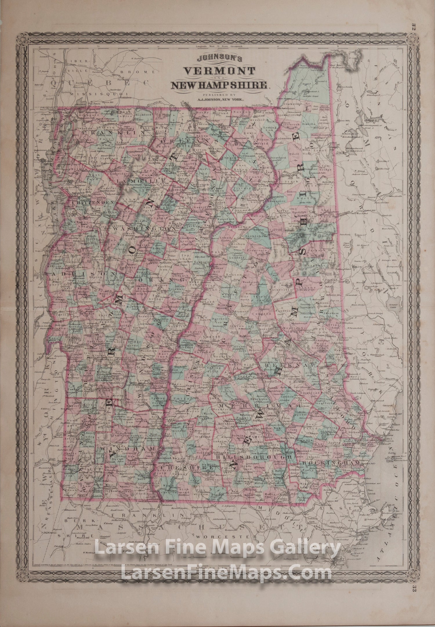
Johnson's Vermont and New Hampshire
DESCRIPTION
This is a colorful 2-page map from Johnson's Atlas published in either 1870 or 1871 (I have not found a way to distinguish between these two years) showing great details of the States of Vermont and New Hampshire. Colored by counties, this map shows railroads, roads, places, towns, canals, rivers, and some detail on neighboring states.
A great resource for all kinds of information on Johnson's Atlases and maps is "Ira Lourie's Johnson U.S. Map Project" which can be found at www.johnsonmapproject.org. There is a handy US Map Identifier tool there that can help identify editions of all his maps. This is Map v5.0 of the possible editions returned in the site's Map Identifier and is listed as rare with smaller page numbers and the railroad from Alfred to Springvale is non-existent.
FULL TITLE
MAPMAKER/CARTOGRAPHER/AUTHOR
PUBLISHER
PUBLICATION
DIMENSIONS (Inches)
CONDITION
Choose options
DESCRIPTION
FULL TITLE
MAPMAKER/CARTOGRAPHER/AUTHOR
PUBLISHER
PUBLICATION
DIMENSIONS (Inches)
CONDITION
DESCRIPTION
FULL TITLE
MAPMAKER/CARTOGRAPHER/AUTHOR
PUBLISHER
PUBLICATION
DIMENSIONS (Inches)
CONDITION