YEAR PUBLISHED: 1941
Atlantic Ocean
DESCRIPTION
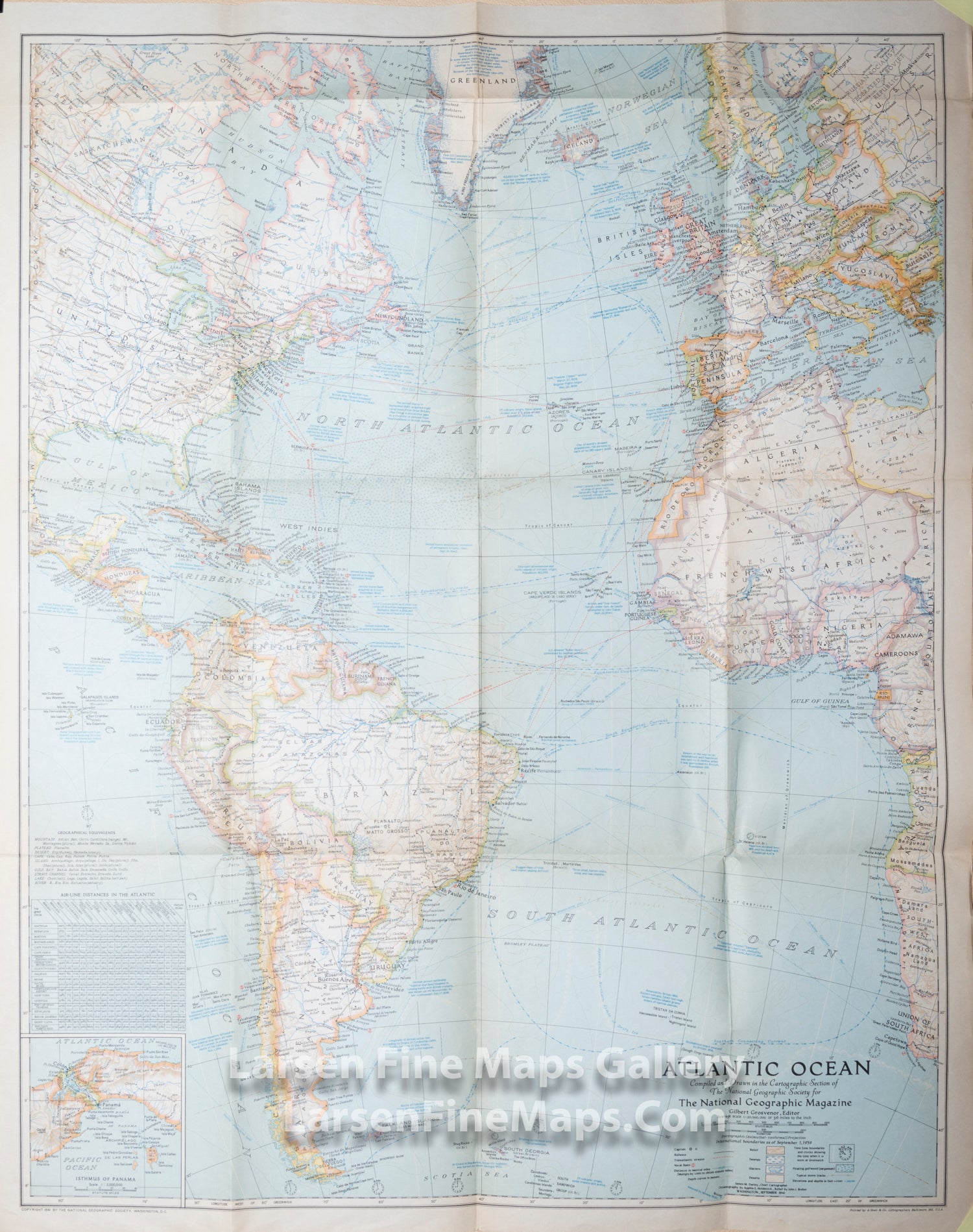
Large folding map of the Atlantic Ocean.
Published in September 1941, this map paints a striking portrait of the Atlantic Ocean on the verge of US involvement in World War II. Naval bases, dates, and locations of war-time events, time zone boundaries, shipping routes, and air travel distances, as well as wind, current, and storm information make this map a unique window into the turbulent times and the desire for a greater understanding of the Atlantic and its significance for travel, trade, and national security.
FULL TITLE
MAPMAKER/CARTOGRAPHER/AUTHOR
PUBLISHER
PUBLICATION
DIMENSIONS (Inches)
CONDITION
Choose options
DESCRIPTION
FULL TITLE
MAPMAKER/CARTOGRAPHER/AUTHOR
PUBLISHER
PUBLICATION
DIMENSIONS (Inches)
CONDITION
DESCRIPTION
FULL TITLE
MAPMAKER/CARTOGRAPHER/AUTHOR
PUBLISHER
PUBLICATION
DIMENSIONS (Inches)
CONDITION