YEAR PUBLISHED: 1854
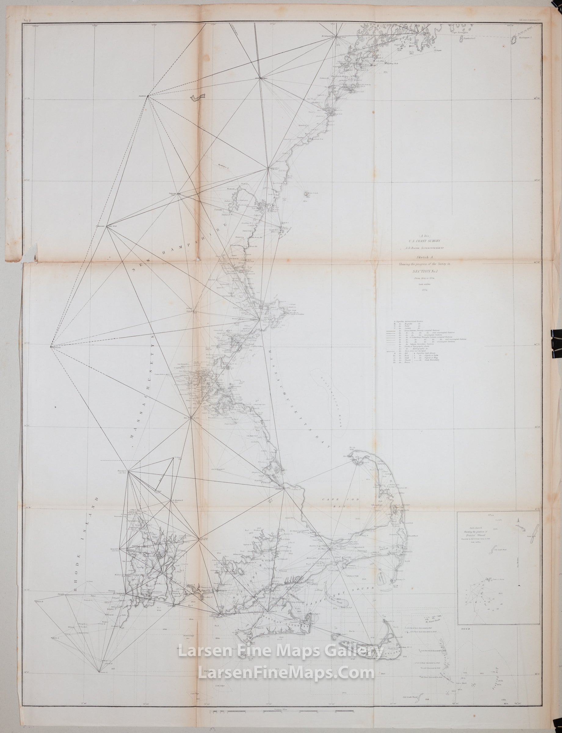
Sketch A Showing the Progress of the Survey in Section No. 1 From 1844-1854
DESCRIPTION
Triangulation chart showing the progress of the survey and some details along coast.
Massachusetts, Rhode Island, New Hampshire, Maine, Nantucket, Marthas Vineyard, Cape Code, Boston, Portland, Maine, Narragansett Bay, Monhegan Island and Tennants Harbor to Campobello Island and more detail up to Casco Bay and Cape Smith. Inlcudes a sub-sketch of Davis' Shoal.
IMPORTANT NOTE:
All of our United States Coast Survey (USCS), United States Coast & Geodetic Survey (USC&GS), and similar maps and charts have been professionally unfolded and flattened using humidity baths, semi-permeable membrane, and drying blotter techniques. Most others you typically see on eBay have not been, and worse, are quickly and crudely unfolded for the low-quality photos you see. Unfolding these maps in that way is damaging and weakens them. Please be aware.
FULL TITLE
MAPMAKER/CARTOGRAPHER/AUTHOR
PUBLISHER
PUBLICATION
DIMENSIONS (Inches)
CONDITION
Choose options
DESCRIPTION
FULL TITLE
MAPMAKER/CARTOGRAPHER/AUTHOR
PUBLISHER
PUBLICATION
DIMENSIONS (Inches)
CONDITION
DESCRIPTION
FULL TITLE
MAPMAKER/CARTOGRAPHER/AUTHOR
PUBLISHER
PUBLICATION
DIMENSIONS (Inches)
CONDITION