Year Published: 1835
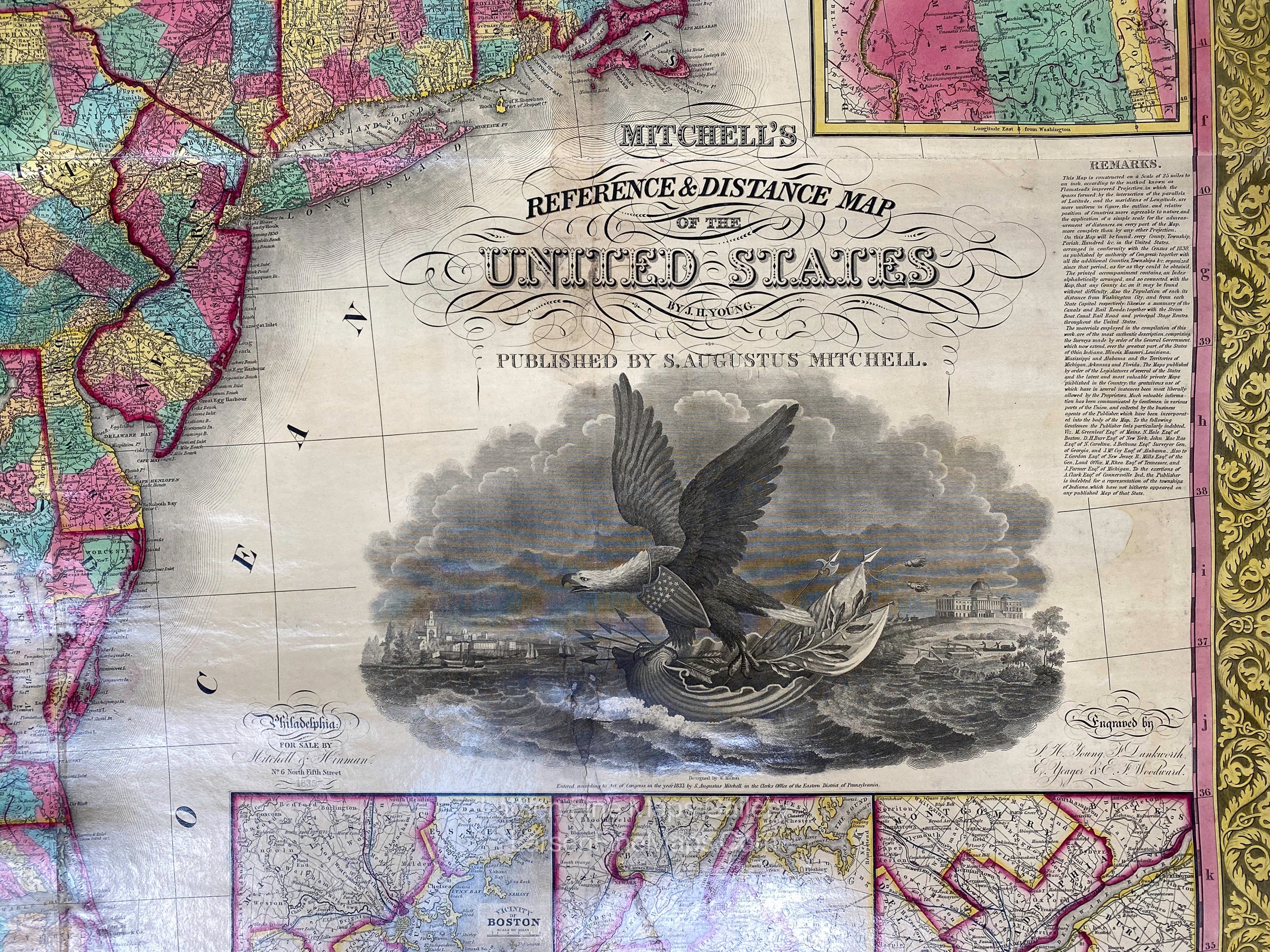
Mitchell's Reference & Distance Map of The United States by J.H. Young
DESCRIPTION
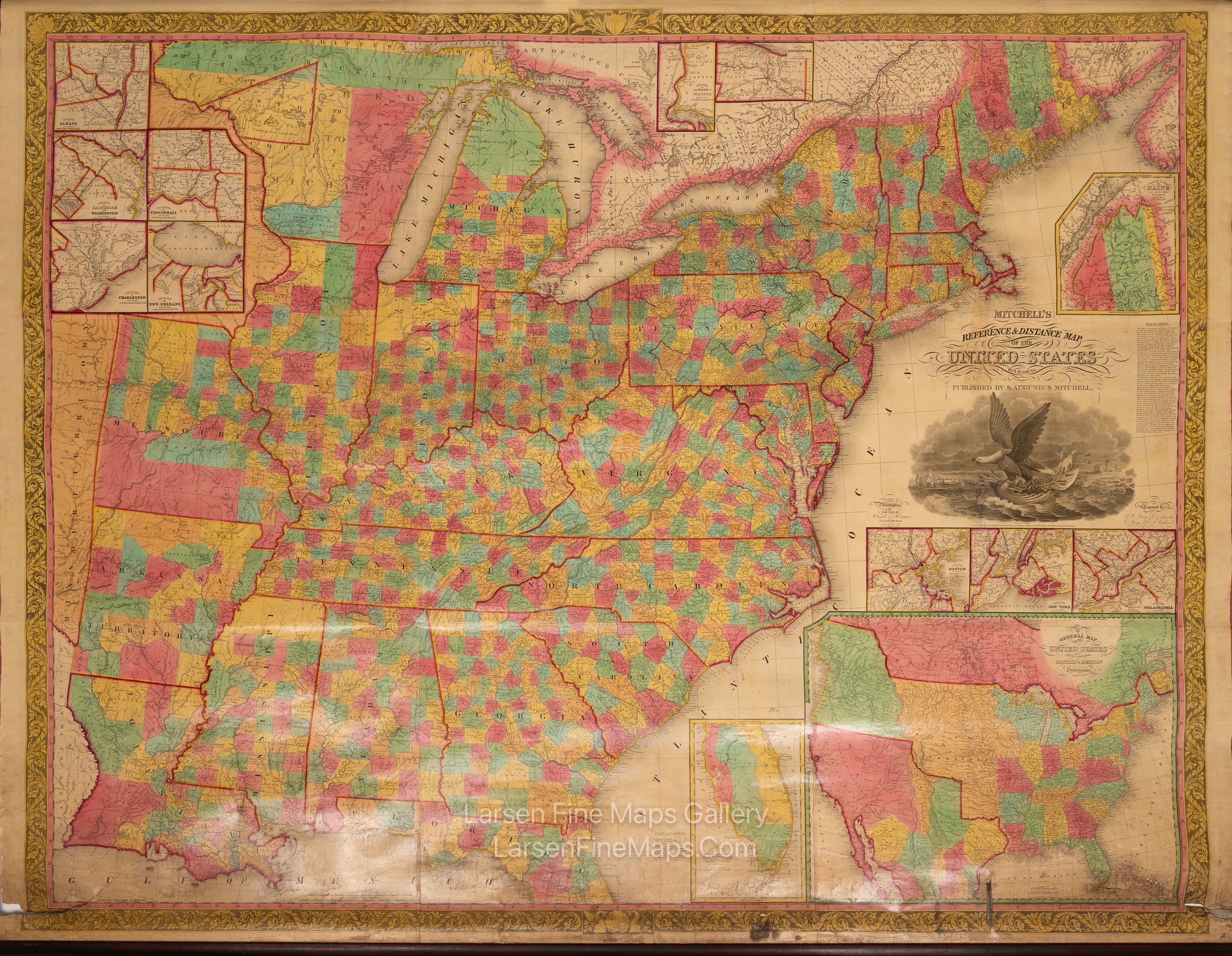
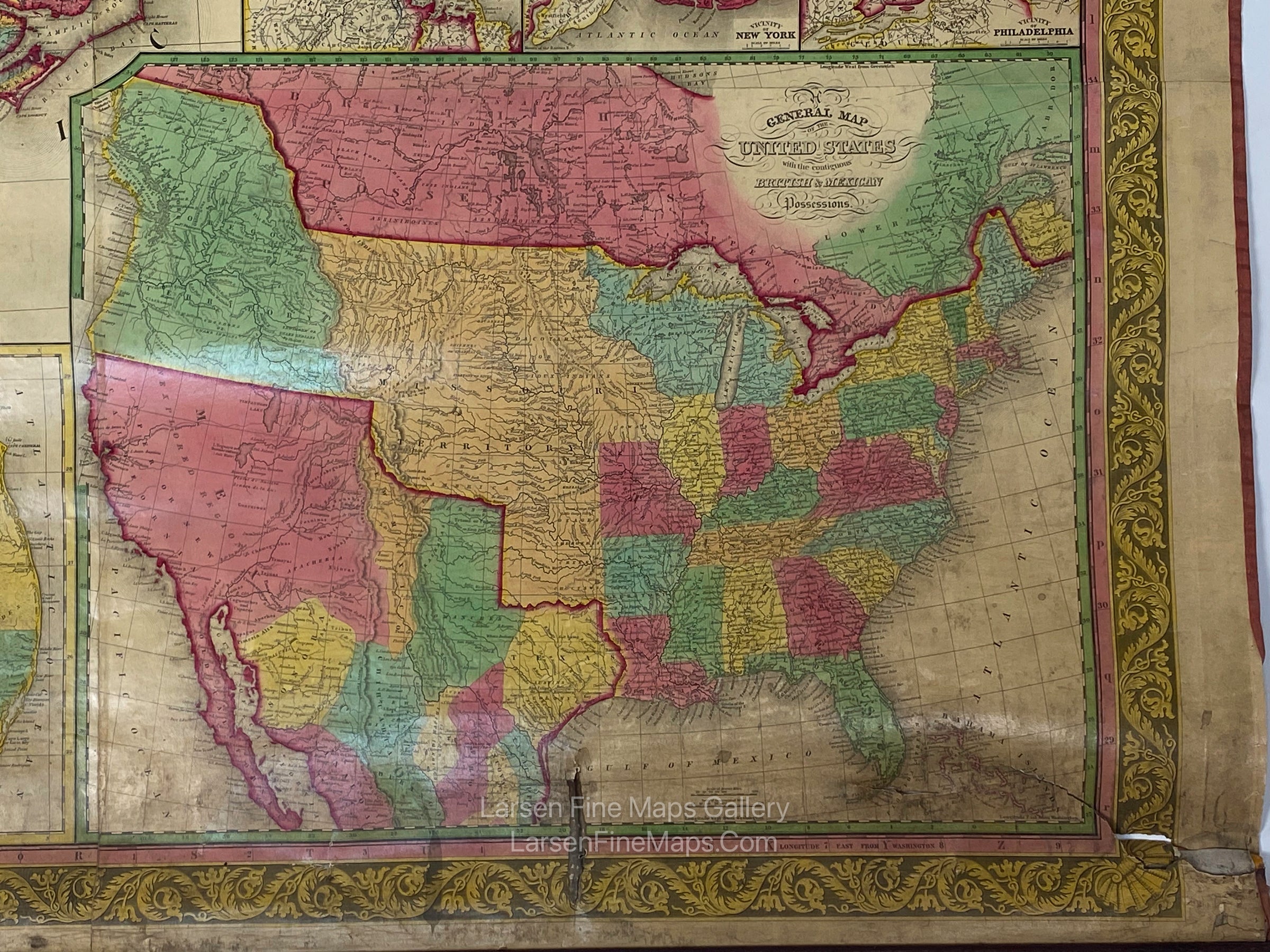
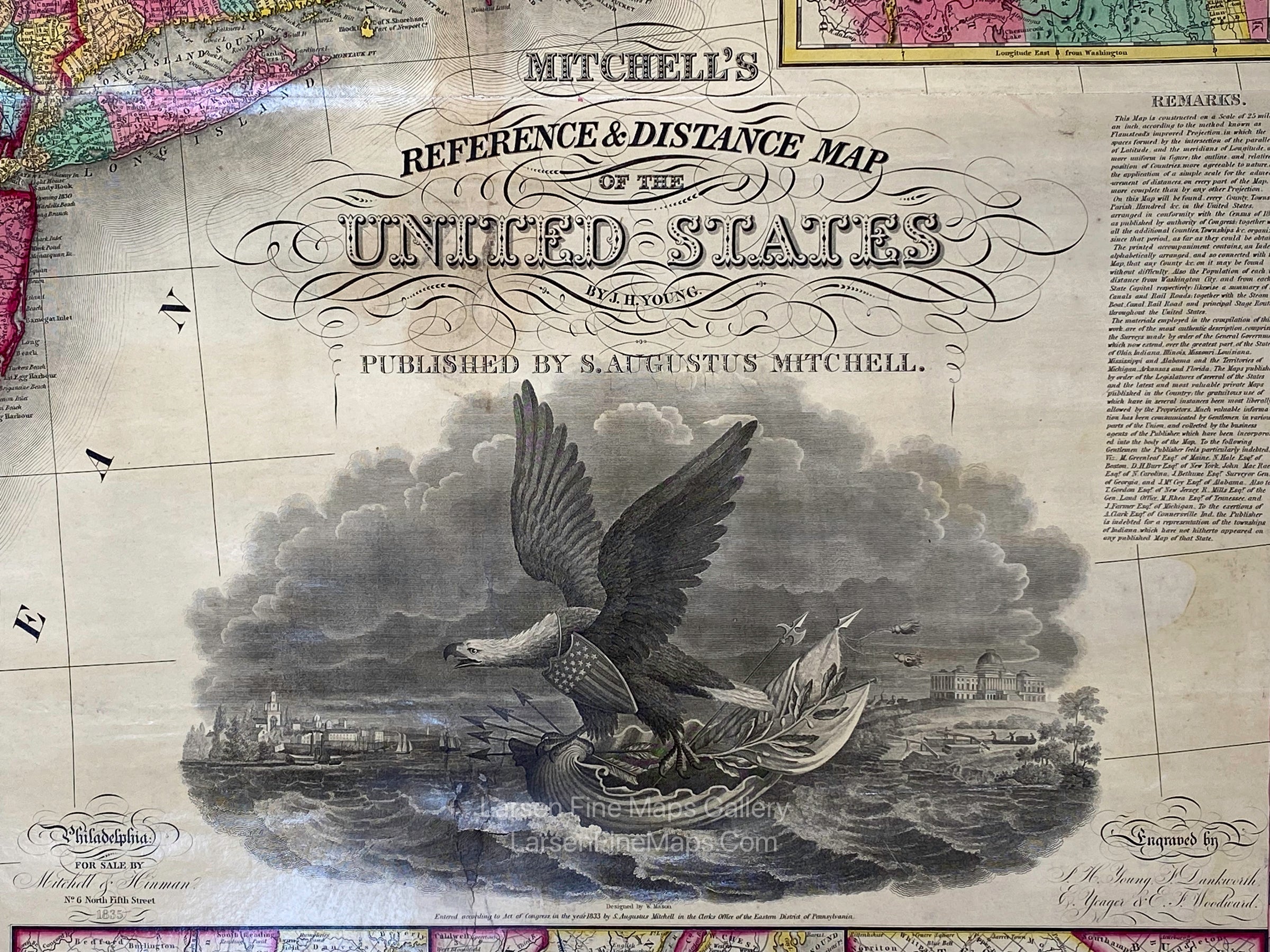
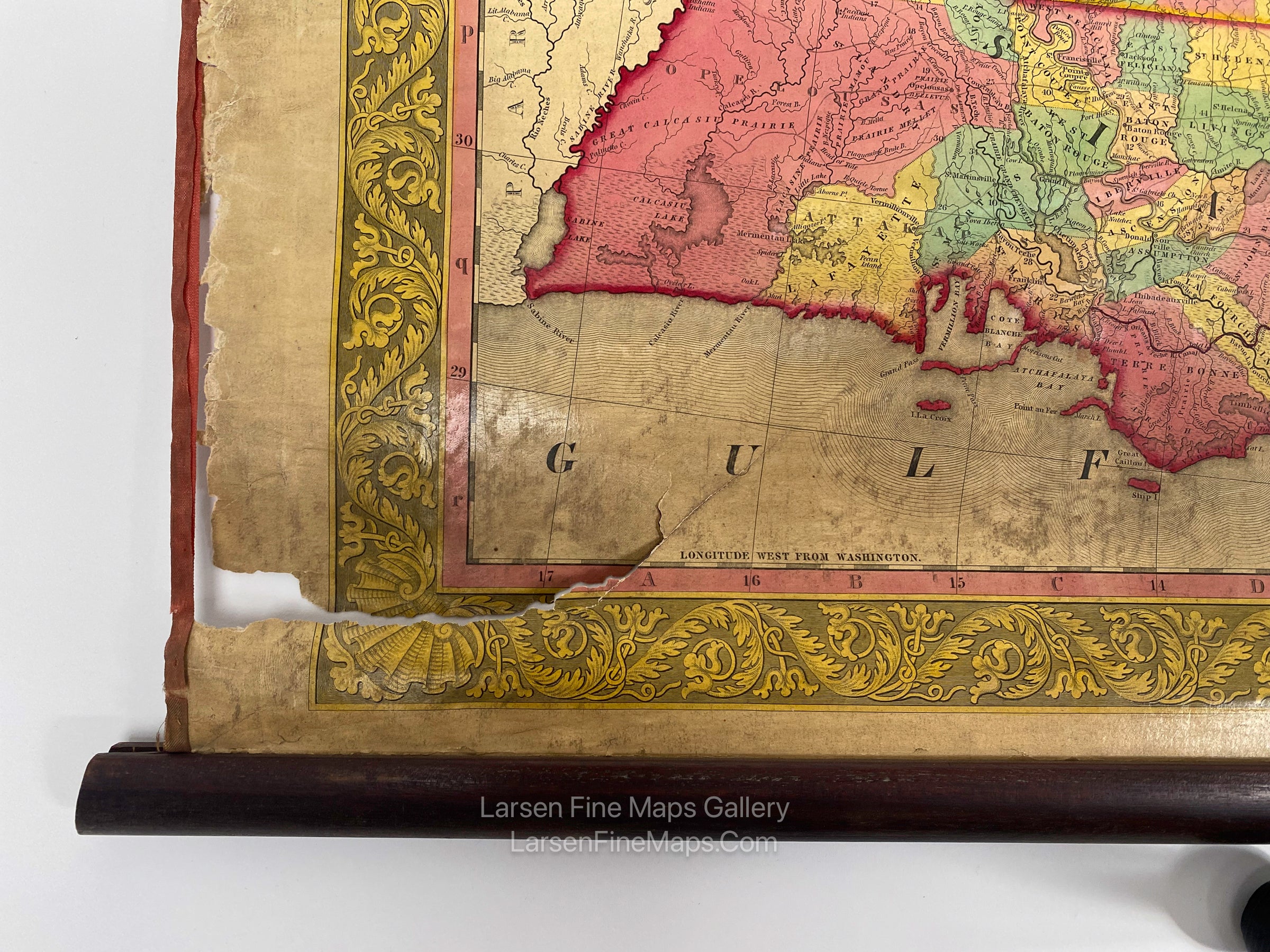
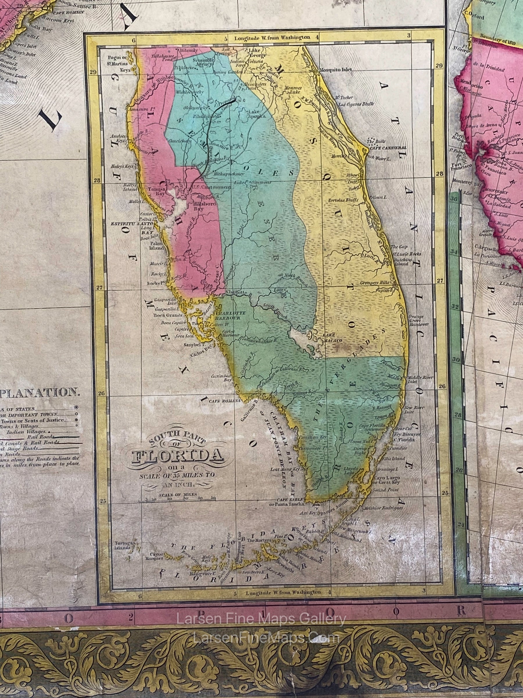
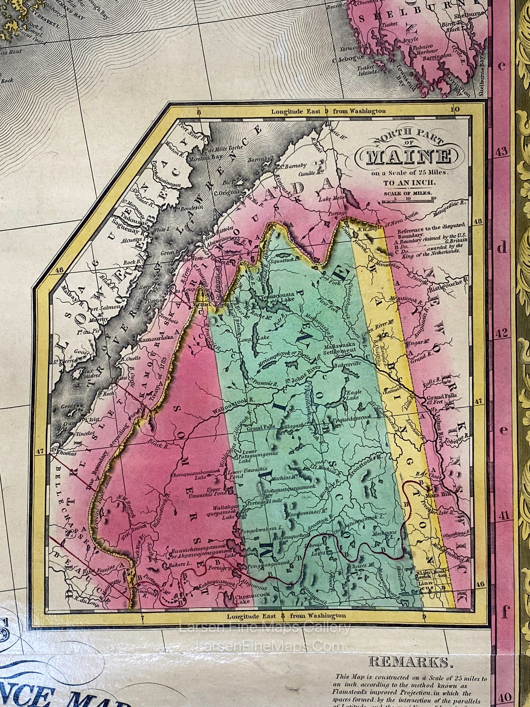
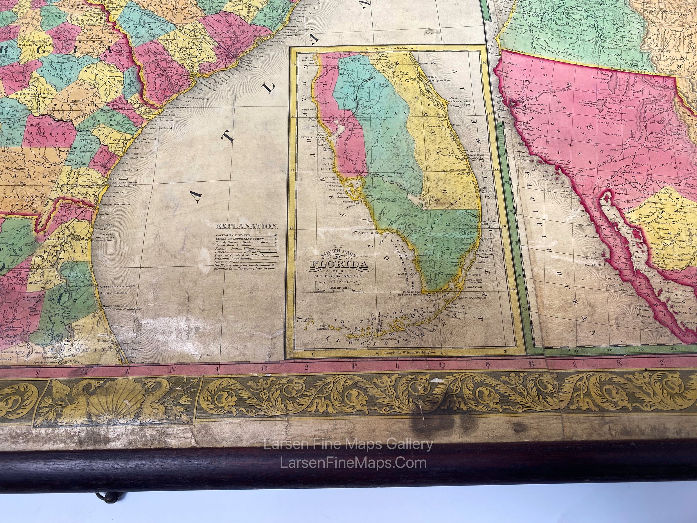
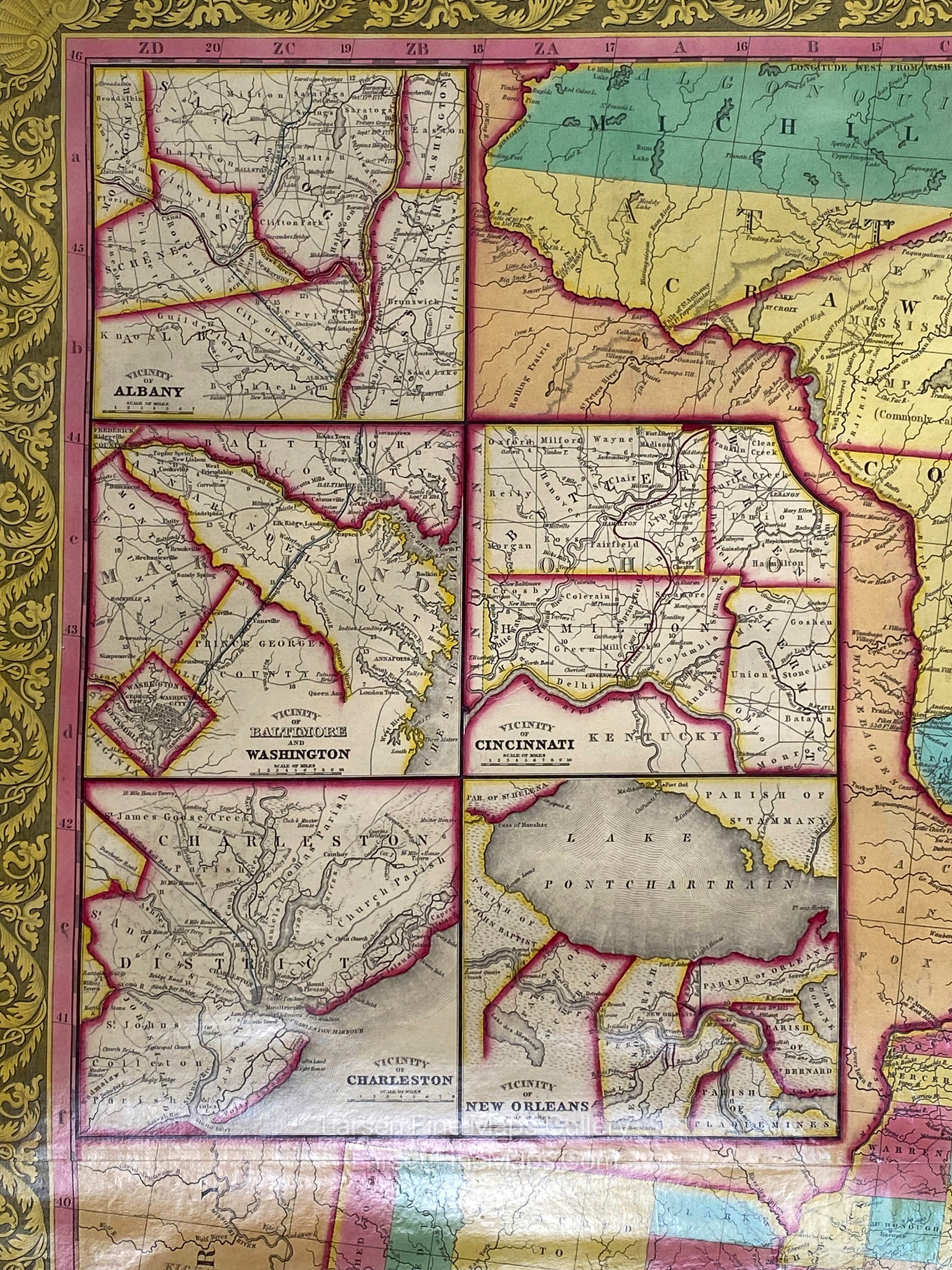
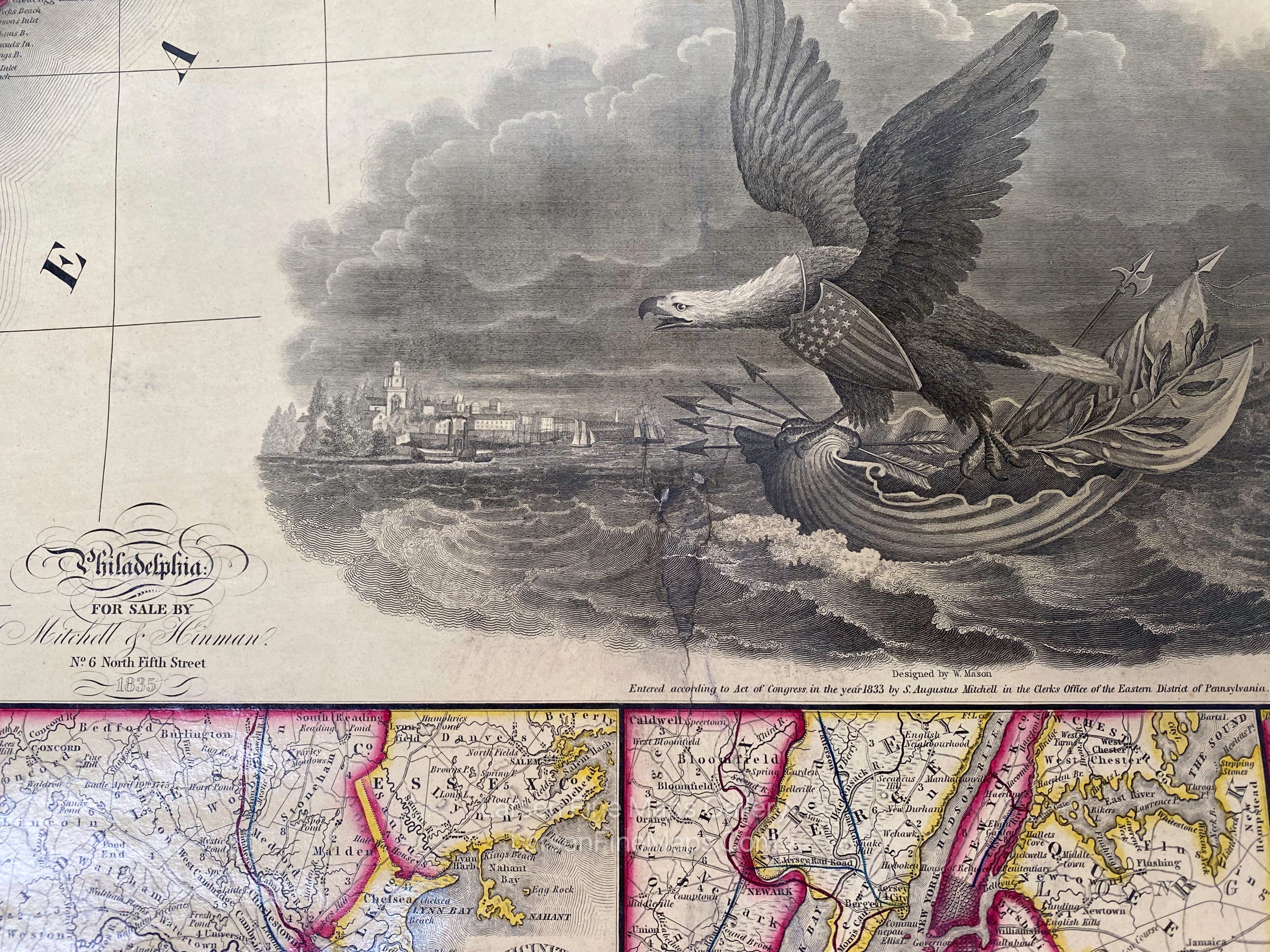
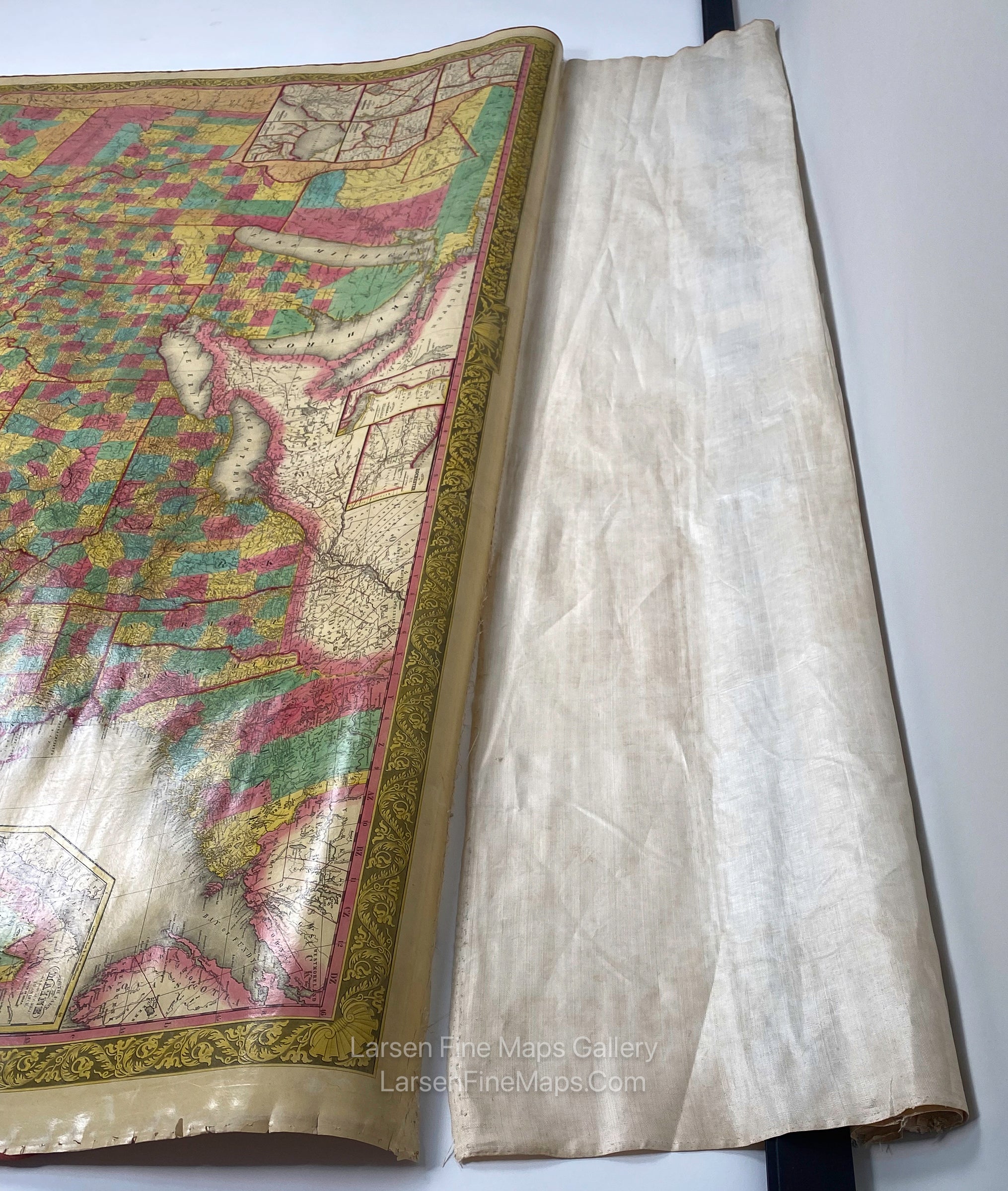
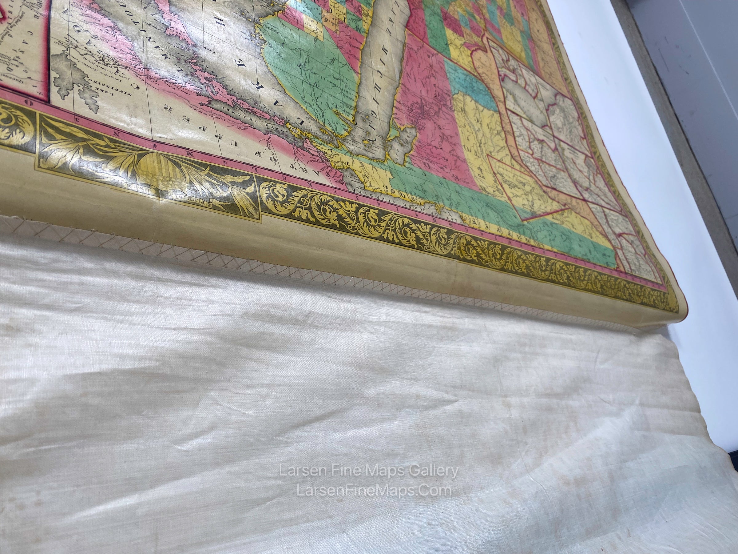
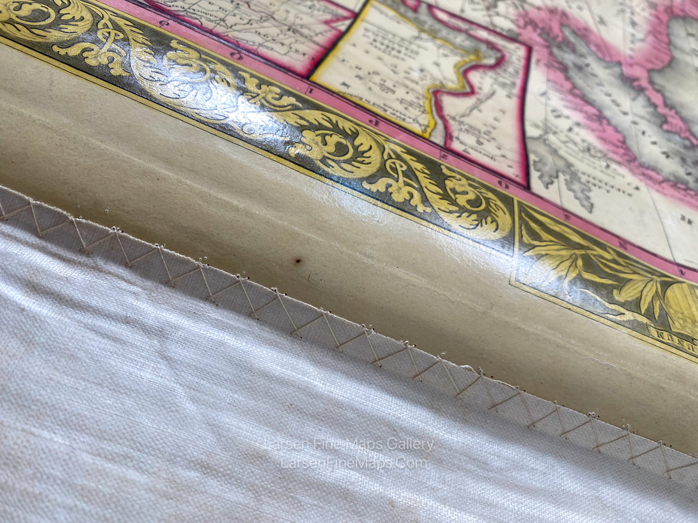
This is an exceptional and striking example of Mitchell's large United States wall map. The map shows the expanding United States to the eastern edge of the Missouri Territory. A large inset map of North America also shows the Oregon Territory to the 54°40' boundary and Mexico's extent at the time. Other smaller inset maps show various cities and their vicinities. The map is complete with offset maps of Maine and the southern portion of Florida. A gorgeous large title cartouche shows a Bald Eagle in a harbor scene on a seashell "boat'. The map was found inside a large bookcase cabinet on a spring-loaded roller, with the bottom wooden edge trim fitting into the cabinet's trim detail work. The cabinet and roller are available (please enquire if interested). Mitchell also published an accompanying reference book with this map, which is available upon request.
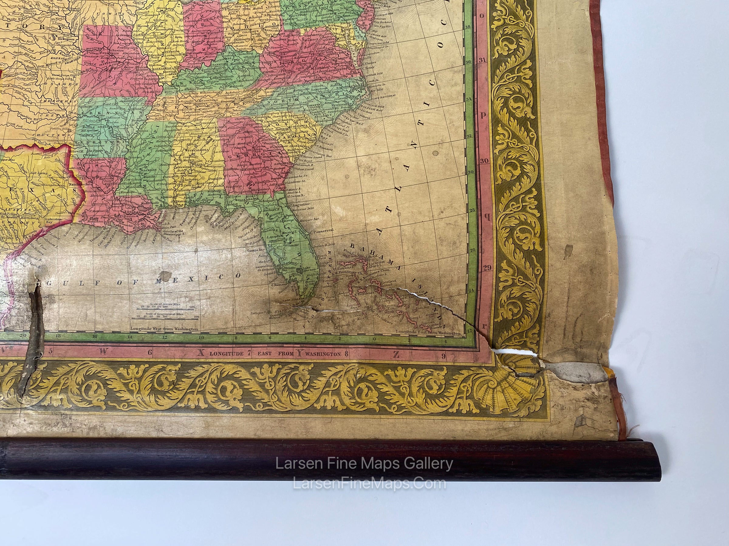
The map is in remarkable original condition, with only some wear and small tears along the bottom edge, as can be seen in the photos. At this time, no restoration has been done to the map.
FULL TITLE
MAPMAKER/CARTOGRAPHER/AUTHOR
PUBLISHER
PUBLICATION
DIMENSIONS (Inches)
CONDITION
Choose options
DESCRIPTION
FULL TITLE
MAPMAKER/CARTOGRAPHER/AUTHOR
PUBLISHER
PUBLICATION
DIMENSIONS (Inches)
CONDITION
DESCRIPTION
FULL TITLE
MAPMAKER/CARTOGRAPHER/AUTHOR
PUBLISHER
PUBLICATION
DIMENSIONS (Inches)
CONDITION