YEAR PUBLISHED: 1780
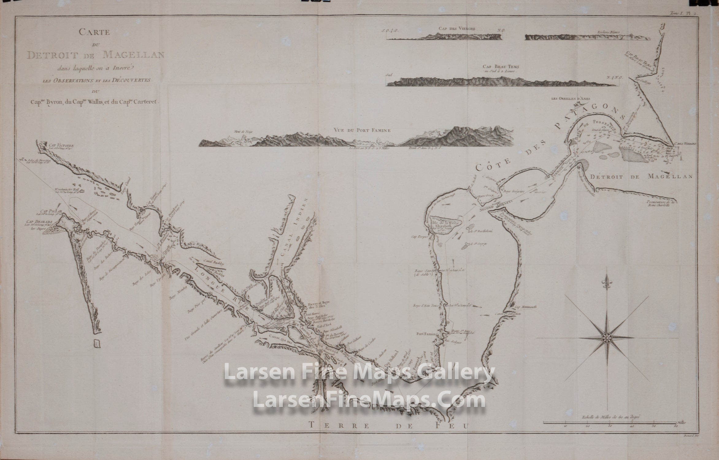
Carte du Detroit de Magellan
DESCRIPTION
A rare large chart detailing the Straits of Magellan and the coast of Pategonia (Cote des Patagons). It depicts the discoveries of the navigators Byron, Wallis, and Carteret. Shown are the route through the straits, anchorages, soundings, current directions, rocks, islands, capes, bays, current directions and shoals. Four elevation views show the various approaches and landmarks (Cap des Vierges, Rochers Blancs, Cap Beau Tems and Vue du Port Famine).
Published in a French edition of John Hawkesworth's An Account of the Voyages Undertaken by the Order of his Present Majesty for Making Discoveries in the Southern Hemisphere.
FULL TITLE
MAPMAKER/CARTOGRAPHER/AUTHOR
PUBLISHER
PUBLICATION
DIMENSIONS (Inches)
CONDITION
Choose options
DESCRIPTION
FULL TITLE
MAPMAKER/CARTOGRAPHER/AUTHOR
PUBLISHER
PUBLICATION
DIMENSIONS (Inches)
CONDITION
DESCRIPTION
FULL TITLE
MAPMAKER/CARTOGRAPHER/AUTHOR
PUBLISHER
PUBLICATION
DIMENSIONS (Inches)
CONDITION