YEAR PUBLISHED: 1850
Reconnaissance of the Western Coast of The United States From Monterey to the Columbia River in three sheets
DESCRIPTION
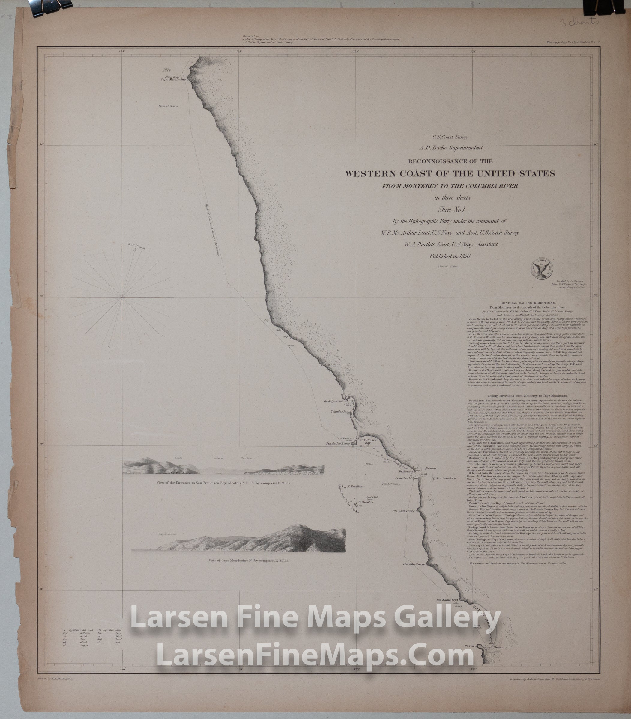
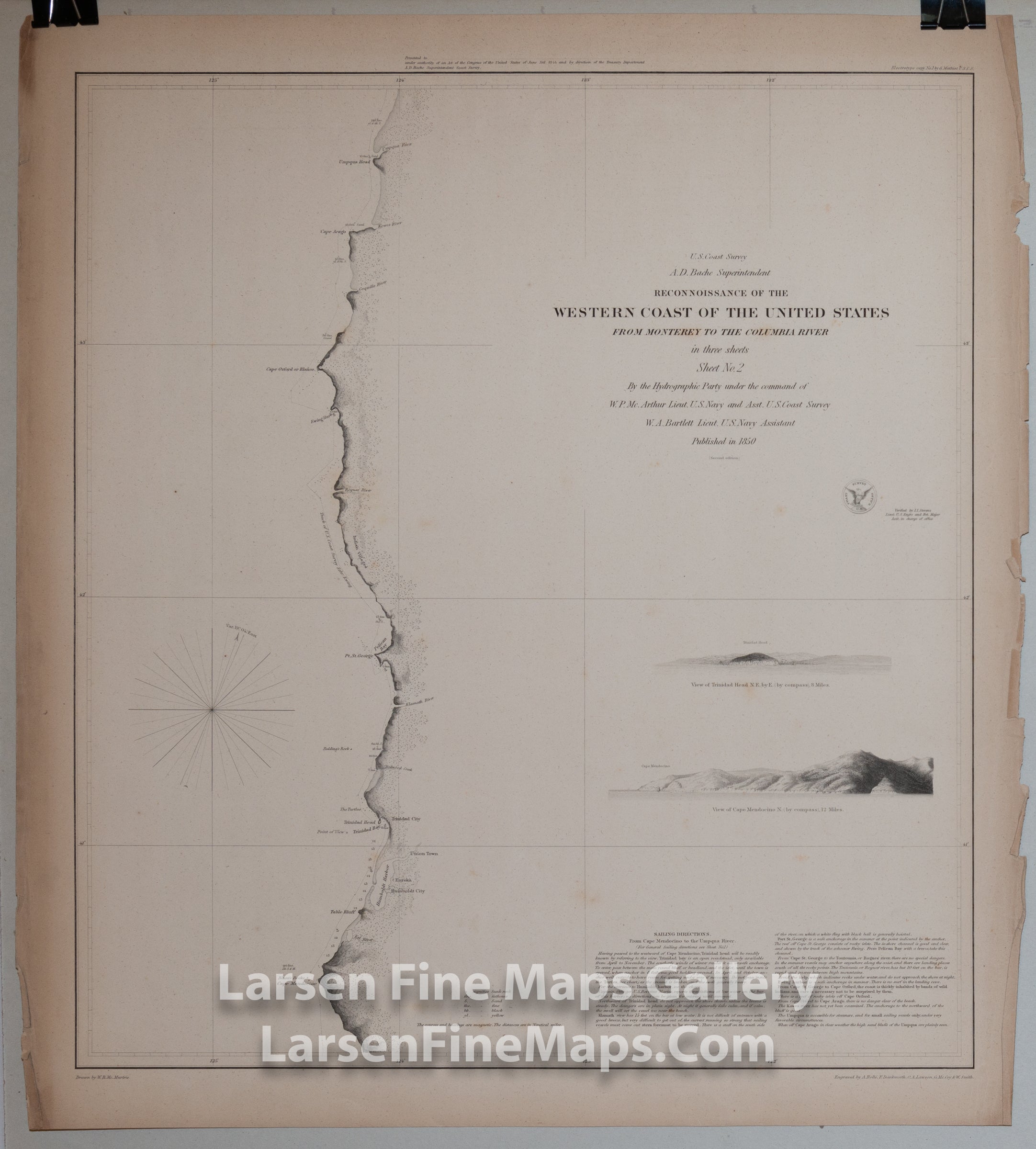
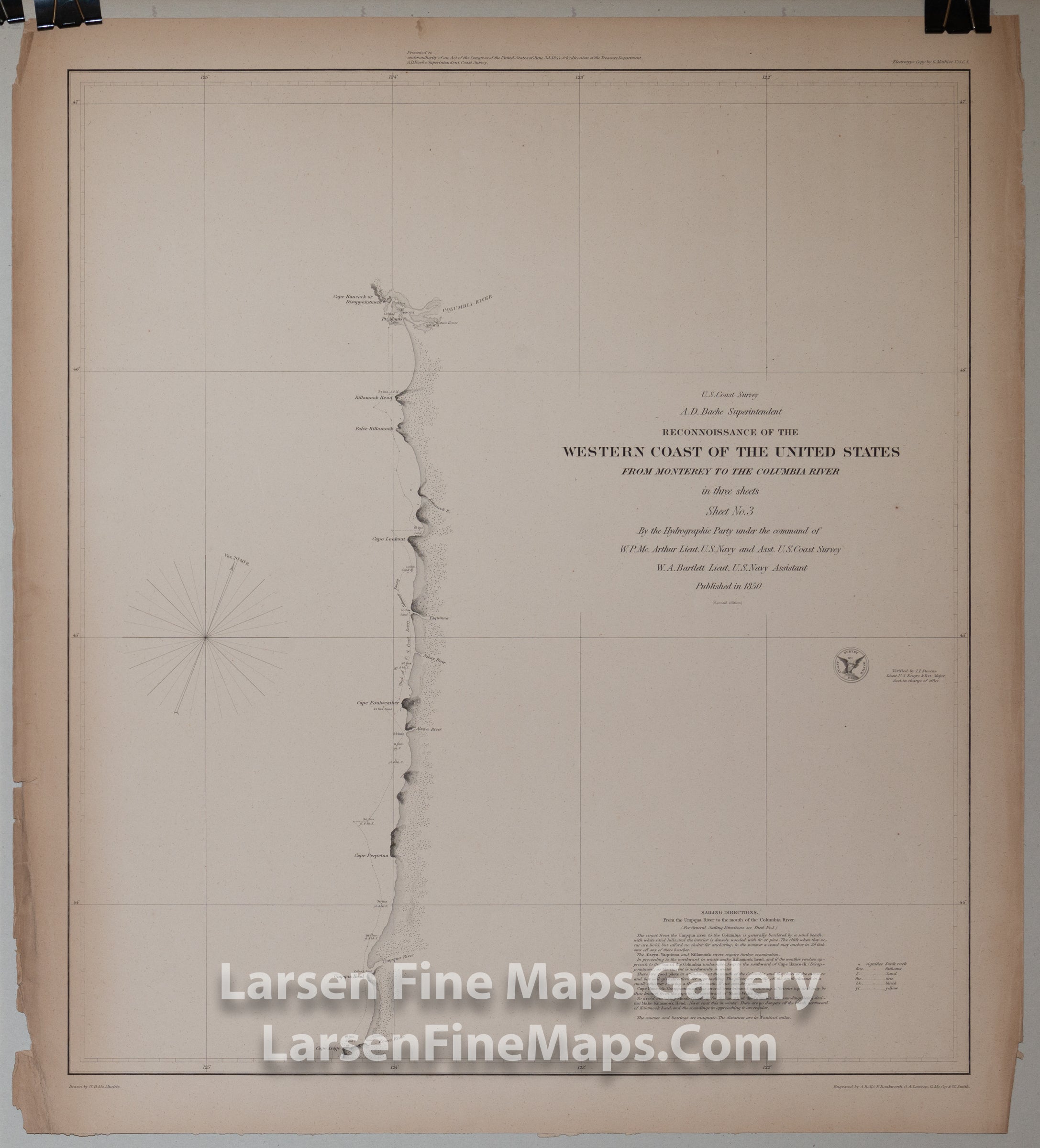
The second edition of the 1850 chart set of the California coastline. The full set charts from Monterey to the Columbia River. Sheet-1 is the southernmost that charts from Monterey to Cape Mendocino and includes 2 elevation views of the Entrance to San Francisco Bay and Cape Mendocino. Sheet-2 is the central sheet that charts from Cape Mendocino to the Umpqua River and includes 2 elevation views of Trinidad Head and Cape Mendocino. Sheet-3 is the northernmost sheet that charts from the Umpqua River to the Columbia River and does not include any elevation views. This chart includes Cape Arago in Oregon, Astoria, Cape Lookout, Cape Foulweather, and Cape Disappointment or Cape Hancock. Interestingly, this set shows the route/track of the U.S. Coast Survey Schooner Ewing and the anchorages she made. Various points, rocks, and harbors are noted along the coastline. Extensive sailing directions are included.
This is a rare separately issued thick-paper edition and is being sold as a COMPLETE SET OF 3 MAP SHEETS.
FULL TITLE
MAPMAKER/CARTOGRAPHER/AUTHOR
PUBLISHER
PUBLICATION
DIMENSIONS (Inches)
CONDITION
Choose options
DESCRIPTION
FULL TITLE
MAPMAKER/CARTOGRAPHER/AUTHOR
PUBLISHER
PUBLICATION
DIMENSIONS (Inches)
CONDITION
DESCRIPTION
FULL TITLE
MAPMAKER/CARTOGRAPHER/AUTHOR
PUBLISHER
PUBLICATION
DIMENSIONS (Inches)
CONDITION