YEAR PUBLISHED: 1849
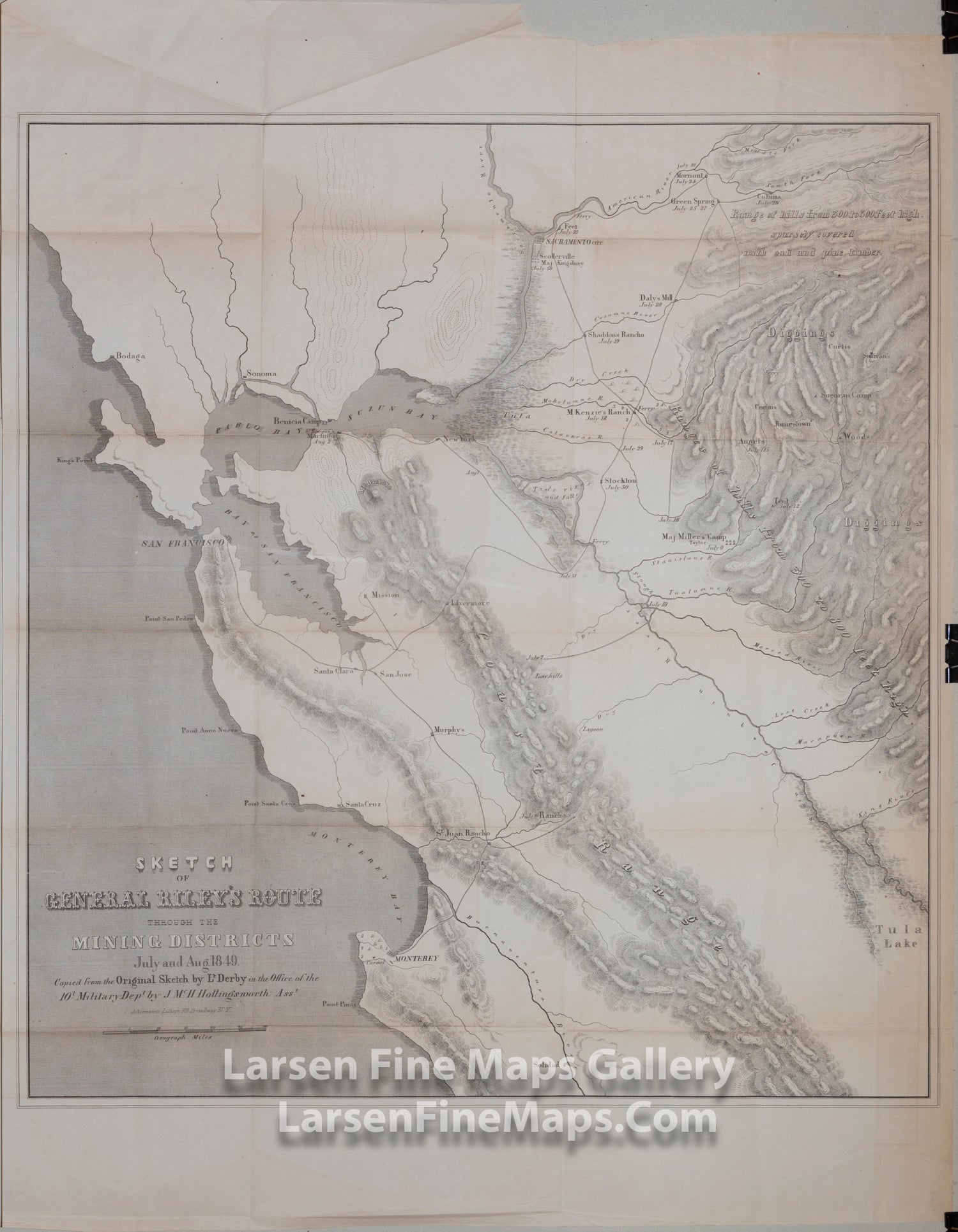
Sketch of General Riley's Route Through Mining Districts, July & August 1849
DESCRIPTION
Important early map of the gold region in California, published shortly after the discovery of gold in California.
A remarkable rare and early map of the Gold Region and surrounding areas from Central California including Bodaga (Bodega Bay) just north of San Francisco, Monterey, east to the Sierra foothills and the Diggings, and including the Basin & Range area of Nevada. Special emphasis on the Diggings and Mother Lode areas show the various mining camps. As the title indicates the map shows the detailed route of General Riley through the mining camps including specific dates at the various camps. The original map was sketched by Lt. Derby who accompanied Brig General Bennet Riley.
The map describes the district as a "Range of hills from 300 to 500 feet high, sparsely covered with oak and pine timber". The gold diggings along the America River, early roads, towns, rivers, and many mining camps and ranches are shown including Scollerville, Green Spring, Colluma, Jonestone, Corons, Angel's, Sororam Camp, Sullivan's, Curtis, Woods, Tent, Maj. Miller's Camp, M. Kenzie's Ranch, Stockton, Daly's Mill, etc.
FULL TITLE
MAPMAKER/CARTOGRAPHER/AUTHOR
PUBLISHER
PUBLICATION
DIMENSIONS (Inches)
CONDITION
Choose options
DESCRIPTION
FULL TITLE
MAPMAKER/CARTOGRAPHER/AUTHOR
PUBLISHER
PUBLICATION
DIMENSIONS (Inches)
CONDITION
DESCRIPTION
FULL TITLE
MAPMAKER/CARTOGRAPHER/AUTHOR
PUBLISHER
PUBLICATION
DIMENSIONS (Inches)
CONDITION