YEAR PUBLISHED: 1854
Reconnaissance of Port Townshend Washington Ter.
DESCRIPTION
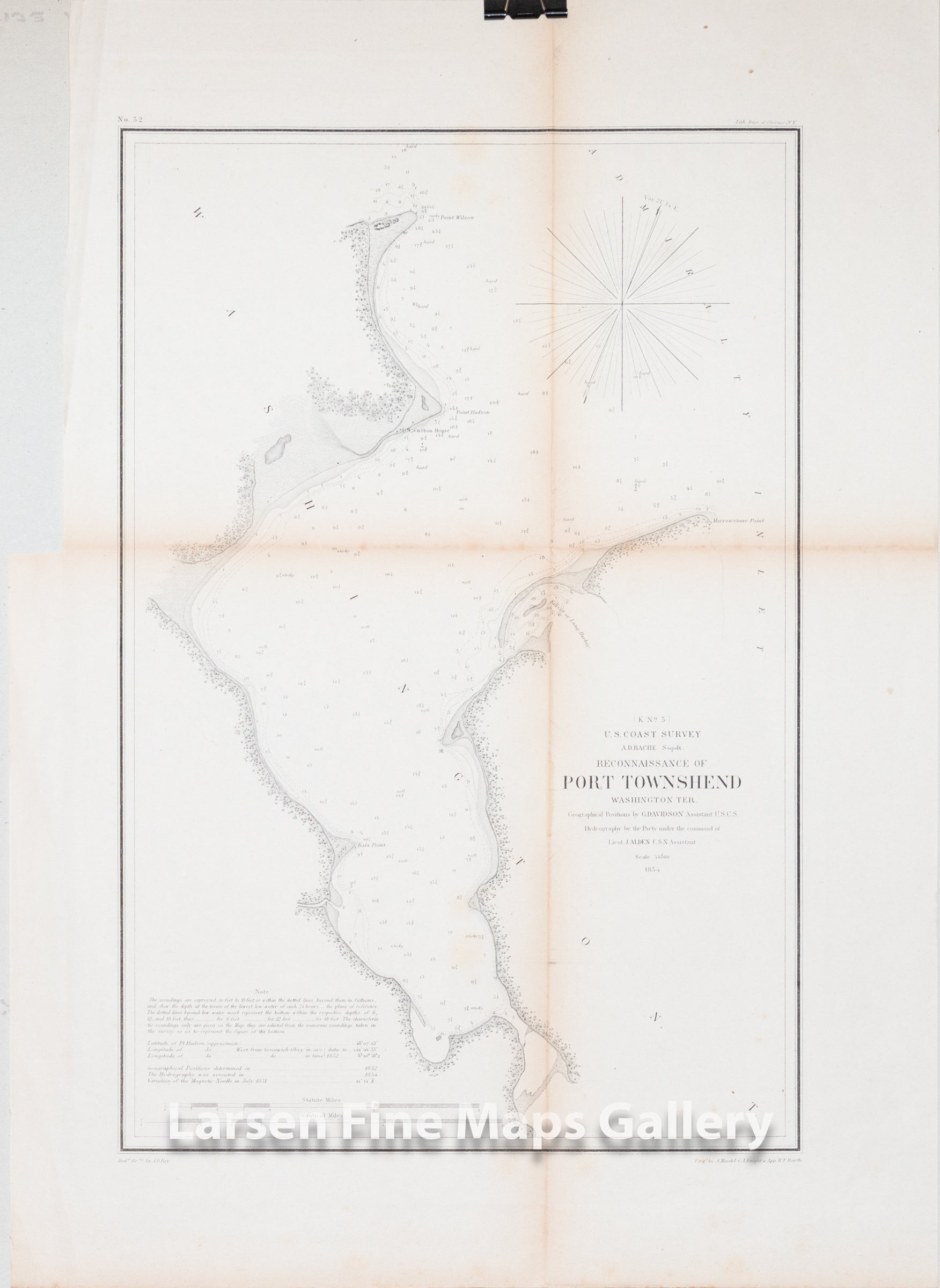
Detailed chart of Port Townshend (Townsend) in the Washington Territory from Point Wilson to Marrowstone Point. Shows great coastal details including U.S. Custom House, Point Hudson, Kala Point, Kihsut or Long Harbor, and some inlets, vegetation and ponds/lagoons. Numerous depth soundings, bottom conditions and explanatory notes are given.
IMPORTANT NOTE:
All of our United States Coast Survey (USCS), United States Coast & Geodetic Survey (USC&GS), and similar maps and charts have been professionally unfolded and flattened using humidity baths, semi-permeable membrane, and drying blotter techniques. Most others you typically see on eBay have not been, and worse, are quickly and crudely unfolded for the low-quality photos you see. Unfolding these maps in that way is damaging and weakens them. Please be aware.
FULL TITLE
MAPMAKER/CARTOGRAPHER/AUTHOR
PUBLISHER
PUBLICATION
DIMENSIONS (Inches)
CONDITION
Choose options
DESCRIPTION
FULL TITLE
MAPMAKER/CARTOGRAPHER/AUTHOR
PUBLISHER
PUBLICATION
DIMENSIONS (Inches)
CONDITION
DESCRIPTION
FULL TITLE
MAPMAKER/CARTOGRAPHER/AUTHOR
PUBLISHER
PUBLICATION
DIMENSIONS (Inches)
CONDITION