YEAR PUBLISHED: 1854
Sketch H Showing the Progress of the Survey in Section No. 8 1846 - 1854
DESCRIPTION
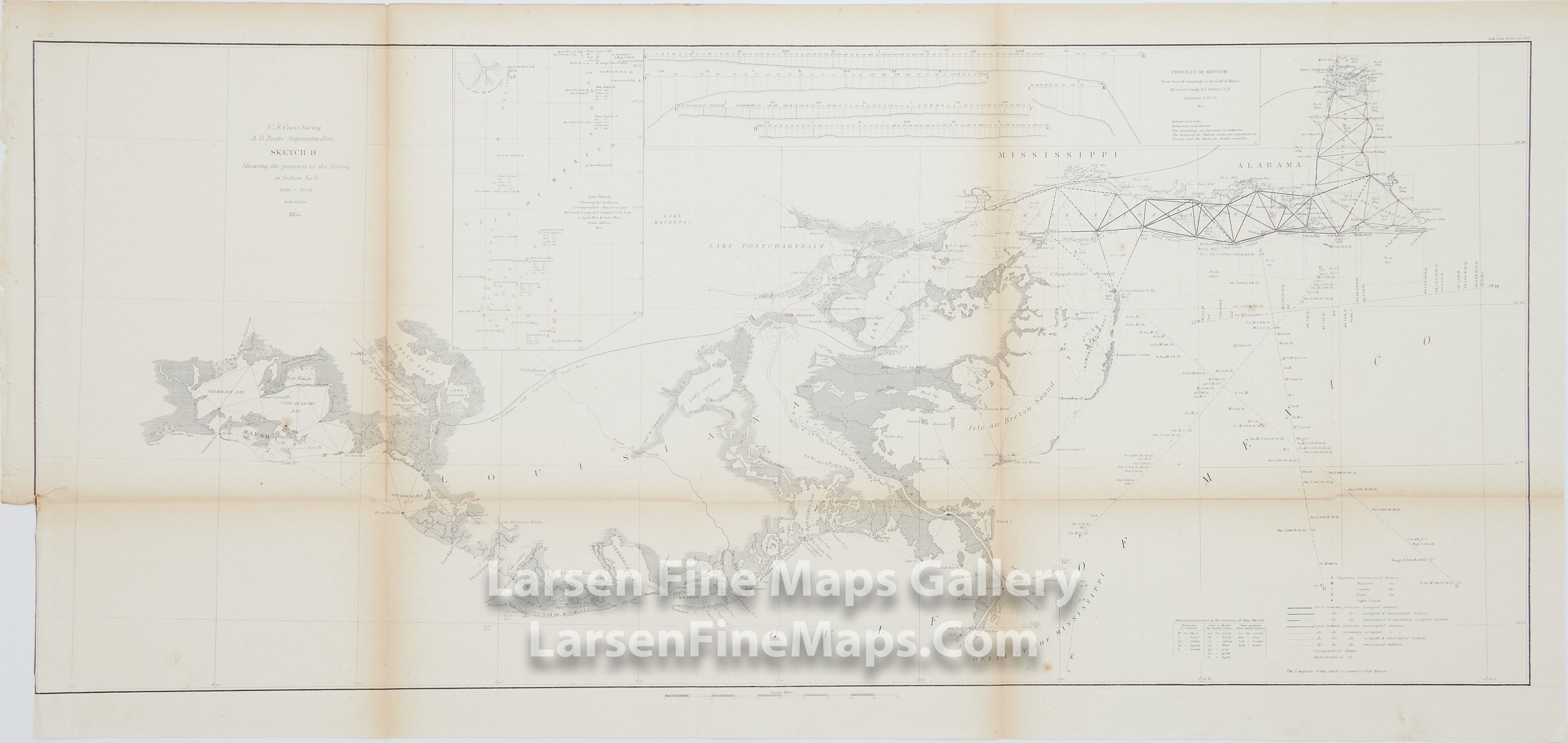
Chart of the coasts of Louisiana, Mississippi, and Alabama. Mapping from Lake Maurepas, Lake Pontchartrain, and Lake Borgne on the west, through the Delta of the Mississippi, Isle au Breton Sound, Mobile Bay, and on to Bon Secour Bay on the east. This later version includes significantly more detail in the areas of Atchafalaya Bay, Caillou Bay, Terrebonne Bay, Timballier Bay, and Barataria Bay, and the main channel of the Mississippi River including Lake Salvador. Other locations noted include Chandeleur Sound, Isle au Breton Sound, Oyster Bay, Bay Ronde, Blind Bay, Garden Island Bay, East Bay, and New Orleans. Various charting, astronomical, magnetic, current, and tidal stations are shown as well.
Inset sub-sketches of temperature observations and bottom profiles are also shown on this version.
IMPORTANT NOTE:
All of our United States Coast Survey (USCS), United States Coast & Geodetic Survey (USC&GS), and similar maps and charts have been professionally unfolded and flattened using humidity baths, semi-permeable membrane, and drying blotter techniques. Most others you typically see on eBay have not been, and worse, are quickly and crudely unfolded for the low-quality photos you see. Unfolding these maps in that way is damaging and weakens them. Please be aware.
FULL TITLE
MAPMAKER/CARTOGRAPHER/AUTHOR
PUBLISHER
PUBLICATION
DIMENSIONS (Inches)
CONDITION
Choose options
DESCRIPTION
FULL TITLE
MAPMAKER/CARTOGRAPHER/AUTHOR
PUBLISHER
PUBLICATION
DIMENSIONS (Inches)
CONDITION
DESCRIPTION
FULL TITLE
MAPMAKER/CARTOGRAPHER/AUTHOR
PUBLISHER
PUBLICATION
DIMENSIONS (Inches)
CONDITION