YEAR PUBLISHED: 1854
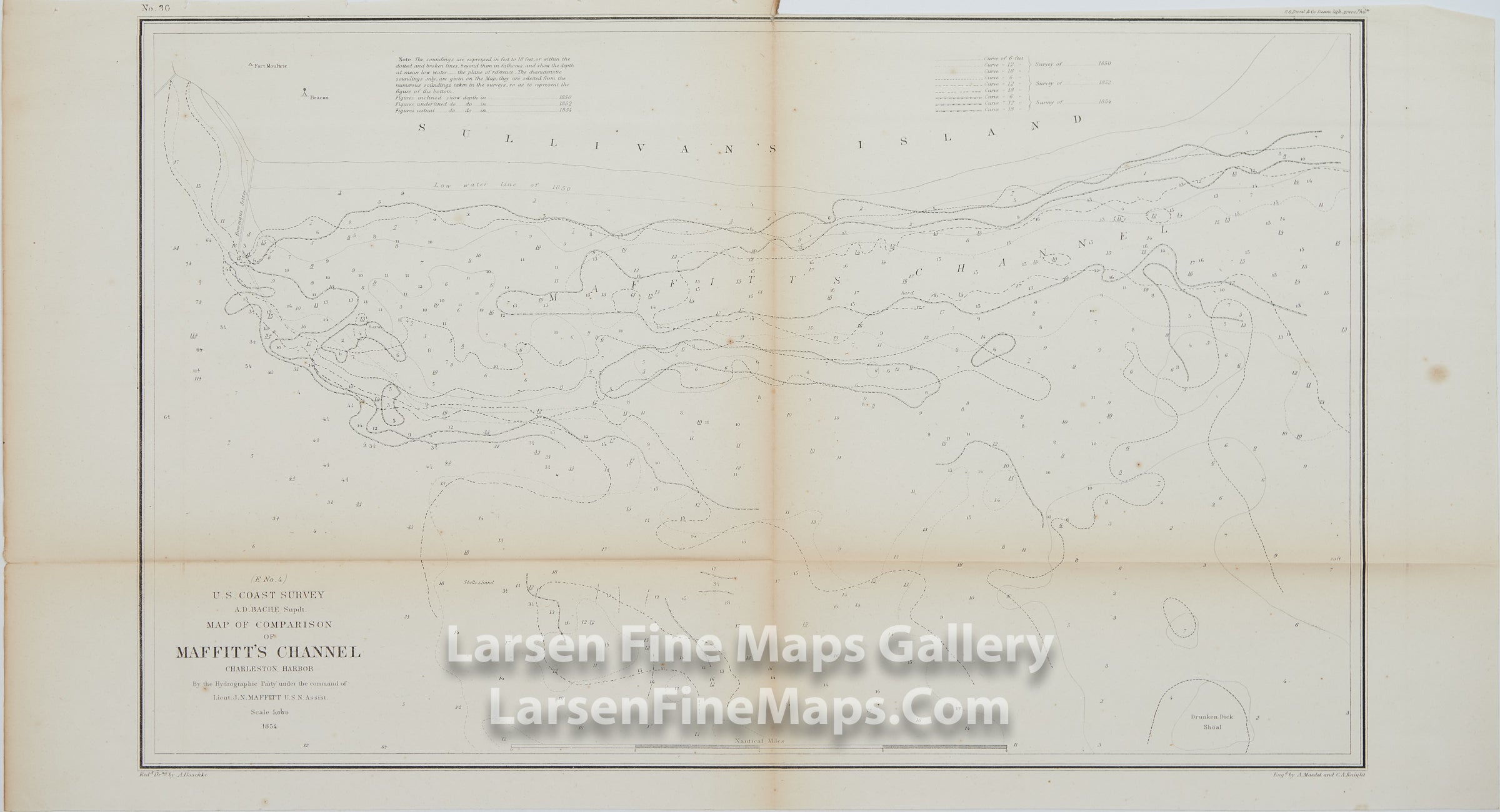
E No. 4 Map of Comparison of Maffitt's Channel Charleston Harbor
DESCRIPTION
Chart of Comparison of the bathymetry of Maffitt's Channel by Sulivan's Island, Charleston Harbor, South Carolina from 1850, 1852, and 1854. Depth soundings and isolines are shown for the various year's surveys along with explanatory notes. One curious place name noted is "Drunken Dick Shoal"… perhaps some Captain named Richard had a few too many and discovered his namesake shoal.
IMPORTANT NOTE:
All of our United States Coast Survey (USCS), United States Coast & Geodetic Survey (USC&GS), and similar maps and charts have been professionally unfolded and flattened using humidity baths, semi-permeable membrane, and drying blotter techniques. Most others you typically see on eBay have not been, and worse, are quickly and crudely unfolded for the low-quality photos you see. Unfolding these maps in that way is damaging and weakens them. Please be aware.
FULL TITLE
MAPMAKER/CARTOGRAPHER/AUTHOR
PUBLISHER
PUBLICATION
DIMENSIONS (Inches)
CONDITION
Choose options
DESCRIPTION
FULL TITLE
MAPMAKER/CARTOGRAPHER/AUTHOR
PUBLISHER
PUBLICATION
DIMENSIONS (Inches)
CONDITION
DESCRIPTION
FULL TITLE
MAPMAKER/CARTOGRAPHER/AUTHOR
PUBLISHER
PUBLICATION
DIMENSIONS (Inches)
CONDITION