
YEAR PUBLISHED: 1798
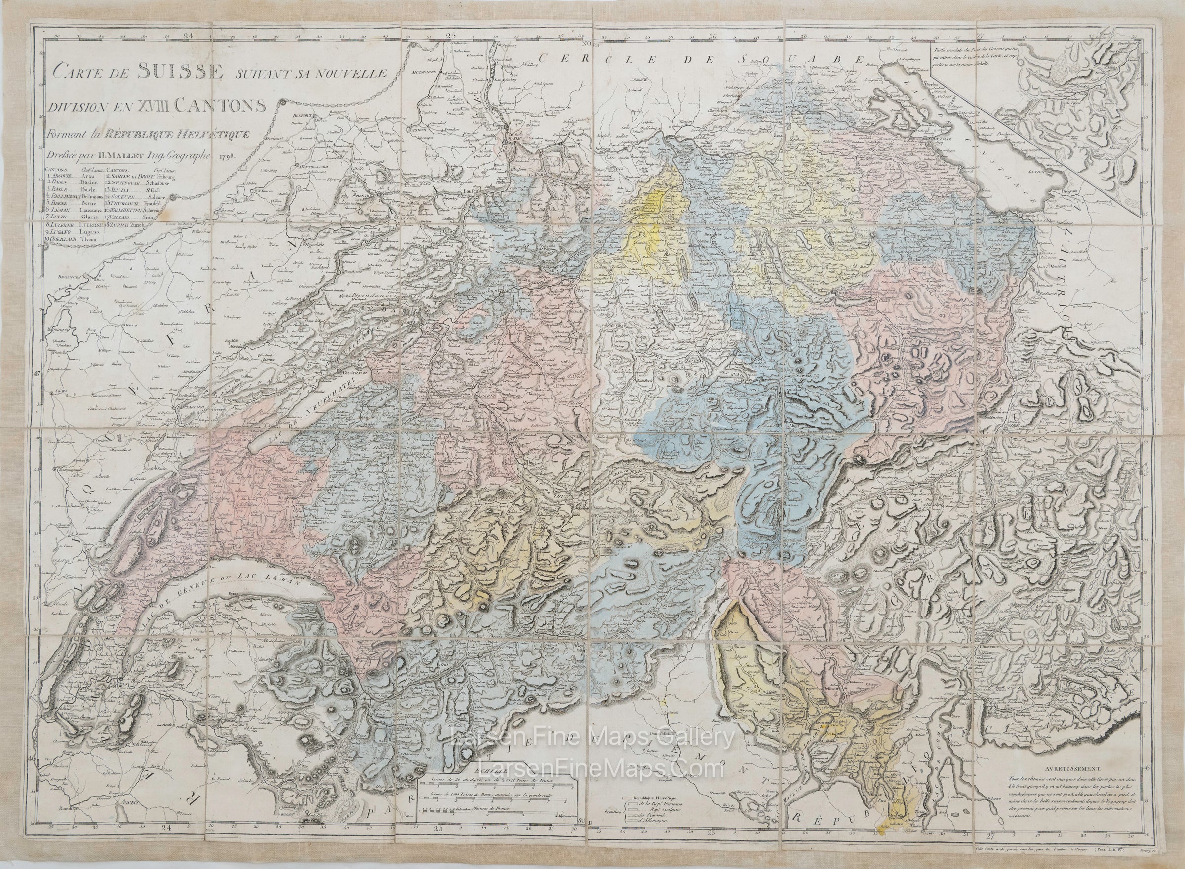
Carte De Suisse Suivant Sa Nouvelle Division En XVIII Cantons Formant al Republique Helvetique
DESCRIPTION
A nice dissected map on linen of the west portion of Switzerland by Henri Mallet. It is possible that the linen is newer as it does not have the folds as is typical with dissected and folded case maps.
The map of Switzerland showing its new division into XVIII cantons forming the Helvetic Republic. These 18 Cantons are listed along with the chief place within them.
Relief is shown by hachures. Hand colored, unclear if color is contemporary.
FULL TITLE
MAPMAKER/CARTOGRAPHER/AUTHOR
PUBLISHER
PUBLICATION
DIMENSIONS (Inches)
CONDITION
Choose options

DESCRIPTION
FULL TITLE
MAPMAKER/CARTOGRAPHER/AUTHOR
PUBLISHER
PUBLICATION
DIMENSIONS (Inches)
CONDITION
DESCRIPTION
FULL TITLE
MAPMAKER/CARTOGRAPHER/AUTHOR
PUBLISHER
PUBLICATION
DIMENSIONS (Inches)
CONDITION